Skelton Glacier is a large glacier flowing from the polar plateau into the Ross Ice Shelf at Skelton Inlet on the Hillary Coast, south of Victoria Land, Antarctica.
The Ohio Range is a range in the Transantarctic Mountains of Antarctica. It is about 30 nautical miles long and 10 nautical miles wide, extending west-southwest – east-northeast from Eldridge Peak to Mirsky Ledge. The range forms the northeast end of the Horlick Mountains and consists primarily of a large snow-topped plateau with steep northern cliffs and several flat-topped ridges and mountains. The highest point, 2,990 metres (9,810 ft), is the summit of Mount Schopf.
The Thiel Mountains are isolated, mainly snow-capped mountains of the Transantarctic Mountains System, located in the Ellsworth Land region of Antarctica. The mountain range is 45 nautical miles long, is located roughly between the Horlick Mountains and the Pensacola Mountains, and extends from Moulton Escarpment on the west to Nolan Pillar on the east. Major components include Ford Massif, Bermel Escarpment and a group of eastern peaks near Nolan Pillar.

The Byrd Glacier is a major glacier in Antarctica, about 136 km (85 mi) long and 24 km (15 mi) wide. It drains an extensive area of the Antarctic plateau, and flows eastward to discharge into the Ross Ice Shelf.
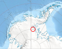
The Churchill Mountains are a mountain range group of the Transantarctic Mountains System, located in the Ross Dependency region of Antarctica. They border on the western side of the Ross Ice Shelf, between Byrd Glacier and Nimrod Glacier.
The Cook Mountains is a group of mountains bounded by the Mulock and Darwin glaciers in Antarctica.

The Darwin Glacier is a large glacier in Antarctica. It flows from the polar plateau eastward between the Darwin Mountains and the Cook Mountains to the Ross Ice Shelf. The Darwin and its major tributary the Hatherton are often treated as one system, the Darwin–Hatherton.

Shackleton Glacier is a major Antarctic glacier, over 60 nautical miles long and from 5 to 10 nautical miles wide, descending from the Antarctic Plateau from the vicinity of Roberts Massif and flowing north through the Queen Maud Mountains to enter the Ross Ice Shelf between Mount Speed and Waldron Spurs. Discovered by the United States Antarctic Service (USAS) (1939–41) and named by the Advisory Committee on Antarctic Names (US-ACAN) for Sir Ernest Shackleton, British Antarctic explorer.
Cape Longing is a rocky cape on the east coast of Graham Land, Antarctica, forming the south end of a large ice-covered promontory which marks the west side of the south entrance to Prince Gustav Channel. It was discovered by the Swedish Antarctic Expedition under Otto Nordenskiöld in 1902, and so named by him because from the position of his winter hut on Snow Hill Island the cape lay in the direction of his "land of longing" which he was anxious to explore.

The Scott Glacier is a major glacier, 120 nautical miles long, that drains the East Antarctic Ice Sheet through the Queen Maud Mountains to the Ross Ice Shelf. The Scott Glacier is one of a series of major glaciers flowing across the Transantarctic Mountains, with the Amundsen Glacier to the west and the Leverett and Reedy glaciers to the east.

The Independence Hills are a line of rugged hills and peaks, 10 miles (16 km) long, with mainly bare rock eastern slopes. They lie 3 miles (5 km) southeast of the Marble Hills and form the southern segment of the west wall of Horseshoe Valley, in the Heritage Range of Antarctica. The Independence Hills were mapped by the United States Geological Survey from ground surveys and U.S. Navy air photos, 1961–66. The name was applied by the Advisory Committee on Antarctic Names in association with the name "Heritage Range".
Pryor Glacier is a glacier flowing northeastward, to the north of Mount Shields and Yermak Point, into Rennick Bay. The feature is about 30 nautical miles long and forms a physical separation between Wilson Hills and Usarp Mountains.
All-Blacks Nunataks is a group of conspicuous nunataks lying midway between Wallabies Nunataks and Wilhoite Nunataks at the southeast margin of the Byrd Névé in Antarctica. Named by the New Zealand Geological Survey Antarctic Expedition (1960–61) for the well known New Zealand national rugby union team.
The Bermel Escarpment is a snow and rock escarpment, 15 nautical miles long, extending from the base of the Ford Massif to King Peak, in the Thiel Mountains of Antarctica. The escarpment drops 300 to 400 metres from the Antarctic Plateau to the ice surface north of these mountains.
The Carlstrom Foothills are a group of peaks and ridges in the Churchill Mountains, Antarctica.
The Darley Hills are a range of high, ice-covered coastal hills in the Churchill Mountains, Antarctica.
Davies Bay is a bay on the coast of Antarctica, 10 nautical miles wide, between Drake Head and Cape Kinsey.
Elephant Moraine is an isolated moraine, 3 nautical miles (6 km) long, located 27 nautical miles (50 km) west of Reckling Peak, to the west of the head of Mawson Glacier in Victoria Land, Antarctica. The moraine, described in some reports as an ice core moraine, is situated along a long, narrow patch of bare ice that extends west from Reckling Peak for 60 nautical miles (110 km). The feature was noted in U.S. satellite imagery of 1973, and in aerial photographs obtained subsequently, by William R. MacDonald of the United States Geological Survey, who originally described it to William A. Cassidy as "a possible nunatak having an outline similar to an elephant." Several United States Antarctic Research Program field parties led by Cassidy collected meteorites at this moraine during the 1979–80 ANSMET season, including the Martian meteorite EETA 79001. The descriptive name was approved by the Advisory Committee on Antarctic Names in 1989.
Starshot Glacier is a glacier 50 nautical miles (90 km) long that flows through the Churchill Mountains to enter the Ross Ice Shelf in Antarctica.