
The Neptune Range is a mountain range, 112 km (70 mi) long, lying WSW of Forrestal Range in the central part of the Pensacola Mountains in Antarctica. The range is composed of Washington Escarpment with its associated ridges, valleys and peaks, the Iroquois Plateau, and the Schmidt and Williams Hills. It was discovered and photographed on January 13, 1956 on a US Navy transcontinental plane flight from McMurdo Sound to Weddell Sea and return.

The Heritage Range is a major mountain range, 160 km (99 mi) long and 48 km (30 mi) wide, situated southward of Minnesota Glacier and forming the southern half of the Ellsworth Mountains in Antarctica. The range is complex, consisting of scattered ridges and peaks of moderate height, escarpments, hills and nunataks, with the various units of relief set off by numerous intervening glaciers.

The Usarp Mountains is a major Antarctic mountain range, lying westward of the Rennick Glacier and trending N-S for about 190 kilometres (118 mi). The feature is bounded to the north by Pryor Glacier and the Wilson Hills. Its important constituent parts include Welcome Mountain, Mount Van der Hoeven, Mount Weihaupt, Mount Stuart, Mount Lorius, Smith Bench, Mount Roberts, Pomerantz Tableland, Daniels Range, Emlen Peaks, Helliwell Hills and Morozumi Range.
Mount Woollard is a mountain nearly 240 km (150 mi) west of the Heritage Range, Ellsworth Mountains, in Antarctica. It was discovered by the Marie Byrd Land Traverse Party (1957–58), and named for George P. Woollard, a member of the Technical Panel on Seismology and Gravity for the U.S. National Committee for the IGY, and a trainer of numerous Antarctic geophysicists.
Athos Range is the northernmost range in the Prince Charles Mountains of Mac. Robertson Land, Antarctica. The range consists of a large number of individual mountains and nunataks that trend east-west for 40 miles (60 km) along the north side of Scylla Glacier.
Balish Glacier is a glacier, 18 nautical miles (33 km) long, flowing north from the Soholt Peaks to enter Splettstoesser Glacier just northeast of Springer Peak, in the Heritage Range, Ellsworth Mountains. It was mapped by the United States Geological Survey from surveys and from U.S. Navy air photos, 1961–66, and was named by the Advisory Committee on Antarctic Names for Commander Daniel Balish, Executive Officer of U.S. Navy Squadron VX-6 during Operation Deep Freeze 1965, and Commanding Officer in 1967.
Chappell Peak is a peak, 1,860 metres (6,100 ft) high, standing 3 nautical miles (6 km) south of Schoeck Peak on the south side of the Enterprise Hills, overlooking the head of Horseshoe Valley in the Heritage Range. It was mapped by the United States Geological Survey from surveys and from U.S. Navy air photos, 1961–66, and named by the Advisory Committee on Antarctic Names for Richard L. Chappell, scientific aide at Little America V Station in 1957.
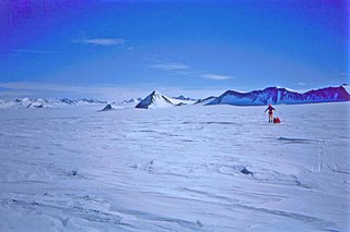
The Enterprise Hills are a prominent group of largely ice-free hills and peaks in the form of an arc. The feature extends for about 30 nautical miles (60 km) to form the north and northeast boundary of Horseshoe Valley in the Heritage Range of the Ellsworth Mountains. These hills were mapped by the United States Geological Survey from surveys and U.S. Navy air photos, 1961–66; the name was applied by the Advisory Committee on Antarctic Names in association with the name Heritage Range.
The Douglas Peaks are the group of peaks standing south of Plummer Glacier in the southeast extremity of the Heritage Range, Ellsworth Mountains. They were named by the University of Minnesota Ellsworth Mountains Party, 1962–63, for Lieutenant Commander John Douglas, a U.S. Navy LC-47 Dakota pilot who flew to the area to evacuate one of the party for emergency appendectomy.
Moulder Peak is a sharp peak 3 nautical miles (6 km) southeast of Mount Rosenthal in the Liberty Hills of the Heritage Range, Antarctica. It was named by the Advisory Committee on Antarctic Names for storekeeper Andrew B. Moulder, U.S. Navy, who was fatally injured in a cargo unloading accident at South Pole Station, February 13, 1966.
Lippert Peak is a sharp pointed peak at the end of a ridge that extends west from the Douglas Peaks into Horseshoe Valley, located 5 nautical miles (9 km) southeast of Strong Peak in the Heritage Range, Antarctica. It was mapped by the United States Geological Survey from surveys and U.S. Navy air photos from 1961–66, and was named by the Advisory Committee on Antarctic Names for George E. Lippert, a United States Antarctic Research Program biologist at Palmer Station in 1965.
Henderson Glacier is a glacier about 7 nautical miles long in the Enterprise Hills of the Heritage Range, Antarctica. It flows northeast from Schoeck Peak and Hoinkes Peak to enter Union Glacier just east of Mount Rossman. Henderson Glacier was mapped by the United States Geological Survey from surveys and U.S. Navy air photos 1961–66, and was named by the Advisory Committee on Antarctic Names for Felix E. Henderson, a United States Antarctic Research Program meteorologist at Eights Station in 1965.
The MacDonald Hills are a compact group of exposed rock hills in the Asgard Range, east of Commonwealth Glacier on the north side of lower Taylor Valley, Victoria Land, Antarctica. They are separated from Hjorth Hill by Quinn Gully.
Redpath Peaks is a cluster of low, snow-covered peaks lying 3 nautical miles (6 km) southeast of Mount Shattuck and the Independence Hills, at the south extremity of the Heritage Range, Ellsworth Mountains. They were named by the Advisory Committee on Antarctic Names (US-ACAN) for Bruce B. Redpath, a United States Antarctic Research Program (USARP) geophysicist on the South Pole—Queen Maud Land Traverse I of 1964-65.
The Liberty Hills are a line of rugged hills and peaks with bare rock eastern slopes, about 10 nautical miles (19 km) long, standing 7 nautical miles (13 km) northwest of the Marble Hills and forming part of the west wall of Horseshoe Valley, in the Heritage Range, Ellsworth Mountains, Antarctica. The Liberty Hills were mapped by the United States Geological Survey from ground surveys and U.S. Navy air photos, 1961–66. The name was applied by the Advisory Committee on Antarctic Names in association with the name Heritage Range. The remarkable High Nunatak towers east of the Hills.
Patriot Hills is a line of rock hills 5 nautical miles (9 km) long, located 3 nautical miles (6 km) east of the north end of Independence Hills in Horseshoe Valley, Heritage Range, Western Antarctica.


