Mount Inderbitzen is a mountain rising to over 2,600 metres (8,500 ft), located 12 nautical miles (22 km) south-southeast of Mount Craddock and 1.5 nautical miles (3 km) south of Mount Milton in Owen Ridge, the southernmost part of the Sentinel Range of the Ellsworth Mountains in Antarctica. It surmounts Wessbecher Glacier to the southeast and Sirma Glacier to the northwest.

Jaburg Glacier is a broad glacier draining westward between the Dufek Massif and the Cordiner Peaks in the Pensacola Mountains of Antarctica. It was mapped by the United States Geological Survey from surveys and U.S. Navy air photos, 1956–66. The glacier was named by the Advisory Committee on Antarctic Names after Lieutenant Conrad J. Jaburg, U.S. Navy, a helicopter pilot with the Ellsworth Station winter party, 1957.

Flask Glacier, is a gently-sloping glacier, 25 nautical miles long, flowing east from Bruce Plateau to enter Scar Inlet between Daggoo Peak and Spouter Peak in Graham Land, Antarctica. The lower reaches of this glacier were surveyed and photographed by the Falklands Islands Dependencies Survey (FIDS) in 1947. The entire glacier was photographed by the Falkland Islands and Dependencies Aerial Survey Expedition in 1955–56, and mapped by the FIDS in 1957. It was named by the UK Antarctic Place-names Committee after the third mate on the Pequod in Herman Melville's Moby-Dick; or, The White Whale.

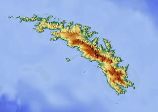
Christophersen Glacier is a glacier 8 nautical miles (15 km) long, flowing west into Jacobsen Bight on the south coast of South Georgia. It was surveyed by the South Georgia Survey in the period 1951–57, and named by the UK Antarctic Place-Names Committee for Pedro Christophersen, one of the first Directors of the Compañía Argentina de Pesca which operated the Grytviken whaling station for more than 50 years beginning in 1904.

Mount Osborne is a mountain standing 5 nautical miles (9 km) east of Mount Craddock, at the end of a side ridge running from the latter and featuring Sanchez Peak and Stolnik Peak, in the Sentinel Range, Ellsworth Mountains, Antarctica. It surmounts Thomas Glacier to the northeast and Saltzman Glacier to the south.

Cornwall Glacier is a glacier 9 nautical miles (17 km) long, flowing south from Crossover Pass in the Shackleton Range to join Recovery Glacier east of Ram Bow Bluff. It was first mapped in 1957 by the Commonwealth Trans-Antarctic Expedition, and named for General Sir James Handyside Marshall-Cornwall, a member of the Committee of Management of the Commonwealth Trans-Antarctic Expedition, 1955–58.

Coulter Glacier is a steeply inclined glacier, 5 nautical miles (9 km) long, flowing south from the Havre Mountains, northern Alexander Island, into Kolokita Cove in Lazarev Bay, Antarctica. The glacier was photographed from the air by the Ronne Antarctic Research Expedition in 1947 and mapped from the photographs by the Falkland Islands Dependencies Survey in 1960. It was named by the Advisory Committee on Antarctic Names for R.W. Coulter, Master of USNS Alatna during U.S. Navy Operation Deepfreeze, 1969.
Greer Peak is a prominent peak, the northernmost of the Wiener Peaks, in the Denfeld Mountains of the Ford Ranges in Marie Byrd Land, Antarctica. It was mapped by the United States Antarctic Service (1939–41) led by Rear Admiral Richard E. Byrd, and was named for Dr. William E. R. Greer, personal physician to Admiral Byrd in the 1950s.
The Douglas Peaks are the group of peaks standing south of Plummer Glacier in the southeast extremity of the Heritage Range, Ellsworth Mountains. They were named by the University of Minnesota Ellsworth Mountains Party, 1962–63, for Lieutenant Commander John Douglas, a U.S. Navy LC-47 Dakota pilot who flew to the area to evacuate one of the party for emergency appendectomy.
Farmer Glacier is a glacier flowing north west into Starshot Glacier, and located between Mount McKerrow to the north and Thompson Mountain to the south, at the southern end of the Surveyors Range in Antarctica. It was named in honor of D. W. Farmer, a member of the 1960 Cape Hallett winter-over team, working as a technician on the geomagnetic project.

Patton Glacier is a broad tributary glacier in the Sentinel Range, Ellsworth Mountains. It drains the east slope of the main ridge between Mounts Ostenso and Tyree, flows east-northeastwards between Evans Peak and Versinikia Peak on the north and Mount Bearskin on the south, and enters Ellen Glacier northeast of Zalmoxis Peak and southeast of Mount Jumper.
Mount Gaston is a mountain 0.5 nautical miles (1 km) southeast of Mount Tarr in the Porthos Range of the Prince Charles Mountains, Antarctica. It was plotted from Australian National Antarctic Research Expeditions (ANARE) air photos of 1965, and was named by the Antarctic Names Committee of Australia for Joseph Gaston, an aircraft engineer with the ANARE Prince Charles Mountains survey party in 1969.

Henderson Glacier is a glacier about 7 nautical miles long in the Enterprise Hills of the Heritage Range, Antarctica. It flows northeast from Schoeck Peak and Hoinkes Peak to enter Union Glacier just east of Mount Rossman. Henderson Glacier was mapped by the United States Geological Survey from surveys and U.S. Navy air photos 1961–66, and was named by the Advisory Committee on Antarctic Names for Felix E. Henderson, a United States Antarctic Research Program meteorologist at Eights Station in 1965.
Mackellar Glacier is a large tributary glacier in the Queen Alexandra Range, Antarctica, flowing north along the east side of Hampton Ridge from Mount Mackellar, to enter Lennox-King Glacier. It was named by the New Zealand Geological Survey Antarctic Expedition (1961–62) in association with Mount Mackellar.

Mount Manthe is a mountain 575 metres (1,890 ft) high standing 5 nautical miles (9 km) north-northeast of Shepherd Dome, in the southern part of the Hudson Mountains, Antarctica. It was mapped from air photos taken by U.S. Navy Operation Highjump in 1946–47, and was named by the Advisory Committee on Antarctic Names for Lawrene L. Manthe, a meteorologist at Byrd Station in 1967.

Mount Lanning is a mountain, 1,820 metres (5,970 ft) high, located at the south side of Newcomer Glacier, 5 nautical miles (9 km) southeast of Mount Warren, in the northern portion of the Sentinel Range, Ellsworth Mountains, Antarctica. It forms the north extremity of Sostra Heights, and surmounts Sabazios Glacier to the southwest and Anchialus Glacier to the southeast.
Mount Rossman is a prominent wedge-shaped, ice-free mountain, 1,450 m, located at the north end of the Enterprise Hills between Union and Henderson Glaciers, in the Heritage Range in Antarctica. It was mapped by the United States Geological Survey (USGS) from surveys and U.S. Navy air photos from 1961-66. It was named by the Advisory Committee on Antarctic Names (US-ACAN) after Rossman W. Smith, an ionospheric physicist at Eights Station, Antarctica in 1965, the Station Scientific Leader at Byrd Station, Antarctica in 1967, and a glaciologist on the Queen Maud Land Traverse, Antarctica in 1968, when it was still "Terra Incognita".

Mount Leech is a peak of the Walker Mountains, standing 5 nautical miles (9 km) northwest of Mount Hubbard in Thurston Island, Antarctica. It was delineated from air photos taken by U.S. Navy Operation Highjump in December 1946, and was named by the Advisory Committee on Antarctic Names for entomologist Robert E. Leech, who participated in a United States Antarctic Research Program airborne insect program in the Ross, Amundsen and Bellingshausen Sea areas in the 1959–60 season.

Levko Glacier is a glacier flowing from Pallid Crest to the eastern end of Thurston Island, Antarctica. It enters Seraph Bay between Tierney Peninsula and Simpson Bluff. The glacier was named by the Advisory Committee on Antarctic Names after G. Levko, Photographer's Mate in the Eastern Group of U.S. Navy Operation Highjump, which obtained aerial photographs of Thurston Island and adjacent coastal areas, 1946–47.


