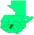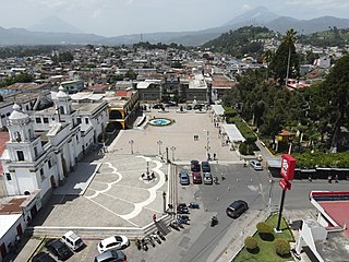
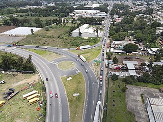
Chimaltenango is a city in Guatemala with a population of 96,985. It serves as both the capital of the department of Chimaltenango and the municipal seat for the surrounding municipality of the same name. Chimaltenango stands some 56 kilometres (35 mi) west of Guatemala City, on the Pan-American Highway. The municipal capital produces textiles and pottery.
Cobán, fully Santo Domingo de Cobán, is the capital of the department of Alta Verapaz in central Guatemala. It also serves as the administrative center for the surrounding Cobán municipality. It is located 219 km from Guatemala City.

Sololá is a city in Guatemala. It is the capital of the department of Sololá and the administrative seat of Sololá municipality. It is located close to Lake Atitlan.
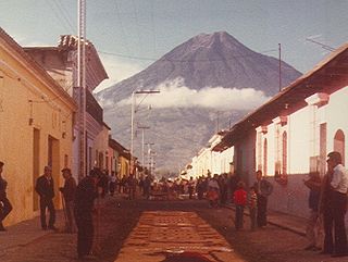
Volcán de Agua is an extinct stratovolcano located in the departments of Sacatepéquez and Escuintla in Guatemala. At 3,760 m (12,340 ft), Agua Volcano towers more than 3,500 m (11,500 ft) above the Pacific coastal plain to the south and 2,000 m (6,600 ft) above the Guatemalan Highlands to the north. It dominates the local landscape except when hidden by cloud cover. The volcano is within 5 to 10 km of the city of Antigua Guatemala and several other large towns situated on its northern apron. These towns have a combined population of nearly 100,000. It is within about 20 km (12 mi) of Escuintla to the south. Coffee is grown on the volcano's lower slopes.

Panajachel is a town in the southwestern Guatemalan Highlands, less than 140 kilometres (90 mi) from Guatemala City, in the department of Sololá. It serves as the administrative centre for the surrounding municipality of the same name. The elevation is 1,597 metres (5,240 ft). Population was 11 thousand in the 2000 census, projected as 15,830 by June 30, 2020 and has approximately doubled each of the last few decades. The town of Panajachel is located on the Northeast shore of Lake Atitlán, and has become a centre for the tourist trade of the area as it provides a base for visitors crossing the lake to visit other towns and villages.

Panzós is a town with a population of 22,068 and a municipality in the Guatemalan department of Alta Verapaz.
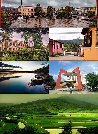
Tactic is a town and a municipality in the Guatemalan department of Alta Verapaz. It is situated at 1,465 m above sea level. The municipality has a population of 38,052 and covers an area of 102 km². At the 2018 census, the population of the Tactic town was 15,213. The languages spoken in Tactic are predominantly Spanish, Poqomchiʼ, and Q'eqchi'.

Alotenango is a town and municipality in the Guatemalan department of Sacatepéquez. According to the 2018 census, the town has a population of 23,358. The municipality consists of four wards and is situated on the Escuintla road. Located in a valley, Alotenango is a Ladino coffee center, since the times of general Justo Rufino Barrios liberal regime (1873–1885).

Ciudad Vieja is a town and municipality in the Guatemalan department of Sacatepéquez. According to the 2018 census, the town has a population of 32,802 and the municipality a population of 33,405. Ciudad Vieja was the second site of Santiago de los Caballeros de Guatemala, the colonial capital of the country.

Santa Maria de Jesus is a town, with a population of 21,795, and a municipality in the department of Sacatepéquez about 10 km from the city of Antigua Guatemala. It is located under the slopes of Volcán de Agua. This town has a height of 2,070 meters above sea level. Its central square has a temple built in the seventeenth century with a carved entry arch. Spanish and Kaqchikel are spoken in this town.
Chinique, from the Kʼicheʼ language «chinic´aj taka´aj», is a municipality in the Guatemalan department of El Quiché. In 1892 Alfred Maudslay and his wife Anne reported that the place was a small group of houses made from adobe with thatched roofs. Its population as of 2023 is 14,052.

San Juan Comalapa is a town, with a population of 32,312, and a municipality in the Chimaltenango department of Guatemala.
El Tejar is a municipality and town in the Chimaltenango department of Guatemala. As of 2018, the municipality has a population of 15,639.
San Andrés Itzapa is a town, with a population of 24,992, and a municipality of Chimaltenango, Guatemala. San Andrés Itzapa is in the eastern region of Chimaltenango, while the district capital lies to the north, Acatenango lies to the south and to the east is Parramos. The municipality cover an area of 63.7 km2, with a total population of 32,083.
Tecpán is a town, with a population of 34,519, and a municipality in the department of Chimaltenango, in Guatemala, on the Inter-American Highway CA-1.
Zaragoza is a town, with a population of 11,176, and a municipality in the Chimaltenango department of Guatemala.
San Jerónimo is a town and municipality in the Baja Verapaz department of Guatemala. The municipality is situated at 940 metres above sea level and has a population of 25,459. It covers an area of 275 km². The annual festival is September 28 – September 30.

San Juan Ostuncalco, is a town, with a population of 20,763, and a municipality in the Quetzaltenango department of Guatemala. Beside Spanish, local people speak the Mam language.

San Antonio Palopó is a municipality in the Sololá Department of Guatemala. The village is on the eastern shore of Lake Atitlán. The lowest elevation is 1,562 metres (5,125 ft) at the shoreline. The people of the region are Cakchiquel Maya with a distinctive style of clothing. The patron saint of the village is St. Anthony of Padua. The annual festival takes place on 13 June.
San Lucas Tolimán is a municipality in the Sololá department of Guatemala. The town of 17,000 people sits on the southeastern shore of Lago de Atitlán. The population is 90–95% Highland Maya. There is a population of about the same size living in the surrounding villages.