Claverack-Red Mills, commomly known as Claverack, is a census-designated place (CDP) in Columbia County, New York, United States. The population was 913 at the 2010 census.

Pavilion is a town in Genesee County, New York, United States. The population was 2,495 at the 2010 census. The town was named after a hotel in Saratoga Springs, New York, by an early resident. The town of Pavilion is in the southeastern corner of Genesee County and is southeast of the city of Batavia.
York is a town in western Livingston County, New York, United States. Its population was 3,397 at the 2010 census.
Greenville is a hamlet and census-designated place (CDP) in the town of Greenville, in Greene County, New York, United States. The population of the CDP was 688 at the 2010 census, out of a total 3,739 people in the town as a whole.
Fillmore is a hamlet in the town of Hume, Allegany County, New York, United States. As of the 2010 census it had a population of 603. It was originally known as "The Mouth of the Creek" but was named for President Millard Fillmore in 1850. The former village of Fillmore dissolved its incorporation and is now simply a named hamlet southeast of the town center of Hume. Fillmore is the mailing address of the Hungarian Scout Camp, the main campsite of the Hungarian Scout Association in Exteris, although the camp is technically within the neighboring town of Granger. Fillmore is also the site of the Most Holy Family Monastery which was designated a hate group by the Southern Poverty Law Center (SPLC) in February 2017.
Retsof is a hamlet and census-designated place (CDP) within the town of York in Livingston County, New York, United States. The community, situated 30 miles (48 km) southwest of the city of Rochester, is off New York State Route 63 approximately one mile east of State Route 36. As of the 2010 census, it had a population of 340.
Hemlock is a hamlet and census-designated place (CDP) in the town of Livonia, Livingston County, New York, United States. The population was 557 as of the 2010 census.
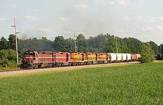
Piffard is a census-designated place (CDP) and hamlet in the town of York, Livingston County, New York, United States. As of the 2010 census, its population was 220. The ZIP Code is 14533.
Dalton is a hamlet and census-designated place (CDP) in the towns of Nunda and Portage in Livingston County, New York, United States. The population was 362 at the 2010 census.
Westport is a hamlet and census-designated place (CDP) in the town of Westport in Essex County, New York, United States. The population of the CDP was 518 at the 2010 census, or 39.4% of the total population of the town of Westport.
Wilmington is a hamlet and census-designated place (CDP) in the town of Wilmington in Essex County, New York, United States. The population of the CDP was 937 at the 2010 census, out of a total town population of 1,253.

Caroga Lake is an unincorporated community and census-designated place (CDP) in the town of Caroga, Fulton County, New York, United States. The population was 518 at the 2010 census. The hamlet is in the southern part of the town of Caroga and is northwest of Gloversville. Two lakes, West Caroga Lake and East Caroga Lake are located next to the hamlet.
Greigsville is a hamlet and census-designated place (CDP) in the town of York, Livingston County, New York, United States. Its population was 209 as of the 2010 census. The community is located at the intersection of New York State Route 36 and New York State Route 63.
Groveland Station is a census-designated place (CDP) in Livingston County, New York, United States. The CDP consists of the hamlet of Groveland and nearby residential areas. The CDP population was 281 as of the 2010 census. New York State Route 63 passes through the community.
Kysorville is a hamlet and census-designated place (CDP) in the town of West Sparta, Livingston County, New York, United States. Its population was 110 as of the 2010 census.
Wadsworth is a hamlet and census-designated place (CDP) in the town of York, Livingston County, New York, United States. Its population was 190 as of the 2010 census. New York State Route 36 passes through the community.
Websters Crossing is a hamlet and census-designated place (CDP) in the town of Springwater, Livingston County, New York, United States. Its population was 69 as of the 2010 census. New York State Route 15 passes through the community.
Woodsville is a hamlet and census-designated place (CDP) in Livingston County, New York, United States. Its population was 80 as of the 2010 census. New York State Route 36 passes through the community.
York is a hamlet and census-designated place (CDP) in the town of York, Livingston County, New York, United States. Its population was 544 as of the 2010 census. New York State Route 36 passes through the community.
Linwood is a hamlet and census-designated place (CDP) in the town of York, Livingston County, New York, United States. Its population was 74 as of the 2010 census. Linwood had a post office until February 6, 1993; it still has its own ZIP code, 14486.


