
Blanco County is a United States county located in the U.S. state of Texas. It is located in Central Texas and its county seat is Johnson City.

Spring Valley Village is a city in Harris County, Texas, United States, and an enclave of Houston. The population was 4,229 at the 2020 U.S. census.
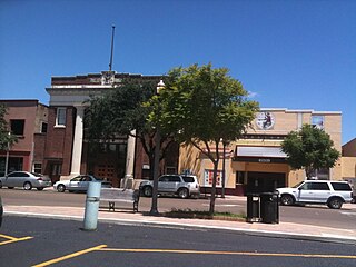
Mercedes is a U.S. city in Hidalgo County, Texas. The population was 15,570 at the 2010 census. It is part of the McAllen–Edinburg–Mission and Reynosa–McAllen metropolitan areas.

The Texas Hill Country is a geographic region of Central and South Texas, forming the southeast part of the Edwards Plateau. Given its location, climate, terrain, and vegetation, the Hill Country can be considered the border between the American Southeast and Southwest. The region represents the very remote rural countryside of Central Texas, but also is home to growing suburban neighborhoods and affluent retirement communities.

Inks Lake State Park is a state park located in Burnet County, Texas, United States, next to Inks Lake on the Colorado River. It contains facilities for swimming, camping, hiking, boating, fishing and general enjoyment of the natural beauty. The landscape consists mainly of hills and includes both forest and cleared land made up of mainly gneiss rock. Containing plants such as cedar, live oak, prickly pear cacti, and yuccas. Devil's Waterhole is a small extension of Inks Lake, which is almost completely surrounded by rock.
Water Valley is an unincorporated community in Tom Green County, Texas, United States. According to the Handbook of Texas, the community had an estimated population of 120 in 2000. The community is part of the San Angelo, Texas, metropolitan statistical area.
Doss is an unincorporated farming and ranching community at the crossroads juncture of FMs 648 and 783 in northwestern Gillespie County, Texas, United States. It is 19 miles northwest of Fredericksburg and 14 miles northeast of Harper. The zip code is 78618. The mean elevation is 1729 feet.
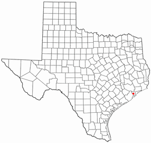
Algoa is an unincorporated community in Galveston County, Texas, United States. The population was 125 according to the 2000 census. The 2010 census did not record the population of Algoa.
Pear Ridge is an area of Port Arthur, Texas, United States that used to be a separate city in Jefferson County.
Montalba is an unincorporated community in central Anderson County, Texas, United States. According to the Handbook of Texas, the community had a population of 809 in 2019. It is located within the Palestine, Texas micropolitan area.

Dobbin is an unincorporated community in Montgomery County, Texas, United States. According to the Handbook of Texas, the community had an estimated population of 170 in 2000, although some estimates place that figure at close to 300. Dobbin is part of the Houston–Sugar Land–Baytown Metropolitan Statistical Area.
Saragosa is a small town in Reeves County, Texas, United States. According to the Handbook of Texas, the community had an estimated population of 185 in 2000.
Valley Spring is an unincorporated community in Llano County, Texas, United States. According to the Handbook of Texas, the community had an estimated population of 50 in 2000. Valley Spring is situated along State Highway 71 in northwestern Llano County, approximately 12 miles northwest of Llano.
Roans Prairie is an unincorporated community in Grimes County, in east central Texas, United States. State Highways 30 and 90 intersect here, seventeen miles northeast of Navasota in central Grimes County.
Loyal Valley is an unincorporated farming and ranching community in the southwestern corner of Mason County, Texas, United States, that was established in 1858, and is 6 miles (9.7 km) north of Cherry Spring. The community is located near Cold Spring Creek, which runs east for 7.5 miles (12.1 km) to its mouth on Marschall Creek in Llano County, just east of Loyal Valley. The community is located on the old Pinta Trail. As of 2000, the population was 50.

The Laguna Madre is a long, shallow, hypersaline lagoon along the western coast of the Gulf of Mexico in Nueces, Kenedy, Kleberg, Willacy and Cameron Counties in Texas, United States. It is one of seven major estuaries along the Gulf Coast of Texas. The roughly 20-mile (32 km) long Saltillo Flats land bridge divides it into Upper and Lower lagoons joined by the Intracoastal Waterway, which has been dredged through the lagoon. Cumulatively, Laguna Madre is approximately 130 miles (210 km) long, the length of Padre Island in the US. The main extensions include Baffin Bay in Upper Laguna Madre, Red Fish Bay just below the Saltillo Flats, and South Bay near the Mexican border. As a natural ecological unit, the Laguna Madre of the United States is the northern half of the ecosystem as a whole, which extends into Tamaulipas, Mexico approximately 144 miles (232 km) south of the US border, to the vicinity of the Rio Soto La Marina and the town of La Pesca, extending approximately 275 miles (443 km) through USA and Mexico in total.
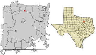
Alpha was an unincorporated freedmen's town in Dallas County, Texas, United States. Founded soon after the American Civil War, the town peaked in the 1890s then dwindled in population throughout the 20th century before being delisted as a community in 1987. The area is now an incorporated part of the city of Dallas.
Palm Valley is a ghost town, a formerly independent community on U.S. Route 79, now incorporated into Round Rock, in the county of Williamson, in the U.S. state of Texas.
Cayote is an unincorporated community in Bosque County, Texas, United States. According to the Handbook of Texas, the community had a population of 75 in 2000.
Cedar Valley is an unincorporated community in Bell County, in the U.S. state of Texas. According to the Handbook of Texas, only four people lived in the community in 2000. It is located within the Killeen-Temple-Fort Hood metropolitan area.

