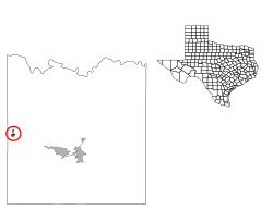
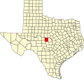
Melvin, Texas

Last updated
Melvin, Texas
TXMap-doton-Melvin.PNG
Location of Melvin, Texas
McCulloch County Melvin.svg
Coordinates: 31°11′49″N99°34′50″W / 31.19694°N 99.58056°W / 31.19694; -99.58056
Country United States
State Texas
County McCulloch
Area
[1]
  Total0.47 sq mi (1.21 km2)
  Land0.46 sq mi (1.20 km2)
  Water0.00 sq mi (0.01 km2)
Elevation
1,857 ft (566 m)
Population
 (2010)
  Total178
  Estimate 
(2019) [2]
168
  Density362.07/sq mi (139.88/km2)
Time zone UTC-6 (Central (CST))
  Summer (DST) UTC-5 (CDT)
ZIP code
76858
Area code 325
FIPS code 48-47568 [3]
GNIS feature ID1362594 [4]

Melvin is a town in McCulloch County, Texas, United States. Its population was 179 at the 2010 census.

Contents

Geography

Melvin is located at 31°11′49″N99°34′50″W / 31.19694°N 99.58056°W / 31.19694; -99.58056 (31.197066, –99.580582). [5]

According to the United States Census Bureau, the town has a total area of 0.5 square miles (1.3 km2), all of it land.

Demographics

Historical population
CensusPop.Note
1950 696
1960 401−42.4%
1970 290−27.7%
1980 202−30.3%
1990 184−8.9%
2000 155−15.8%
2010 17814.8%
2019 (est.)168 [2] −5.6%
U.S. Decennial Census [6]

As of the census [3] of 2000, 155 people, 68 households, and 39 families were residing in the town. The population density was 329.2 inhabitants per square mile (127.1/km2). The 100 housing units averaged 212.4 per square mile (82.1/km2). The racial makeup of the town was 87.10% White, 12.26% from other races, and 0.65% from two or more races. Hispanics or Latinos of any race were 27.10% of the population.

Of the 68 households, 27.9% had children under the age of 18 living with them, 48.5% were married couples living together, 8.8% had a female householder with no husband present, and 42.6% were not families. About 38.2% of all households were made up of individuals, and 23.5% had someone living alone who was 65 years of age or older. The average household size was 2.28, and the average family size was 3.00.

In the town, the age distribution was 24.5% under 18, 5.2% from 18 to 24, 24.5% from 25 to 44, 23.2% from 45 to 64, and 22.6% who were 65 or older. The median age was 43 years. For every 100 females, there were 93.8 males. For every 100 females age 18 and over, there were 80.0 males.

The median income for a household in the town was $14,107, and for a family was $17,386. Males had a median income of $20,625 versus $21,875 for females. The per capita income for the town was $11,124. About 36.7% of families and 50.0% of the population were below the poverty line, including 67.5% of those under the age of 18 and 57.9% of those 65 or over.

Education

The Melvin Independent School District was closed in summer 1971 and its responsibilities were taken over by the Brady Independent School District.

Climate

The climate in this area is characterized by hot, humid summers and generally mild to cool winters. According to the Köppen climate classification, Melvin has a humid subtropical climate, Cfa on climate maps. [7]

Related Research Articles

<span class="mw-page-title-main">Hector, Arkansas</span> Town in Arkansas, United States

Hector is a town in Pope County, Arkansas, United States. The population was 450 at the 2010 census. It is part of the Russellville Micropolitan Statistical Area.

<span class="mw-page-title-main">Masardis, Maine</span> Town in the state of Maine, United States

Masardis is a town in Aroostook County, Maine, United States. The population was 204 at the 2020 census.

Springfield is a town in Penobscot County, Maine, United States. The population was 293 at the 2020 census.

Danforth is a town in Washington County, Maine, United States. The town was named for proprietor Thomas Danforth. The population was 587 at the 2020 census. The town contains the villages of Danforth and Eaton. East Grand High School is located in Danforth.

Jonesboro is a town in Washington County, Maine, United States. The town was named for John Coffin Jones, a landholder. The population was 587 at the 2020 census.

Topsfield is a town in Washington County, Maine, United States. The population was 179 at the 2020 census.

<span class="mw-page-title-main">Montpelier, North Dakota</span> City in North Dakota, United States

Montpelier is a city in Stutsman County, North Dakota, United States. The population was 85 at the 2020 census. Montpelier was founded in 1885.

<span class="mw-page-title-main">Woodworth, North Dakota</span> City in North Dakota, United States

Woodworth is a city in Stutsman County, North Dakota, United States. The population was 44 at the 2020 census.

<span class="mw-page-title-main">Pukwana, South Dakota</span> Town in South Dakota, United States

Pukwana is a town in Brule County, South Dakota, United States. The population was 233 at the 2020 census.

<span class="mw-page-title-main">Paint Rock, Texas</span> Town in Texas, United States

Paint Rock is a town in and the county seat of Concho County, Texas, United States. The population was 273 at the 2010 census, down from 320 at the 2000 census.

<span class="mw-page-title-main">Broaddus, Texas</span> Town in Texas, United States

Broaddus is a town in San Augustine County, Texas, United States. The population was 207 at the 2010 census.

<span class="mw-page-title-main">Lawn, Texas</span> Town in Texas, United States

Lawn is a town in Taylor County, Texas, in the United States. As of the 2010 census, the town population was 314. It is part of the Abilene, Texas Metropolitan Statistical Area.

<span class="mw-page-title-main">Tye, Texas</span> City in Texas, United States

Tye is a city in Taylor County, Texas, United States. The population was 1,242 at the 2010 census. It is part of the Abilene, Texas Metropolitan Statistical Area.

<span class="mw-page-title-main">Goshen, Utah</span> Town in the state of Utah, United States

Goshen is a town in Utah County, Utah, United States. It is part of the Provo–Orem Metropolitan Statistical Area. The population was 921 at the 2010 census.

<span class="mw-page-title-main">Monterey, Virginia</span> Town in Virginia, United States

Monterey is a town in Highland County, Virginia, United States. The population was 147 at the 2010 census. It is the county seat of Highland County.

<span class="mw-page-title-main">Stony Creek, Virginia</span> Town in Virginia, United States

Stony Creek is a town in Sussex County, Virginia, United States. The population was 198 at the 2010 census.

<span class="mw-page-title-main">Grantsville, West Virginia</span> Town in West Virginia, United States

Grantsville is a town in Calhoun County, West Virginia, United States. The population was 482 at the 2020 census. It is the county seat of Calhoun County. The town was established along the Little Kanawha River in 1865 and named for Ulysses S. Grant. Grantsville is home to Wayne Underwood Park, which includes a .25-mile-long (0.40 km) walking trail, and to the annual West Virginia Wood Festival.

<span class="mw-page-title-main">Middlebourne, West Virginia</span> Town in West Virginia, United States

Middlebourne is a town in Tyler County, West Virginia, United States. The population was 715 at the 2020 census. It serves as the county seat of Tyler County.

<span class="mw-page-title-main">Elizabeth, West Virginia</span> Town in West Virginia, United States

Elizabeth is a town in and the county seat of Wirt County, West Virginia, United States, situated along the Little Kanawha River. The population was 724 as of the 2020 census.

<span class="mw-page-title-main">La Barge, Wyoming</span> Town in Wyoming, United States

La Barge is a town in Lincoln County, Wyoming, United States. The population was 551 at the 2010 census. It is approximately 20 miles from Big Piney. The area around La Barge is rich in oil fields, and the town has one bar and four churches.

References

  1. "2019 U.S. Gazetteer Files". United States Census Bureau. Retrieved August 7, 2020.
  2. 1 2 "Population and Housing Unit Estimates". United States Census Bureau. May 24, 2020. Retrieved May 27, 2020.
  3. 1 2 "U.S. Census website". United States Census Bureau . Retrieved 2008-01-31.
  4. "US Board on Geographic Names". United States Geological Survey. 2007-10-25. Retrieved 2008-01-31.
  5. "US Gazetteer files: 2010, 2000, and 1990". United States Census Bureau. 2011-02-12. Retrieved 2011-04-23.
  6. "Census of Population and Housing". Census.gov. Retrieved June 4, 2015.
  7. Climate Summary for Melvin, Texas