
Luna County(Spanish: Condado de Luna) is a county located in the U.S. state of New Mexico. As of the 2020 census, the population was 25,427. Its county seat is Deming. This county abuts the Mexican border. Luna County comprises the Deming, NM Micropolitan Statistical Area.
El Cerro Mission is a census-designated place (CDP) in Valencia County, New Mexico, United States. The population was 4,657 at the 2010 census. It is part of the Albuquerque Metropolitan Statistical Area.

Los Lunas is a village in Valencia County, New Mexico, United States. As of the 2010 census, the village population is 14,835 inside the village limits due to the new housing developments at El Cerro de Los Lunas. It is the county seat of Valencia County. Los Lunas is part of the Albuquerque Metropolitan Statistical Area.

Peralta is a town in Valencia County, New Mexico, United States. Prior to its incorporation on July 1, 2007, it was a census-designated place (CDP). The population was 3,660 as of the 2010 census. Peralta is part of the Albuquerque metropolitan area.
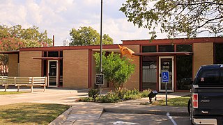
San Saba is a city located in, and the county seat of, San Saba County, Texas, United States. It was settled in 1854 and named for its location on the San Saba River. Its population was 3,099 at the 2010 census.
Luna is a census-designated place in northwestern Catron County, New Mexico, United States. As of the 2010 census it had a population of 158. It is situated on the San Francisco River and U.S. Route 180, 7 miles (11 km) east of the Arizona border and 20 miles (32 km) northwest of Reserve, the Catron county seat.

Deming is a city in Luna County, New Mexico, United States, 60 miles (97 km) west of Las Cruces and 35 miles (56 km) north of the Mexican border. The population was 14,758 as of the 2020 census. Deming is the county seat and principal community of Luna County.
City of the Sun is an intentional community and census-designated place in Luna County, New Mexico, United States. Its population was 33 as of the 2020 census. The community, which is on the northern border of Columbus, was founded in 1972.
Keeler Farm is a census-designated place in Luna County, New Mexico, United States. Its population was 1,305 as of the 2010 census.
La Hacienda is a census-designated place in Luna County, New Mexico, United States. Its population was 725 as of the 2010 census.
Mountain View is a census-designated place in Luna County, New Mexico, United States. Its population was 122 as of the 2010 census. Mountain View had a post office from 1911 to 1914.

Tome is an unincorporated village and census-designated place in Valencia County, New Mexico, United States. It is located in the Rio Grande valley near the foot of Tome Hill, a notable Catholic pilgrimage site. The village lies along New Mexico State Road 47 and is neighbored by Valencia to the north and Adelino to the south. It is the location of the Valencia Campus of the University of New Mexico. Tome has a post office with ZIP code 87060. The population was 1,867 as of the 2010 census.
Pulpotio Bareas is a census-designated place in Luna County, New Mexico, United States. Its population was 120 as of the 2010 census.
Sunshine is a census-designated place in Luna County, New Mexico, United States. Its population was 420 as of the 2010 census. New Mexico State Road 11 passes through the community.
Ventura is a census-designated place in Luna County, New Mexico, United States. Its population was 468 as of the 2010 census.
Monterey Park is a census-designated place in Valencia County, New Mexico, United States. Its population was 1,567 as of the 2010 census. It is part of the Albuquerque Metropolitan Statistical Area.
El Cerro is a census-designated place in Valencia County, New Mexico, United States. Its population was 2,953 as of the 2010 census. It is part of the Albuquerque Metropolitan Statistical Area.
Chical is a census-designated place in Valencia County, New Mexico, United States. Its population was 107 as of the 2010 census.
Highland Meadows is a census-designated place in Valencia County, New Mexico, United States. Its population was 624 as of the 2010 census.
Old Town is a census-designated place (CDP) in Luna County, New Mexico, United States. It was first listed as a CDP prior to the 2020 census.


