Penile Hill

Last updated

Penile Hill is a summit in Franklin County, Tennessee, in the United States. [1] With an elevation of 1,152 feet (351 m), Penile Hill is the 1207th highest summit in the state of Tennessee. [2]

Summit A point on a surface that is higher in elevation than all points immediately adjacent to it, in topography

A summit is a point on a surface that is higher in elevation than all points immediately adjacent to it. The topographic terms acme, apex, peak, and zenith are synonymous.

Franklin County, Tennessee County in the United States

Franklin County is a county located in the U.S. state of Tennessee. As of the 2010 census, the population was 41,052. Its county seat is Winchester.

United States Federal republic in North America

The United States of America (USA), commonly known as the United States or America, is a country comprising 50 states, a federal district, five major self-governing territories, and various possessions. At 3.8 million square miles, the United States is the world's third or fourth largest country by total area and is slightly smaller than the entire continent of Europe's 3.9 million square miles. With a population of over 327 million people, the U.S. is the third most populous country. The capital is Washington, D.C., and the largest city by population is New York City. Forty-eight states and the capital's federal district are contiguous in North America between Canada and Mexico. The State of Alaska is in the northwest corner of North America, bordered by Canada to the east and across the Bering Strait from Russia to the west. The State of Hawaii is an archipelago in the mid-Pacific Ocean. The U.S. territories are scattered about the Pacific Ocean and the Caribbean Sea, stretching across nine official time zones. The extremely diverse geography, climate, and wildlife of the United States make it one of the world's 17 megadiverse countries.

Related Research Articles

Chapel Hill, Tennessee Town in Tennessee, United States

Chapel Hill is a town in northeastern Marshall County, Tennessee, United States. The town was named after Chapel Hill, North Carolina by settlers from that area. The population was 1,445 as of the 2010 census.

Ardmore, Tennessee City in Tennessee, United States

Ardmore is a city in Giles and Lincoln counties, Tennessee. The population was 1,213 at the 2010 census. Ardmore is the site of a Tennessee Department of Tourist Development Welcome Center. It borders its sister city, Ardmore, Alabama.

Spring Hill, Tennessee City in Tennessee, United States

Spring Hill is a city in Maury and Williamson counties, Tennessee, located approximately 30 miles (48 km) south of Nashville. Spring Hill's population as of 2018 was 40,436.

Middle Tennessee is a distinct portion of the state of Tennessee, delineated according to state law as the 41 counties in the Middle Grand Division of Tennessee.

The Battle of Thompson's Station was a battle of the American Civil War, occurring on March 5, 1863 in Williamson County, Tennessee.

The Battle of Vaught's Hill, also known as the Battle of Milton, was a battle of the American Civil War, occurring on March 20, 1863, in Rutherford County, Tennessee.

The 1863 Battle of Franklin was fought April 10, 1863, in Williamson County, Tennessee, during the American Civil War. It was a minor engagement in about the same location as the more famous Battle of Franklin, part of the Franklin-Nashville Campaign.

Nashville Tennessee Temple temple of The Church of Jesus Christ of Latter-day Saints

The Nashville Tennessee Temple is the 84th operating temple of The Church of Jesus Christ of Latter-day Saints. It is located in Franklin, Tennessee, United States, approximately 20 miles (32 km) southwest of central Nashville.

Mount Chapman mountain in Great Smoky Mountains, USA

Mount Chapman is a mountain in the Great Smoky Mountains, located in the Southeastern United States. It has an elevation of 6,417 feet above sea level. While the mountain is located deep within the Great Smokies, the Appalachian Trail crosses its eastern slope, coming to within 200 feet (61 m) of the summit. Mount Chapman is among the 10 highest mountains in the Appalachian range, if subpeaks are not included.

Church of the Immaculate Conception (Knoxville, Tennessee) church in Knoxville, Tennessee

The Roman Catholic Church of the Immaculate Conception is a historic church located at 414 West Vine on Summit Hill in Knoxville, Tennessee.

Lascassas is an unincorporated community in Rutherford County, Tennessee, near the city of Murfreesboro. Its geographic coordinates are 35°55'49"N, 86°17'28"W.

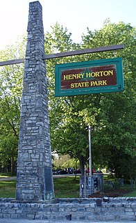
Henry Horton State Park park in Tennessee, United States

Henry Horton State Park is a state park located near Chapel Hill, Tennessee, United States. The park was constructed in the 1960s on the estate of the former governor of Tennessee, Henry Horton.

Dark Horse Recording Studios is located in Franklin, Tennessee, originally opened in 1993 and expanded in 2009. Its early client base consisted of Neil Diamond, Faith Hill, and Martina McBride; it was designed and built by author, speaker, and recording artist Robin Crow.

Arrington is an unincorporated community near Franklin in Williamson County, Tennessee. The Arrington area is known for rolling hills.

Allisona, Tennessee Unincorporated community in Tennessee, United States

Allisona is an unincorporated community in Rutherford and Williamson counties, Tennessee.

Red Hill is an unincorporated community in Lawrence County, Indiana, in the United States.

Beech Hill is an unincorporated community in Franklin County, in the U.S. state of Tennessee.

Beech Hill is an unincorporated community in Giles County, in the U.S. state of Tennessee.

Gee Hill [el. 696 ft (212 m)] is a summit in Hickman County, Tennessee, in the United States.

References

Coordinates: 35°14′55″N86°02′12″W / 35.2486933°N 86.0366496°W / 35.2486933; -86.0366496

Geographic coordinate system Coordinate system

A geographic coordinate system is a coordinate system that enables every location on Earth to be specified by a set of numbers, letters or symbols. The coordinates are often chosen such that one of the numbers represents a vertical position and two or three of the numbers represent a horizontal position; alternatively, a geographic position may be expressed in a combined three-dimensional Cartesian vector. A common choice of coordinates is latitude, longitude and elevation. To specify a location on a plane requires a map projection.