Pennsylvania Route 428

Last updated • 2 min readFrom Wikipedia, The Free Encyclopedia

PA-428.svg

Pennsylvania Route 428

Pennsylvania Route 428
Route information
Maintained by PennDOT
Length19.383 mi [1]  (31.194 km)
Major junctions
South endUS 62.svgPA-8.svg US 62  / PA 8 in Oil City
Major intersections
North endPA-408.svg PA 408 in Troy Township
Location
Country United States
State Pennsylvania
Counties Venango, Crawford
Highway system
PA-427.svg PA 427 PA-430.svg PA 430

Pennsylvania Route 428 (PA 428) is a 19-mile-long (31 km) state highway located in Venango and Crawford counties in Pennsylvania. The southern terminus is at U.S. Route 62 (US 62) and PA 8 in Oil City. The northern terminus is at PA 408 in Troy Township.

Contents

Route description

PA 428 northbound past US 62/PA 8 in Oil City 2022-06-06 13 20 11 View north along Pennsylvania State Route 428 (Halyday Street) at Pennsylvania State Route 8 (Main Street) and U.S. Route 62 (Petroleum Street) in Oil City, Venango County, Pennsylvania.jpg
PA 428 northbound past US 62/PA 8 in Oil City

PA 428 begins at an intersection with US 62/PA 8 in the city of Oil City in Venango County, heading north on two-lane undivided Halyday Street. The road heads through wooded areas with occasional homes, crossing into Cornplanter Township and becoming Halyday Run Road. The route curves to the northwest and heads through more woodland with some fields and residences as it continues into the borough of Sugarcreek and turns north. PA 428 enters Oakland Township and becomes an unnamed road, passing through Fosters Corners and running through more farmland and woodland with some homes, curving northwest. The road continues northwest through more rural areas, coming to an intersection with PA 417. At this point, PA 428 turns northeast to form a concurrency with PA 417 for a short distance before heading north onto Wallaceville Road. The route heads through more agricultural and wooded areas with a few residences, turning northwest and crossing into Plum Township. The road heads north again and passes through Wallaceville, running north-northwest through wooded areas. PA 428 turns northeast to remain on Wallaceville Road, continuing through more woodland with occasional fields. The route curves north at Propers Corners before a turn to the east and another curve back to the north. The road runs through areas of farms and woods with some homes as it reaches the PA 27 intersection. Here, PA 428 turns southwest to follow PA 27 briefly on Meadville Road before splitting at Diamond and heading northwest on Troy Center Road. The route heads through more farmland and woodland with occasional residences, heading north. [2] [3]

PA 428 enters Troy Township in Crawford County and continues north through more rural areas on Troy Center Road. The road makes a curve to the northwest and runs through more farms and woods with some homes, reaching the community of Troy Center. At this point, the route turns north to remain on Troy Center Road and runs through more rural areas, ending at an intersection with PA 408. [2] [4]

Major intersections

CountyLocationmi [1] kmDestinationsNotes
Venango Oil City 0.0000.000US 62.svgPA-8.svgHospital sign.svg US 62  / PA 8 (Petroleum Street / Main Street) Franklin Southern terminus
Oakland Township 7.32911.795South plate.svg
PA-417.svg
PA 417 south Franklin
South end of PA 417 overlap
7.49812.067North plate.svg
PA-417.svg
PA 417 north Titusville
North end of PA 417 overlap
Plum Township 14.81823.847East plate.svg
PA-27.svg
PA 27 east (Meadville Road) Titusville
South end of PA 27 overlap
14.92024.011West plate.svg
PA-27.svg
PA 27 west (Meadville Road) Meadville
North end of PA 27 overlap
Crawford Troy Township 19.38331.194PA-408.svg PA 408  Townville Northern terminus
1.000 mi = 1.609 km; 1.000 km = 0.621 mi

See also

Related Research Articles

<span class="mw-page-title-main">Pennsylvania Route 44</span> State highway in Pennsylvania, US

Pennsylvania Route 44 is a 149.24 mi (240.18 km)-long state highway in the U.S. state of Pennsylvania. The route, which is signed north-south, is designated from Interstate 80 (I-80) and PA 42 in Buckhorn northwest to the New York state line near New York State Route 417 in Ceres Township.

<span class="mw-page-title-main">Pennsylvania Route 38</span> State highway in Pennsylvania, US

Pennsylvania Route 38 is a 40.2-mile-long (64.7 km) state highway located in northwest Pennsylvania. The southern terminus is at U.S. Route 422 and PA 68 northeast of downtown Butler. The northern terminus is at US 322 in Rockland Township.

<span class="mw-page-title-main">Pennsylvania Route 77</span> State highway in Pennsylvania, US

Pennsylvania Route 77 is a 36-mile-long (58 km) east–west state highway located in northwest Pennsylvania. The western terminus of the route is at PA 27 in Meadville. The eastern terminus is at PA 426 in Corry.

<span class="mw-page-title-main">Pennsylvania Route 98</span> State highway in Pennsylvania, US

Pennsylvania Route 98 is a state highway located in western Pennsylvania. The southern terminus of the route is at U.S. Route 6 (US 6)/US 19/US 322 in Vernon Township. The northern terminus is at PA 5 in the borough of Avonia, one mile (1.6 km) from Lake Erie.

<span class="mw-page-title-main">Pennsylvania Route 157</span> State highway in Pennsylvania, US

Pennsylvania Route 157 is a 14-mile (23 km) state highway in Pennsylvania. The route runs from US 62 near Seneca east to PA 208 in Fryburg.

<span class="mw-page-title-main">Pennsylvania Route 108</span> State highway in Pennsylvania, US

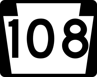
Pennsylvania Route 108 is a highway in Western Pennsylvania that runs for 32 miles (51 km) from the Ohio state line near SNPJ to PA 8 in Adams Corner. PA 108 intersects Interstate 376 (I-376) near New Castle and U.S. Route 19 (US 19) near Harlansburg. PA 108 also has an interchange with Interstate 79 (I-79) at exit 105.

<span class="mw-page-title-main">Pennsylvania Route 271</span> State highway in Pennsylvania, US

Pennsylvania Route 271 is a north–south state route located in Western Pennsylvania. Its southern terminus is at PA 711 in Oak Grove in Ligonier Township, and its northern terminus is at U.S. Route 219 (US 219) in Northern Cambria. The route was designated on May 27, 1935 in coordination with the release of a new state road map.

<span class="mw-page-title-main">Pennsylvania Route 136</span> State highway in Pennsylvania, US

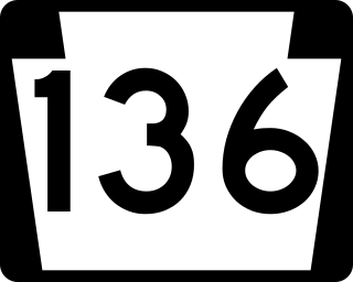
Pennsylvania Route 136 is a 40-mile-long (64 km) state highway located in Washington, Allegheny, and Westmoreland counties in Pennsylvania. The western terminus is at US 40 and PA 18 in Washington. The eastern terminus is at US 30 in Greensburg.

<span class="mw-page-title-main">Pennsylvania Route 187</span> State highway in Pennsylvania, US

Pennsylvania Route 187 is a 43.1-mile-long (69.4 km) state highway located in Wyoming and Bradford counties in Pennsylvania. The southern terminus is at PA 87 in Lovelton. The northern terminus is at the New York state line, north of Windham Center. The route continues as New York State Route 282 (NY 282) for 3+12 miles (5.6 km) north to its terminus at NY 17C.

<span class="mw-page-title-main">Pennsylvania Route 221</span>

Pennsylvania Route 221 is a 31-mile-long (50 km) state highway located in Greene and Washington counties in Pennsylvania. The southern terminus is at PA 188 near Jefferson. The northern terminus is at PA 231 in Acheson.

<span class="mw-page-title-main">Pennsylvania Route 227</span>

Pennsylvania Route 227 is a 21.3-mile-long (34.3 km) state highway located in Venango and Forest counties in Pennsylvania. The western terminus is at PA 8 in Rouseville. The eastern terminus is at PA 127 in Harmony Township.

<span class="mw-page-title-main">Pennsylvania Route 257</span> State highway in Pennsylvania, US

Pennsylvania Route 257 is a 5.12-mile-long (8.24 km) state highway located in Venango county in Pennsylvania. The southern terminus is at U.S. Route 322 in Cranberry Township. The northern terminus is at US 62 in Oil City.

<span class="mw-page-title-main">Pennsylvania Route 258</span> State highway in Pennsylvania, US

Pennsylvania Route 258 is a 27-mile-long (43 km) state highway located in Butler and Mercer counties in Pennsylvania. The southern terminus is at PA 108/PA 173 in Slippery Rock. The northern terminus is at PA 18 in Clark.

<span class="mw-page-title-main">Pennsylvania Route 308</span> State highway in Pennsylvania, US

Pennsylvania Route 308 is a 28.5-mile-long (45.9 km) state highway located in Butler and Venango Counties in Pennsylvania. The southern terminus is at PA 8 near Butler. The northern terminus is at State Route 3013 north of an interchange with the PA 8 expressway in Pearl.

<span class="mw-page-title-main">Pennsylvania Route 381</span> State highway in Pennsylvania, US

Pennsylvania Route 381 is a 49.3-mile-long (79.3 km) state highway located in Fayette, and Westmoreland counties in Pennsylvania. The southern terminus is the West Virginia state line near Elliottsville, Pennsylvania, where it continues as Preston County Route 8 to its southern terminus at WV 26 in Brandonville, West Virginia. The northern terminus is at U.S. Route 30 (US 30) near Ligonier.

<span class="mw-page-title-main">Pennsylvania Route 414</span> State highway in Pennsylvania, United States

Pennsylvania Route 414 is a 79.4-mile-long (127.8 km) state highway located in Lycoming, Tioga, and Bradford Counties in Pennsylvania. The western terminus is at PA 44 in Waterville. The eastern terminus is at US 220 in Monroe. The first leg of the highway, between its intersection with PA 44 in Waterville and Blackwell is very narrow and rugged.

<span class="mw-page-title-main">Pennsylvania Route 427</span> State highway in Pennsylvania, US

Pennsylvania Route 427 is a 10.7-mile-long (17.2 km) state highway located in Venango and Crawford counties in Pennsylvania. The southern terminus is at U.S. Route 322 in Sugarcreek. The northern terminus is at PA 27 near Bradleytown.

<span class="mw-page-title-main">Pennsylvania Route 475</span> State highway in Pennsylvania, US

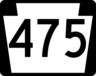
Pennsylvania Route 475 is a 19.6-mile-long (31.5 km) state highway located in Fulton and Huntingdon Counties in Pennsylvania. The southern terminus is at US 522 in Dublin Township. The northern terminus is at PA 994 near Rockhill Furnace. The route was created in 1964, replacing Pennsylvania Route 176 due to the designation of Interstate 176 (I-176) in Pennsylvania.

<span class="mw-page-title-main">Pennsylvania Route 819</span> State highway in Pennsylvania, US

Pennsylvania Route 819 is a 46.6-mile-long (75.0 km) state highway located in Fayette and Westmoreland counties in Pennsylvania, United States. The southern terminus is at PA 201 in Vanderbilt. The northern terminus is at PA 66 in Oklahoma.

<span class="mw-page-title-main">Pennsylvania Route 948</span> State highway in Pennsylvania, US

Pennsylvania Route 948 is a 38.5-mile-long (62.0 km) state highway located in Elk, Forest, and Warren counties in Pennsylvania. The southern terminus is at PA 255 in Fox Township. The northern terminus is at PA 666 in Sheffield Township.

References

  1. 1 2 Bureau of Maintenance and Operations (January 2019). Roadway Management System Straight Line Diagrams (Report) (2019 ed.). Pennsylvania Department of Transportation . Retrieved March 1, 2019.
  2. 1 2 Google (August 17, 2011). "overview of Pennsylvania Route 428" (Map). Google Maps . Google. Retrieved August 17, 2011.
  3. Venango County, Pennsylvania Highway Map (PDF) (Map). PennDOT. 2018. Retrieved March 1, 2019.
  4. Crawford County, Pennsylvania Highway Map (PDF) (Map). PennDOT. 2018. Retrieved March 1, 2019.
Template:Attached KML/Pennsylvania Route 428
KML is from Wikidata