U.S. Route 62 in Pennsylvania

Last updated

US 62.svg

U.S. Route 62

U.S. Route 62 in Pennsylvania
US 62 highlighted in red and US 62 Business in blue
Route information
Maintained by PennDOT
Length119 mi [1]  (192 km)
Existed1932 [2] –present
Major junctions
South endUS 62.svg US 62 at Ohio border in Sharon
Major intersections
North endUS 62.svg US 62 at New York border in Pine Grove Township
Location
Country United States
State Pennsylvania
Counties Mercer, Venango, Forest, Warren
Highway system
PA-61.svg PA 61 PA-62 (1926).svg PA 62

U.S. Route 62 (US 62) is a signed north-south U.S. Highway that is located in the Commonwealth of Pennsylvania in the United States. It stretches diagonally southwest-northeast through the industrial northwestern part of the commonwealth.

Contents

Although initial portions of the route opened in 1926 in other areas of the country, US 62 was not designated in the commonwealth until 1932. The highway connects the small cities of Sharon, Franklin, Oil City, and Warren to larger markets, such as Youngstown, Ohio and Buffalo, New York.

Route description

US 62 northbound in Hickory Township 2022-06-13 15 04 49 View north along U.S. Route 62 at Little Hickory Road in Hickory Township, Forest County, Pennsylvania.jpg
US 62 northbound in Hickory Township

U.S. Route 62 enters Pennsylvania from Ohio as part of the Shenango Valley Freeway. Four lanes, winding, and with limited stop lights, the road, which was built in 1958, bypasses the city of Sharon. A business route is signed on the former path of the highway. After passing through Sharon, the road reverts to two lane status, as it travels toward Mercer, the county seat of Mercer County.

Here, it briefly joins US 19 through the center of town. The road then turns sharply toward a north-northeast alignment and features an interchange with Interstate 79. After cutting through rural Mercer and Venango counties, US 62 reaches the twin industrial towns of Franklin and Oil City. In Franklin, the highway is briefly cosigned with US 322, as it passes through the west side of town. The road then joins PA 8 to form a fourlane riverfront connector between the two towns.

Immediately before entering Oil City, the roads split, with US 62 branching off to cross the Allegheny River over the Petroleum Street Bridge and serve the south side of town. After crossing this 1995 girder structure, which replaced a 1910 truss bridge, the highway remains four lanes until leaving the municipality.

The Allegheny River is only rarely out of sight as the highway winds its way through Venango and Forest Counties, crossing from the south bank to the north by way of the Hunter Station Bridge, an unusual 1934 truss design. It crosses the river a third time on the Tionesta Bridge, a 1961 girder structure that set the tone for 1980s90s replacements of a series of historic bridges along the waterway.

While traveling through Forest and into Warren County, the road is oriented in a north-south direction, which is reflected in its guide signs, despite the national route’s east-west direction. The route passes through the Allegheny Islands Wilderness, crosses the river again via the Irvine Bridge, and subsequently joins with US 6 via a trumpet interchange to form part of the freeway bypass of Warren, which was constructed in 1969. The routes divide near the city center, and US 62 follows a narrow path of city streets in the old city core before becoming a fourlane highway north of the town. The highway becomes a twolane road again as it heads toward the New York boundary.

History

US 62 was designated in Pennsylvania in 1932, replacing PA 65 between the Ohio border near Sharon and Franklin, PA 8 between Franklin and Oil City, PA 57 between Oil City and Fryburg, and PA 66 between Fryburg and the New York border. Signs were installed by June 1 of that year. [2]

Major intersections

CountyLocation [3] mikmDestinationsNotes
Mercer Sharon West plate.svg
US 62.svg
US 62 west Youngstown
Continues into Ohio
North plate.svg
Business plate.svg
US 62.svg
US 62 Bus. north (Irvine Avenue)
Southern terminus of US 62 Bus.
PA-718.svgPA-760.svg PA 718  / PA 760 (South Dock Street) Farrell, Wheatland Interchange
PA-518.svg PA 518 (Stambaugh Avenue)
Hermitage PA-418.svg PA 418 (Maple Drive)
PA-18.svgTo plate blue.svg
I-376.svg
To plate blue.svg
I-80.svg
PA 18 (South Hermitage Road) to I-376  / I-80
South plate.svg
Business plate.svg
US 62.svg
To plate.svg
North plate.svg
PA-18.svg
US 62 Bus. south (State Street) to PA 18 north
Roundabout; northern terminus of US 62 Bus.
Mercer North plate.svg
PA-258.svg
PA 258 north (North Maple Street) Clark
Southern end of PA 258 concurrency
South plate.svg
PA-158.svg
To plate.svg
PA-318.svg
PA 158 south (South Shenango Street) to PA 318
Northern terminus of PA 158
South plate.svg
US 19.svg
To plate blue.svg
I-80.svg
US 19 south (South Erie Street) to I-80  Zelienople
East plate.svg
PA-58.svg
South plate.svg
PA-258.svg
PA 58 east / PA 258 south (Diamond Street)
Northern end of PA 258 concurrency; southern end of US 19 and PA 58 concurrencies
West plate.svg
PA-58.svg
PA 58 west (Greenville Road) Greenville
Northern end of PA 58 concurrency
Coolspring Township North plate.svg
US 19.svg
US 19 north (Perry Highway) Meadville
Northern end of US 19 concurrency
Jackson Township I-79.svg I-79  Erie, Pittsburgh I-79 exit 121
East plate.svg
PA-965.svg
PA 965 east (Henderson Road) Polk, Franklin
Western terminus of PA 965
Sandy Lake Township North plate.svg
PA-845.svg
PA 845 north (Walnut Street) Stoneboro
Southern terminus of PA 845
Sandy Lake South plate.svg
PA-173.svg
PA 173 south (South Main Street)
Southern end of PA 173 concurrency
North plate.svg
PA-173.svg
PA 173 north (North Main Street)
West plate.svg
PA-358.svg
To plate blue.svg
I-79.svg
PA 358 west (Lake Street) to I-79
Northern end of PA 173 concurrency; eastern terminus of PA 358
Venango Victory Township West plate.svg
PA-965.svg
PA 965 west (Jackson Center-Polk Road) Jackson Center
Eastern terminus of PA 965
French Creek Township South plate.svg
PA-8.svg
To plate blue.svg
I-80.svg
PA 8 south (Pittsburgh Road) to I-80  Butler
Southern end of PA 8 concurrency
Franklin West plate.svg
US 322.svg
US 322 west (13th Street)
Southern end of US 322 concurrency
East plate.svg
US 322.svg
US 322 east (Liberty Street)
Northern end of US 322 concurrency
Oil City North plate.svg
PA-8.svg
PA 8 north (Main Street) Titusville
North plate.svg
PA-428.svg
PA 428 north (Halyday Street)
Northern end of PA 8 concurrency; southern terminus of PA 428
South plate.svg
PA-257.svg
PA 257 south Cranberry
Northern terminus of PA 257
Cranberry Township East plate.svg
PA-157.svg
PA 157 east Fryburg
Eastern terminus of PA 157
Forest Tionesta Township North plate.svg
PA-36.svg
PA 36 north (Colonel Drake Highway) Pleasantville
Southern end of PA 36 concurrency
Tionesta South plate.svg
PA-36.svg
PA 36 south (Elm Street) Brookville
Northern end of PA 36 concurrency
Hickory Township North plate.svg
PA-127.svg
PA 127 north (Main Street) West Hickory
Southern terminus of PA 127
East plate.svg
PA-666.svg
PA 666 east Endeavor
Western terminus of PA 666
Warren Limestone Township South plate.svg
PA-127.svg
PA 127 south (Buckingham Street) Tidioute
Northern terminus of PA 127
Brokenstraw Township West plate.svg
US 6.svg
US 6 west (Grand Army of the Republic Highway) Youngsville
Southern end of US 6 concurrency; interchange
Warren East plate.svg
US 6.svg
US 6 east (Grand Army of the Republic Highway)
Begin plate.svg
Business plate.svg
US 6.svg
US 6 Bus. begins
Northern end of US 6 concurrency; southern end of US 6 Bus. concurrency; interchange
East plate.svg
Business plate.svg
US 6.svg
US 6 Bus. east (Pennsylvania Avenue West)
Northern end of US 6 Bus. concurrency
Conewango Township North plate.svg
PA-69.svg
PA 69 north (Jackson Run Road) Sugar Grove
Southern terminus of PA 69
Pine Grove Township West plate.svg
PA-957.svg
PA 957 west Sugar Grove
Eastern terminus of PA 957
North plate.svg
US 62.svg
US 62 north Jamestown
Continues into New York
1.000 mi = 1.609 km; 1.000 km = 0.621 mi

See also

Related Research Articles

<span class="mw-page-title-main">Venango County, Pennsylvania</span> County in Pennsylvania, United States

Venango County is a county in the Commonwealth of Pennsylvania. As of the 2020 census, the population was 50,454. Its county seat is Franklin. The county was created in 1800 and later organized in 1805.

<span class="mw-page-title-main">Interstate 376</span> Highway in Pennsylvania

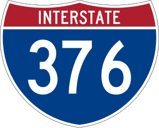
Interstate 376 (I-376) is a major auxiliary route of the Interstate Highway System in the US state of Pennsylvania, located within the Allegheny Plateau. It runs from I-80 near Sharon south and east to a junction with the Pennsylvania Turnpike in Monroeville, after having crossed the Pennsylvania Turnpike at an interchange in Big Beaver. The route serves Pittsburgh and its surrounding areas and is the main access road to Pittsburgh International Airport (PIT). Portions of the route are known as the Beaver Valley Expressway, Southern Expressway, and Airport Parkway. Within Allegheny County, the route runs along the majority of the Penn-Lincoln Parkway, known locally as Parkway West and Parkway East. It is currently the ninth-longest auxiliary Interstate route in the system and second only to I-476 within Pennsylvania.

<span class="mw-page-title-main">Pennsylvania Route 60</span> State highway in Allegheny County, Pennsylvania, US

Pennsylvania Route 60 (PA 60) is a state highway located in the western suburbs of Pittsburgh, Pennsylvania. Although the route follows a mostly east–west alignment, it is signed as a north–south highway. The southern terminus of the route is at a partial interchange with U.S. Route 19 (US 19) and PA 51 in Pittsburgh's West End while the northern terminus is at an interchange with Interstate 376 (I-376), US 22, and US 30 in Robinson Township. The portion of PA 60 outside of Pittsburgh is known as the Steubenville Pike; within the city, PA 60 follows several different streets.

<span class="mw-page-title-main">Pennsylvania Route 65</span> State highway in Pennsylvania, US

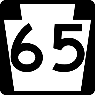
Pennsylvania Route 65 is a major 51-mile-long (82 km) state highway located in western Pennsylvania, United States. The route, traveling north–south from the Interstate 279/U.S. Route 19 Truck concurrency in Pittsburgh north to the PA 108/PA 168 concurrency in New Castle, connects downtown Pittsburgh to the northwestern portion of the Pittsburgh Metropolitan Area. PA 65 is similar in its purpose to PA 18 and PA 51, both of which run parallel to PA 65 at one point or another; however, the three routes pass through different cities for most of their respective alignments.

<span class="mw-page-title-main">Pennsylvania Route 8</span> State highway in Pennsylvania, US

Pennsylvania Route 8 is a major 148.6-mile-long (239.1 km) state route in western Pennsylvania. Officially, PA 8 is named the William Flinn Highway.

<span class="mw-page-title-main">Pennsylvania Route 208</span> State highway in Pennsylvania, US

Pennsylvania Route 208 is located in Western Pennsylvania; its western terminus just west of the village of New Bedford in Lawrence County at U.S. Route 422 and the Ohio state line. It runs nearly 75 miles (121 km) to its eastern terminus in the village of Frills Corners in Clarion County at PA 36.

<span class="mw-page-title-main">Pennsylvania Route 38</span> State highway in Pennsylvania, US

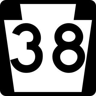
Pennsylvania Route 38 is a 40.2-mile-long (64.7 km) state highway located in northwest Pennsylvania. The southern terminus is at U.S. Route 422 and PA 68 northeast of downtown Butler. The northern terminus is at US 322 in Rockland Township.

<span class="mw-page-title-main">Pennsylvania Route 36</span> State highway in Pennsylvania, US

Pennsylvania Route 36 is a 151.12 mi (243.2 km) long state highway located in the U.S. state of Pennsylvania. The southern terminus is at PA 26 near the Hopewell Township community of Yellow Creek. The northern terminus is at PA 27 and PA 227 in Pleasantville.

<span class="mw-page-title-main">Pennsylvania Route 157</span> State highway in Pennsylvania, US

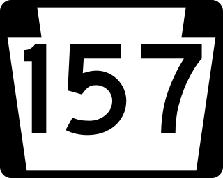
Pennsylvania Route 157 is a 14-mile (23 km) state highway in Pennsylvania. The route runs from US 62 near Seneca east to PA 208 in Fryburg.

<span class="mw-page-title-main">French Creek Council</span> Boy Scout council in Ohio and Pennsylvania

The French Creek Council serves Boy Scouts in six counties in northwestern Pennsylvania and one township in Ohio. The council was organized in 1972 from a merger of the former Washington Trail Council of Erie, Custaloga Council of Sharon and Colonel Drake Council of Oil City, Pennsylvania. It has headquarters in Erie, Pennsylvania.

<span class="mw-page-title-main">Pennsylvania Route 127</span> State highway in Pennsylvania, US

Pennsylvania Route 127 (PA 127) is a 10-mile-long (16 km) state highway located in Forest and Warren counties in Pennsylvania. The southern terminus is at U.S. Route 62 in West Hickory. The northern terminus is at US 62 outside of Tidioute.

<span class="mw-page-title-main">Pennsylvania Route 227</span> State highway in Pennsylvania, United States

Pennsylvania Route 227 is a 21.3-mile-long (34.3 km) state highway located in Venango and Forest counties in Pennsylvania. The western terminus is at PA 8 in Rouseville. The eastern terminus is at PA 127 in Harmony Township.

<span class="mw-page-title-main">Pennsylvania Route 257</span> State highway in Pennsylvania, US

Pennsylvania Route 257 is a 5.12-mile-long (8.24 km) state highway located in Venango County in Pennsylvania. The southern terminus is at U.S. Route 322 in Cranberry Township. The northern terminus is at US 62 in Oil City.

<span class="mw-page-title-main">Pennsylvania Route 417</span> State highway in Venango County, Pennsylvania, US

Pennsylvania Route 417 is a 12-mile-long (19 km) state highway located in Venango County in Pennsylvania. The southern terminus is at US 322 in Franklin. The northern terminus is at PA 8 in Cherrytree Township.

<span class="mw-page-title-main">Pennsylvania Route 428</span> State highway in Pennsylvania, US

Pennsylvania Route 428 is a 19-mile-long (31 km) state highway located in Venango and Crawford counties in Pennsylvania. The southern terminus is at U.S. Route 62 (US 62) and PA 8 in Oil City. The northern terminus is at PA 408 in Troy Township.

<span class="mw-page-title-main">Pennsylvania Route 518</span> State highway in Mercer County, Pennsylvania, US

Pennsylvania Route 518 is an 8.5-mile-long (13.7 km) state highway located in Mercer County, Pennsylvania. The southern terminus is at PA 18 in Hermitage. The northern terminus is at PA 18 in Hermitage.

<span class="mw-page-title-main">Pennsylvania Route 965</span> State highway in Pennsylvania, US

Pennsylvania Route 965 is an 11.6-mile-long (18.7 km) state highway located in Mercer County and Venango County, Pennsylvania. The route terminates at each end at U.S. Route 62. In the west, it begins in Jackson Township, before traveling through rural areas to its end in Frenchcreek Township.

<span class="mw-page-title-main">Pennsylvania Route 760</span> State highway in Mercer County, Pennsylvania, US

Pennsylvania Route 760 is a state highway located in Mercer County, Pennsylvania. The route runs from an interchange with Interstate 80 (I-80) and I-376 in Shenango Township to an intersection with U.S. Route 62 Business and PA 718 in Sharon. The road was designated as the northernmost part of PA 60 until 2009, when I-376 was extended from the Pittsburgh area to I-80 along PA 60.

<span class="mw-page-title-main">Jersey Bridge (Cherrytree Township, Pennsylvania)</span> Listed on the NRHP in Venango County

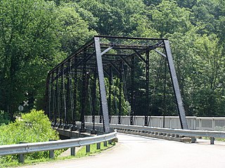
The Jersey Bridge is a one-lane, Pratt through truss bridge that spans Oil Creek in Cherrytree Township, Venango County in the U.S. state of Pennsylvania. It connects the city of Titusville to the Drake Well Museum and Oil Creek State Park. The bridge was listed on the National Register of Historic Places in 1988. It was replaced in 1998 with a newer bridge that used the superstructure of the old bridge.

The following is a list of former state routes in Pennsylvania. These roads are now either parts of other routes or no longer carry a traffic route number. This list also includes original routes of numbers that were decommissioned and later reactivated in other locations in which most of these are still active today.

References

  1. Google (June 29, 2013). "U.S. Route 62 in Pennsylvania" (Map). Google Maps . Google. Retrieved June 29, 2013.
  2. 1 2 "No. 62 Designated As New Number Of Route Through Franklin". The News-Herald. Franklin, PA. February 18, 1932. p. 2. Retrieved May 25, 2016 via Newspapers.com. Open Access logo PLoS transparent.svg
  3. "Video Log". Pennsylvania Department of Transportation . Retrieved June 10, 2016.
Template:Attached KML/U.S. Route 62 in Pennsylvania
KML is from Wikidata
US 62.svg U.S. Route 62
Previous state:
Ohio
Pennsylvania Next state:
New York