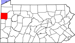
Clark, Pennsylvania

Last updated
Clark, Pennsylvania
Milton south of Nora, Clark.jpg
Houses on Milton Street
Mercer County Pennsylvania Incorporated and Unincorporated areas Clark Highlighted.svg
Location of Clark in Mercer County, Pennsylvania.
Coordinates: 41°16′55″N80°24′35″W / 41.28194°N 80.40972°W / 41.28194; -80.40972
Country United States
State Pennsylvania
County Mercer
Established1829
Area
[1]
  Total3.62 sq mi (9.38 km2)
  Land3.01 sq mi (7.80 km2)
  Water0.61 sq mi (1.58 km2)
Highest elevation
[2] (southwest corner of township)
1,200 ft (400 m)
Lowest elevation
[2] (Shenango River Reservoir)
896 ft (273 m)
Population
 (2020) [3]
  Total576
  Density191.30/sq mi (73.87/km2)
Time zone UTC-4 (EST)
  Summer (DST) UTC-5 (EDT)
Zip code
16113
Area code 724

Clark is a borough in western Mercer County, Pennsylvania, United States, along the southern shore of the Shenango River Reservoir. The population was 576 at the 2020 census. [4] It is part of the Hermitage micropolitan area.

Contents

History

Clark bore the name of Clarksville into the late 1950s. The original community was moved to the present site following the construction of a Shenango River dam for flood control near Sharpsville.

Geography

Clark is located at 41°16′55″N80°24′35″W / 41.28194°N 80.40972°W / 41.28194; -80.40972 (41.282049, -80.409591). [5]

According to the United States Census Bureau, the borough has a total area of 3.8 square miles (9.8 km2), of which 3.0 square miles (7.8 km2) is land and 0.7 square miles (1.8 km2) (19.31%) is water.

Notable locations

Demographics

Historical population
CensusPop.Note
1880 264
1900 220
1910 216−1.8%
1920 2243.7%
1930 27924.6%
1940 32115.1%
1950 3457.5%
1960 312−9.6%
1970 46749.7%
1980 66742.8%
1990 610−8.5%
2000 6333.8%
2010 6401.1%
2020 576−10.0%
2021 (est.)571 [4] −0.9%
Sources: [6] [7] [8] [9] [3]

As of the census [7] of 2000, there were 633 people, 227 households, and 194 families residing in the borough. The population density was 207.9 inhabitants per square mile (80.3/km2). There were 233 housing units at an average density of 76.5 per square mile (29.5/km2). The racial makeup of the borough was 99.53% White, 0.16% African American, 0.16% from other races, and 0.16% from two or more races. Hispanic or Latino of any race were 0.47% of the population.

There were 227 households, out of which 32.2% had children under the age of 18 living with them, 76.7% were married couples living together, 7.0% had a female householder with no husband present, and 14.1% were non-families. 11.9% of all households were made up of individuals, and 5.3% had someone living alone who was 65 years of age or older. The average household size was 2.79 and the average family size was 3.02.

In the borough the population was spread out, with 23.4% under the age of 18, 6.3% from 18 to 24, 28.0% from 25 to 44, 29.2% from 45 to 64, and 13.1% who were 65 years of age or older. The median age was 41 years. For every 100 females there were 92.4 males. For every 100 females age 18 and over, there were 93.2 males.

The median income for a household in the borough was $53,438, and the median income for a family was $56,944. Males had a median income of $40,729 versus $26,625 for females. The per capita income for the borough was $24,892. About 1.0% of families and 1.7% of the population were below the poverty line, including none of those under age 18 and 4.3% of those age 65 or over.

Official Clark Borough, Mercer County Website

Related Research Articles

<span class="mw-page-title-main">Mercer County, Pennsylvania</span> County in Pennsylvania, United States

Mercer County is a county in the Commonwealth of Pennsylvania. As of the 2020 census, the population was 110,652. Its county seat is Mercer, and its largest city is Hermitage.

<span class="mw-page-title-main">Fairfield Township, Crawford County, Pennsylvania</span> Township in Pennsylvania, United States

Fairfield Township is a township in Crawford County, Pennsylvania, United States. The population was 1,015 at the 2020 census, down from the 2010 census.

<span class="mw-page-title-main">Pymatuning South, Pennsylvania</span> Census-designated place in Pennsylvania, United States

Pymatuning South is a census-designated place (CDP) in Crawford County, Pennsylvania, United States. The population was 479 at the 2010 census.

<span class="mw-page-title-main">South Shenango Township, Crawford County, Pennsylvania</span> Township in Pennsylvania, United States

South Shenango Township is a township in Crawford County, Pennsylvania, United States. The population was 1,836 at the 2020 census, down from 2,037 at the 2010 census.

<span class="mw-page-title-main">West Fallowfield Township, Crawford County, Pennsylvania</span> Township in Pennsylvania, United States

West Fallowfield Township is a township in Crawford County, Pennsylvania, United States. The population was 578 at the 2020 census, down from 605 at the 2010 census.

<span class="mw-page-title-main">West Shenango Township, Crawford County, Pennsylvania</span> Township in Pennsylvania, United States

West Shenango Township is a township in Crawford County, Pennsylvania, United States. The population was 436 at the 2020 census, down from 504 at the 2010 census.

<span class="mw-page-title-main">Greenville, Pennsylvania</span> Borough in Pennsylvania, United States

Greenville is a borough with home rule status in northwestern Mercer County, Pennsylvania, United States. Located along the Shenango River, it lies roughly 80 miles from both Pittsburgh and Cleveland. It is 1.89 square miles in area, and had a population of 5,541 as of the 2020 census.

<span class="mw-page-title-main">Hermitage, Pennsylvania</span> City in Pennsylvania, United States

Hermitage is a city in western Mercer County, Pennsylvania, United States. The population was 16,230 at the 2020 census, making it the largest city in Mercer County. It is located about 15 miles (24 km) northeast of Youngstown and about 60 miles (97 km) northwest of Pittsburgh. It is the principal city of the Hermitage micropolitan area, which includes all of Mercer County.

<span class="mw-page-title-main">Jackson Center, Pennsylvania</span> Borough in Pennsylvania, United States

Jackson Center is a borough in eastern Mercer County, Pennsylvania, United States. The population was 192 at the 2020 census. It is part of the Hermitage micropolitan area.

<span class="mw-page-title-main">Jamestown, Pennsylvania</span> Borough in Pennsylvania, United States

Jamestown is a borough in northwestern Mercer County, Pennsylvania, United States, along the Shenango River. The population was reported as 580 on the 2020 census. It is part of the Hermitage micropolitan area.

<span class="mw-page-title-main">Mercer, Pennsylvania</span> Borough in Pennsylvania, United States

Mercer is a borough in and the county seat of Mercer County, Pennsylvania, United States. The population was 1,982 at the 2020 census. It is part of the Hermitage micropolitan area.

<span class="mw-page-title-main">New Lebanon, Pennsylvania</span> Borough in Pennsylvania, United States

New Lebanon is a borough in northeastern Mercer County, Pennsylvania, United States. The population was 186 at the 2020 census. It is part of the Hermitage micropolitan area.

<span class="mw-page-title-main">Sandy Lake, Pennsylvania</span> Borough in Pennsylvania, United States

Sandy Lake is a borough in eastern Mercer County, Pennsylvania, United States. It was established in 1849. The population was 649 at the 2020 census. It is part of the Hermitage micropolitan area.

<span class="mw-page-title-main">Sharpsville, Pennsylvania</span> Borough in Pennsylvania, United States

Sharpsville is a borough that is located in western Mercer County, Pennsylvania, United States, along the Shenango River. The population was 4,253 as of the 2020 census. It is part of the Hermitage micropolitan area.

<span class="mw-page-title-main">Sheakleyville, Pennsylvania</span> Borough in Pennsylvania, United States

Sheakleyville is a borough in northern Mercer County, Pennsylvania, United States. The population was 142 at the 2010 census, a figure which increased to 150 tabulated residents in 2020. It is part of the Hermitage micropolitan area.

<span class="mw-page-title-main">Shenango Township, Mercer County, Pennsylvania</span> Township in Pennsylvania, United States

Shenango Township is a township in Mercer County, Pennsylvania, United States. The population was 3,519 at the 2020 census, down from 3,929 in 2010.

<span class="mw-page-title-main">Stoneboro, Pennsylvania</span> Borough in Pennsylvania, United States

Stoneboro is a borough in eastern Mercer County, Pennsylvania, United States. The population was 946 at the 2020 census. It is part of the Hermitage micropolitan area.

<span class="mw-page-title-main">West Middlesex, Pennsylvania</span> Borough in Pennsylvania, United States

West Middlesex is a borough along the Shenango River in southwestern Mercer County, Pennsylvania, United States. The population was 815 at the 2020 Census. It is part of the Hermitage micropolitan area.

<span class="mw-page-title-main">Wheatland, Pennsylvania</span> Borough in Pennsylvania, United States

Wheatland is a borough in Mercer County, Pennsylvania, United States, along the Shenango River. The population was 583 at the 2020 census. It is part of the Hermitage micropolitan area.

<span class="mw-page-title-main">Lynn, Wisconsin</span> Town in Wisconsin, United States

Lynn is a town in Clark County in the U.S. state of Wisconsin. The population was 834 at the 2000 census.

References

  1. "ArcGIS REST Services Directory". United States Census Bureau. Retrieved October 12, 2022.
  2. 1 2 "Pymatuning Creek Topo Map, Mercer County PA (Sharpsville Area)". TopoZone. Locality, LLC. Retrieved 6 September 2019.
  3. 1 2 "Census Population API". United States Census Bureau. Retrieved Oct 12, 2022.
  4. 1 2 Bureau, US Census. "City and Town Population Totals: 2020-2021". Census.gov. US Census Bureau. Retrieved 17 July 2022.
  5. "US Gazetteer files: 2010, 2000, and 1990". United States Census Bureau. 2011-02-12. Retrieved 2011-04-23.
  6. "Census of Population and Housing". U.S. Census Bureau. Retrieved 11 December 2013.
  7. 1 2 "U.S. Census website". United States Census Bureau . Retrieved 2008-01-31.
  8. "Incorporated Places and Minor Civil Divisions Datasets: Subcounty Resident Population Estimates: April 1, 2010 to July 1, 2012". Population Estimates. U.S. Census Bureau. Archived from the original on 11 June 2013. Retrieved 11 December 2013.
  9. "Census of Population and Housing". Census.gov. Retrieved June 4, 2016.