West Middlesex, Pennsylvania

Last updated
West Middlesex, Pennsylvania
West Middlesex funeral home.jpg
Main Street funeral home, October 2014
Mercer County Pennsylvania Incorporated and Unincorporated areas West Middlesex Highlighted.svg
Location of West Middlesex in Mercer County, Pennsylvania.
USA Pennsylvania location map.svg
Red pog.svg
West Middlesex, Pennsylvania
Location of West Middlesex within Pennsylvania
Coordinates: 41°10′25″N80°27′25″W / 41.17361°N 80.45694°W / 41.17361; -80.45694
CountryUnited States
State Pennsylvania
County Mercer
Established1836
Government
  MayorStacey Curry [1]
Area
[2]
  Total0.84 sq mi (2.19 km2)
  Land0.84 sq mi (2.19 km2)
  Water0.00 sq mi (0.00 km2)
Elevation
[3] (center of borough)
860 ft (260 m)
Highest elevation
[3] (eastern border)
980 ft (300 m)
Lowest elevation820 ft (250 m)
Population
 (2020) [4]
  Total815 Decrease2.svg
  Estimate 
(2021) [4]
809
  Density950.30/sq mi (366.75/km2)
Time zone UTC-4 (EST)
  Summer (DST) UTC-5 (EDT)
Zip code
16159
Area code 724

West Middlesex is a borough along the Shenango River in southwestern Mercer County, Pennsylvania, United States. The population was 815 at the 2020 Census. [4] It is part of the Hermitage micropolitan area.

Contents

Geography

West Middlesex is located at 41°10′25″N80°27′25″W / 41.17361°N 80.45694°W / 41.17361; -80.45694 (41.173630, -80.456874). [5]

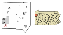
According to the United States Census Bureau, the borough has a total area of 0.9 square miles (2.3 km2). The Shenango River runs through West Middlesex, making it part of the Shenango Valley.

History

West Middlesex is one of the oldest localities in Mercer County. Samuel Byers, Andrew Wylie, William Bell, Richard Vanfleet and several others arrived in the vicinity in the late 18th century. In 1787, James Gibson received a plot of land west of the Shenango River for military services. Shortly thereafter, ownership of that land passed to Jacob Edeburn. In 1818, Jacob's son William Edeburn built a log grist mill on part of the land. It was purchased by James McConnell in 1821, who built a log house nearby. [6]

In 1830, Edeburn built a sawmill, and McConnell built a flour mill. James Gilkey, cultivator of the "Neshannock potatoes," surveyed the site and platted the town in 1836 on McConnell's land. A store and a tavern were opened about the time the town was platted, and in 1840 the post office was established, with Robert Young as the first postmaster. [6]

In 1864 West Middlesex was incorporated as a borough. The first burgess was D. Edeburn, and the first members of the council were C.W. Watson, Hiram Veach and G.R. Tuttle. [6]

West Middlesex was one of the first places in the Shenango Valley to become a center of the iron business. The old Middlesex furnace, erected in 1845, was a charcoal-burning plant. [6] Additional coke and ore furnaces followed, including the Fannie (1873, remodeled in 1885) and the Ella (1882). [7]

Demographics

Historical population
CensusPop.Note
1870 888
1880 9183.4%
1890 9665.2%
1900 930−3.7%
1910 1,15724.4%
1920 1,34916.6%
1930 1,181−12.5%
1940 1,126−4.7%
1950 1,2178.1%
1960 1,3016.9%
1970 1,293−0.6%
1980 1,064−17.7%
1990 982−7.7%
2000 929−5.4%
2010 863−7.1%
2020 815−5.6%
2021 (est.)809 [4] −0.7%
Sources: [8] [9] [10]

As of the census of 2010, [11] there were 863 people, 368 households, and 244 families residing in the borough. The racial makeup of the borough was 96.9% White, 1.2% African American, 0.3% Asian, 0.6% from other races, and 1.0% from two or more races. Hispanic or Latino of any race were 0.3% of the population.

There were 391 housing units and 368 households, out of which 26.6% had children under the age of 18 living with them, 46.5% were married couples living together, 14.9% had a female householder with no husband present, and 33.7% were non-families. 30.2% of all households were made up of individuals, and 9.3% had someone living alone who was 65 years of age or older. The average household size was 2.35 people, and the average family size was 2.88 people.

The age distribution was 20.2% under the age of 18, 9.2% from 18 to 24, 24.2% from 25 to 44, 30.9% from 45 to 64, and 15.5% who were 65 years of age or older. The median age was 43.3 years old.

According to the 2015 American Community Survey, [12] the median income for a household in the borough was $46,103, and the median income for a family was $53,750. Among full-time, year-round workers, males had a median income of $45,526 versus $33,675 for females. About 13.6% of families and 16.6% of the population had annual incomes below the poverty line.

Political affiliation

West Middlesex has supported Republican politicians by comfortable margins in recent years. The town is presently represented by Republican Mike Kelly in the House of Representatives, and voted for GOP incumbent Donald Trump in the 2020 presidential election by a 30 percentage point margin as opposed to Democratic challenger Joe Biden. [13]

Education

The West Middlesex Area School District serves the borough of West Middlesex and its two neighboring townships, Shenango Township and Lackawannock Township. The school district serves students in grades K-12, and it also offers Head Start preschool.

Historically, West Middlesex has served students since shortly after the town was platted. A small frame house was built in 1837 for school sessions and church services, and in 1855, it was replaced by a two-story building: the first story for education, and the second story for worship. A three-story brick union schoolhouse was built in 1868. [6]

Transportation

West Middlesex is the location of the northwestern terminus of Interstate 376, which gives West Middlesex a direct highway connection to Pittsburgh as well as its primary airport. West Middlesex also lies directly on the path of Interstate 80, itself running cross-country between the New York metropolitan area and San Francisco Bay Area, and is accessible to downtown West Middlesex via I-376. The junction of I-80 and I-376 is also the southern terminus of Pennsylvania Route 760, which continues north into Mercer County. West Middlesex's downtown area is centered at the intersection of Pennsylvania State Routes 18 and 318. [14]

No public transportation nor rail lines exist within West Middlesex; the closest bus stops to West Middlesex are in New Wilmington. [15]

West Middlesex is the home of an eponymous airport, though it exclusively serves general aviation and has no regularly scheduled commercial flights. The closest airports with regularly scheduled commercial service are Youngstown–Warren Regional Airport and Pittsburgh International Airport. [16]

Notable people

See also

Related Research Articles

<span class="mw-page-title-main">Mercer County, Pennsylvania</span> County in Pennsylvania, United States

Mercer County is a county in the Commonwealth of Pennsylvania. As of the 2020 census, the population was 110,652. Its county seat is Mercer, and its largest city is Hermitage.

<span class="mw-page-title-main">Big Beaver, Pennsylvania</span> Borough in Pennsylvania, United States

Big Beaver is a borough in northern Beaver County, Pennsylvania, United States. The population was 1,852 at the 2020 census. It is a part of the Pittsburgh metropolitan area. The area was originally incorporated as Big Beaver Township in 1802, and was reincorporated as a borough in 1958.

<span class="mw-page-title-main">Mars, Pennsylvania</span> Borough in Pennsylvania, United States

Mars is a borough in southern Butler County, Pennsylvania, United States. The population was 1,458 at the 2020 census. It is part of the Pittsburgh metropolitan area.

<span class="mw-page-title-main">Richland Township, Clarion County, Pennsylvania</span> Township in Pennsylvania, United States

Richland Township is a township in Clarion County, Pennsylvania, United States. The population was 473 at the 2020 census, a decrease from the figure of 494 tabulated in 2010.

<span class="mw-page-title-main">Benton, Columbia County, Pennsylvania</span> Borough in Pennsylvania, United States

Benton is a borough in Columbia County, Pennsylvania, United States. It is part of Northeastern Pennsylvania. The population was 824 at the 2020 census. It is part of the Bloomsburg-Berwick micropolitan area.

<span class="mw-page-title-main">Beaver Township, Crawford County, Pennsylvania</span> Township in Pennsylvania, United States

Beaver Township is a township in Crawford County, Pennsylvania, United States. The population was 795 at the 2020 census.

<span class="mw-page-title-main">South Shenango Township, Crawford County, Pennsylvania</span> Township in Pennsylvania, United States

South Shenango Township is a township in Crawford County, Pennsylvania, United States. The population was 1,836 at the 2020 census, down from 2,037 at the 2010 census.

<span class="mw-page-title-main">West Shenango Township, Crawford County, Pennsylvania</span> Township in Pennsylvania, United States

West Shenango Township is a township in Crawford County, Pennsylvania, United States. The population was 436 at the 2020 census, down from 504 at the 2010 census.

<span class="mw-page-title-main">Oakwood, Pennsylvania</span> Census-designated place in Pennsylvania, United States

Oakwood is an unincorporated area and census-designated place (CDP) in Lawrence County, Pennsylvania, United States. The population was 2,270 at the 2010 census.

<span class="mw-page-title-main">Shenango Township, Lawrence County, Pennsylvania</span> Township in Pennsylvania, United States

Shenango Township is a township in Lawrence County, Pennsylvania, United States. The population was 7,133 at the 2020 census, a decline from the figure of 7,479 tabulated in 2010. Shenango Township is situated between the city of New Castle to the north and the borough of Ellwood City to the south.

<span class="mw-page-title-main">Clark, Pennsylvania</span> Borough in Pennsylvania, United States

Clark is a borough in western Mercer County, Pennsylvania, United States, along the southern shore of the Shenango River Reservoir. The population was 576 at the 2020 census. It is part of the Hermitage micropolitan area.

<span class="mw-page-title-main">Greenville, Pennsylvania</span> Borough in Pennsylvania, United States

Greenville is a borough with home rule status in northwestern Mercer County, Pennsylvania, United States. Located along the Shenango River, it lies roughly 80 miles from both Pittsburgh and Cleveland. It is 1.89 square miles in area, and had a population of 5,541 as of the 2020 census.

<span class="mw-page-title-main">Grove City, Pennsylvania</span> Borough in Pennsylvania, United States

Grove City is a borough in southeastern Mercer County, Pennsylvania, United States, located approximately 60 miles (97 km) north of Pittsburgh and 75 miles (121 km) south of Erie. At the 2020 census, the population was 7,894. It is part of the Hermitage micropolitan area. It is the home of Grove City College, a private liberal arts college, as well as George Junior Republic. The nearby Grove City Premium Outlets take their name from Grove City.

<span class="mw-page-title-main">Hermitage, Pennsylvania</span> City in Pennsylvania, United States

Hermitage is a city in western Mercer County, Pennsylvania, United States. The population was 16,230 at the 2020 census, making it the largest city in Mercer County. It is located about 15 miles (24 km) northeast of Youngstown and about 60 miles (97 km) northwest of Pittsburgh. It is the principal city of the Hermitage micropolitan area, which includes all of Mercer County.

<span class="mw-page-title-main">Jamestown, Pennsylvania</span> Borough in Pennsylvania, United States

Jamestown is a borough in northwestern Mercer County, Pennsylvania, United States, along the Shenango River. The population was reported as 580 on the 2020 census. It is part of the Hermitage micropolitan area.

<span class="mw-page-title-main">Sharon, Pennsylvania</span> City in Pennsylvania, United States

Sharon is a city in western Mercer County, Pennsylvania, United States. The city, located along the banks of the Shenango River on the state border with Ohio, is about 15 miles (24 km) northeast of Youngstown, about 65 miles (105 km) southeast of Cleveland and about 60 miles (97 km) northwest of Pittsburgh. The population was 13,147 at the 2020 census. It is part of the Hermitage micropolitan area.

<span class="mw-page-title-main">Sharpsville, Pennsylvania</span> Borough in Pennsylvania, United States

Sharpsville is a borough that is located in western Mercer County, Pennsylvania, United States, along the Shenango River. The population was 4,253 as of the 2020 census. It is part of the Hermitage micropolitan area.

<span class="mw-page-title-main">Shenango Township, Mercer County, Pennsylvania</span> Township in Pennsylvania, United States

Shenango Township is a township in Mercer County, Pennsylvania, United States. The population was 3,519 at the 2020 census, down from 3,929 in 2010.

<span class="mw-page-title-main">Wheatland, Pennsylvania</span> Borough in Pennsylvania, United States

Wheatland is a borough in Mercer County, Pennsylvania, United States, along the Shenango River. The population was 583 at the 2020 census. It is part of the Hermitage micropolitan area.

<span class="mw-page-title-main">West Middlesex Area School District</span> School district in Pennsylvania

The West Middlesex Area School District is a small, rural public school district serving the southwestern portion of Mercer County, Pennsylvania. It encompasses the communities of West Middlesex, Shenango Township, and Lackawannock Township. The West Middlesex Area School District encompasses approximately 52 square miles (130 km2). The district operates on a single 40-acre campus. According to 2000 federal census data, it served a resident population of 7,527. By 2010, the district's population declined to 7,454 people. In 2009, the district residents’ per capita income was $16,870, while the median family income was $40,558. In the Commonwealth, the median family income was $49,501 and the United States median family income was $49,445, in 2010.

References

  1. "Borough of West Middlesex, Mercer County, Pennsylvania". www.boroughofwestmiddlesex.com. Retrieved 2023-06-28.
  2. "2019 U.S. Gazetteer Files". United States Census Bureau. Retrieved July 28, 2020.
  3. 1 2 3 "Sharon Topo Map, Mercer County PA (Sharon East Area)". TopoZone. Locality, LLC. Retrieved 7 September 2019.
  4. 1 2 3 4 Bureau, US Census. "City and Town Population Totals: 2020-2021". Census.gov. US Census Bureau. Retrieved 18 July 2022.
  5. "US Gazetteer files: 2010, 2000, and 1990". United States Census Bureau. 2011-02-12. Retrieved 2011-04-23.
  6. 1 2 3 4 5 White, J.G. (1909). A Twentieth-Century History of Mercer County, Pennsylvania. Chicago: Lewis Publishing. pp. 143–144.
  7. Directory of Iron and Steel Works of the United States and Canada. American Iron and Steel Institute. 1888-01-01.
  8. "Census of Population and Housing". U.S. Census Bureau. Retrieved 11 December 2013.
  9. "U.S. Census website". United States Census Bureau . Retrieved 2008-01-31.
  10. "Incorporated Places and Minor Civil Divisions Datasets: Subcounty Resident Population Estimates: April 1, 2010 to July 1, 2012". Population Estimates. U.S. Census Bureau. Retrieved 11 December 2013.
  11. Bureau, U.S. Census. "American FactFinder - Results". factfinder.census.gov. Archived from the original on 2020-02-13. Retrieved 2017-01-29.
  12. Bureau, U.S. Census. "American FactFinder - Results". factfinder.census.gov. Archived from the original on 2020-02-13. Retrieved 2017-01-29.
  13. Park, Alice; Smart, Charlie; Taylor, Rumsey; Watkins, Miles (2021-02-02). "An Extremely Detailed Map of the 2020 Election". The New York Times. ISSN   0362-4331 . Retrieved 2023-06-28.
  14. "West Middlesex Road Conditions with Driving and Traffic Flow - LocalConditions.com". www.localconditions.com. Retrieved 2023-06-28.
  15. Ltd, Rome2Rio Pty. "Rome2Rio". Rome2Rio. Retrieved 2023-06-28.
  16. "Airports Near Me - West Middlesex, Pennsylvania | Travelmath". www.travelmath.com. Retrieved 2023-06-28.
  17. "3T Takes Top Prize in eAcademy Competition | Business Journal Daily". 4 May 2018.