Sharpsville, Pennsylvania | |
---|---|
Coordinates: 41°15′32″N80°28′54″W / 41.25889°N 80.48167°W | |
Country | United States |
State | Pennsylvania |
County | Mercer |
Established | 1874 |
Government | |
• Mayor | Mark Gill |
Area | |
• Total | 1.40 sq mi (3.63 km2) |
• Land | 1.39 sq mi (3.60 km2) |
• Water | 0.01 sq mi (0.03 km2) |
Elevation [2] (center of borough) | 1,000 ft (300 m) |
Highest elevation [2] (southeast corner of borough) | 1,140 ft (350 m) |
Lowest elevation | 870 ft (270 m) |
Population | |
• Total | 4,255 |
• Density | 3,058.95/sq mi (1,181.06/km2) |
Time zone | UTC-4 (EST) |
• Summer (DST) | UTC-5 (EDT) |
Zip code | 16150 |
Area code | 724 |
Website | www.sharpsville.org |
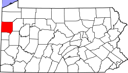
Sharpsville is a borough that is located in western Mercer County, Pennsylvania, United States, along the Shenango River. The population was 4,253 as of the 2020 census. [4] It is part of the Hermitage micropolitan area.
The First Universalist Church of Sharpsville and Jonas J. Pierce House are listed on the National Register of Historic Places. [5]
In 2004 local politicians proposed the creation of Shenango Valley City, consisting of Sharpsville as well as Hermitage, Sharon, Farrell, and Wheatland with the issue being put on the ballot in the form of a referendum. [6] Then Governor of Pennsylvania, Ed Rendell voiced support for the measure and would be joined by Kathleen McGinty, Secretary of the Department of Environmental Protection, and Dennis Yablonsky, Secretary of the Department of Community and Economic Development with the trio touring the region to urge for voters to pass the motion. [6] The city would largely be an expansion of Hermitage, whose city government would be retained including the office of mayor and its nine-member city council. [6] The merger would have kept the various independent school districts intact. [6] The effort would ultimately be defeated, and via the ordinance the issue of merger could not be brought up again until 2009. [7]
Sharpsville is located at 41°15′32″N80°28′54″W / 41.25889°N 80.48167°W (41.259005, -80.481791). [8]
According to the United States Census Bureau, the borough has a total area of 1.4 square miles (3.6 km2), of which 1.4 square miles (3.6 km2) is land and 0.04 square miles (0.10 km2) (1.42%) is water.
Census | Pop. | Note | %± |
---|---|---|---|
1880 | 1,824 | — | |
1890 | 2,330 | 27.7% | |
1900 | 2,970 | 27.5% | |
1910 | 3,634 | 22.4% | |
1920 | 4,674 | 28.6% | |
1930 | 5,194 | 11.1% | |
1940 | 5,129 | −1.3% | |
1950 | 5,414 | 5.6% | |
1960 | 6,061 | 12.0% | |
1970 | 6,126 | 1.1% | |
1980 | 5,375 | −12.3% | |
1990 | 4,729 | −12.0% | |
2000 | 4,500 | −4.8% | |
2010 | 4,415 | −1.9% | |
2020 | 4,253 | −3.7% | |
2021 (est.) | 4,218 | [4] | −0.8% |
U.S. Decennial Census [9] |
As of the census [10] of 2022, there were 3,930 people, 1,971 households and 804 families residing in the borough.
The population density was 2,825 inhabitants per square mile (1,091/km2). There were 2,016 housing units at an average density of 1,453.4 per square mile (561.2/km2).
The racial makeup of the borough was 97.53% White, 1.22% African American, 0.91% Asian, and 0.34% from two or more races. Hispanic or Latino of any race were 0.6% of the population.
There were 1,971 households, of which 40.8% were married couples living together; 14.9% had a female householder with no husband present, 4% had a male householder with no wife present, and 40.4% were non-families. The average household size was 2.11 and the average family size was 2.77.
Within the borough, the population was spread out, with 28.9% of residents who were under the age of 20, 24.8% from 21 to 40, 29.6% from 41 to 60, and 16.9% from 60 to 80+. The median age was 44.5 years, for males it is 42.5, and females 47.2. The sex ratio is 2,269 female at 54.4%, and male at 1,899 at 45.6%.
The median income for a household in the borough was $46,523, and the median income for a family was $65,000. Males had a median income of $41,900 compared with that of $31,439 for females.
The per capita income for the borough was $29,830.
Approximately 12.6% of the population were living below the poverty line, including 25% of those who were under the age of eighteen and 4% of those who were aged sixty-five or older.
Because of Sharpsville's location near the Pennsylvania/Ohio border, it is served by WKBN-TV (CBS), WFMJ-TV (NBC), WYTV (ABC), WYFX-LD (Fox) and WBCB (CW), all broadcast from nearby Youngstown, OH.
Sharpsville is served by AM radio stations such as WPIC (790 AM) from Sharon and WKBN (570 AM) from Youngstown and FM radio stations such as WYFM/"Y-103" (102.9 FM) from Sharon, WAKZ/"KISS FM" (95.9 FM) from Sharpsville, WYLE/"Willie 95.1" (95.1 FM) from Grove City, and WMXY/"Mix 98.9" (98.9 FM) from Youngstown.
Mercer County is a county in the Commonwealth of Pennsylvania. As of the 2020 census, the population was 110,652. Its county seat is Mercer, and its largest city is Hermitage. The county is part of the Northwest Pennsylvania region of the state.
Big Beaver is a borough in northern Beaver County, Pennsylvania, United States. The population was 1,852 at the 2020 census. It is a part of the Pittsburgh metropolitan area. The area was originally incorporated as Big Beaver Township in 1802, and was reincorporated as a borough in 1958.
North Shenango Township is a township in Crawford County, Pennsylvania, United States. The population was 1,274 at the 2020 census, down from 1,410 at the 2010 census.
Pymatuning South is a census-designated place (CDP) in Crawford County, Pennsylvania, United States. The population was 479 at the 2010 census.
South Shenango Township is a township in Crawford County, Pennsylvania, United States. The population was 1,831 at the 2020 census, down from 2,037 at the 2010 census.
West Shenango Township is a township in Crawford County, Pennsylvania, United States. The population was 433 at the 2020 census, down from 504 at the 2010 census.
New Castle Northwest is an unincorporated area and census-designated place (CDP) in Lawrence County, Pennsylvania, United States. The population was 1,413 at the 2010 census.
Oakwood is an unincorporated area and census-designated place (CDP) in Lawrence County, Pennsylvania, United States. The population was 2,270 at the 2010 census.
Shenango Township is a township in Lawrence County, Pennsylvania, United States. The population was 7,133 at the 2020 census, a decline from the figure of 7,479 tabulated in 2010. Shenango Township is situated between the city of New Castle to the north and the borough of Ellwood City to the south.
South New Castle is a borough in central Lawrence County, Pennsylvania, United States. The population was 649 at the 2020 census. It is primarily a residential community which lies south of the city of New Castle, and is part of the Pittsburgh metropolitan area. The borough will officially be annexed into nearby Shenango Township on January 1, 2026.
Clark is a borough in western Mercer County, Pennsylvania, United States, along the southern shore of the Shenango River Reservoir. The population was 576 at the 2020 census. It is part of the Hermitage micropolitan area.
Farrell is a city in western Mercer County, Pennsylvania, United States, along the Shenango River. The population was 4,258 at the 2020 census. It is part of the Hermitage micropolitan area.
Greenville is a borough with home rule status in northwestern Mercer County, Pennsylvania, United States. Located along the Shenango River, it lies roughly 80 miles from both Pittsburgh and Cleveland. It is 1.89 square miles in area, and had a population of 5,541 as of the 2020 census.
Hermitage is a city in western Mercer County, Pennsylvania, United States. The population was 16,230 at the 2020 census, making it the largest city in Mercer County. It is located about 15 miles (24 km) northeast of Youngstown and about 60 miles (97 km) northwest of Pittsburgh. It is the principal city of the Hermitage micropolitan area, which includes all of Mercer County.
Jamestown is a borough in northwestern Mercer County, Pennsylvania, United States, along the Shenango River. The population was reported as 580 on the 2020 census. It is part of the Hermitage micropolitan area.
Sharon is a city in western Mercer County, Pennsylvania, United States. The city, located along the banks of the Shenango River on the state border with Ohio, is about 15 miles (24 km) northeast of Youngstown, about 65 miles (105 km) southeast of Cleveland and about 60 miles (97 km) northwest of Pittsburgh. The population was 13,147 at the 2020 census. It is part of the Hermitage micropolitan area.
Shenango Township is a township in Mercer County, Pennsylvania, United States. The population was 3,519 at the 2020 census, down from 3,929 in 2010.
Stoneboro is a borough in eastern Mercer County, Pennsylvania, United States. The population was 946 at the 2020 census. It is part of the Hermitage micropolitan area.
West Middlesex is a borough along the Shenango River in southwestern Mercer County, Pennsylvania, United States. The population was 815 at the 2020 Census. It is part of the Hermitage micropolitan area.
Wheatland is a former borough in Mercer County, Pennsylvania, United States, along the Shenango River. The population was 583 at the 2020 census. On January 1, 2024, Wheatland merged with the neighboring city of Hermitage after residents of both communities voted to approve the merger in November 2022.
{{cite web}}
: |last1=
has generic name (help){{cite web}}
: |last=
has generic name (help)