Sandy Lake, Pennsylvania

Last updated
Sandy Lake, Pennsylvania
Main at Lacock, Sandy Lake.jpg
Commercial buildings on Main Street
Mercer County Pennsylvania Incorporated and Unincorporated areas Sandy Lake Highlighted.svg
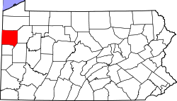
Location of Sandy Lake in Mercer County, Pennsylvania.
Coordinates: 41°21′4″N80°5′0″W / 41.35111°N 80.08333°W / 41.35111; -80.08333
Country United States
State Pennsylvania
County Mercer
Established1849
Government
  MayorMary Barrick
Area
[1]
  Total0.83 sq mi (2.16 km2)
  Land0.83 sq mi (2.16 km2)
  Water0.00 sq mi (0.00 km2)
Elevation
[2] (center of borough)
1,160 ft (350 m)
Highest elevation
[2] (northwest border)
1,380 ft (420 m)
Lowest elevation
[2] (Sandy Creek)
1,150 ft (350 m)
Population
 (2020) [3]
  Total649
  Density780.05/sq mi (301.12/km2)
Time zone UTC-4 (EST)
  Summer (DST) UTC-5 (EDT)
Zip code
16145
Area code 724
Website http://sandylakeborough.com

Sandy Lake is a borough in eastern Mercer County, Pennsylvania, United States. It was established in 1849. The population was 649 at the 2020 census. [4] It is part of the Hermitage micropolitan area.

Contents

Geography

Sandy Lake is located at 41°21′04″N80°05′00″W / 41.351165°N 80.083220°W / 41.351165; -80.083220 (41.351165, -80.083220). [5]

According to the United States Census Bureau, the borough has a total area of 0.8 square miles (2.1 km2), all land.

Demographics

Historical population
CensusPop.Note
1870 428
1880 73070.6%
1890 721−1.2%
1900 632−12.3%
1910 6391.1%
1920 6450.9%
1930 6795.3%
1940 7185.7%
1950 7676.8%
1960 8389.3%
1970 772−7.9%
1980 7790.9%
1990 722−7.3%
2000 7432.9%
2010 659−11.3%
2020 649−1.5%
2021 (est.)643 [4] −0.9%
U.S. Decennial Census [6]

As of the census [7] of 2000, there were 743 people, 298 households, and 211 families residing in the borough. The population density was 896.4 inhabitants per square mile (346.1/km2). There were 330 housing units at an average density of 398.1 per square mile (153.7/km2). The racial makeup of the borough was 99.33% White, 0.13% African American, 0.40% Asian, and 0.13% from two or more races. Hispanic or Latino of any race were 0.13% of the population.

There were 298 households, out of which 36.2% had children under the age of 18 living with them, 55.0% were married couples living together, 14.4% had a female householder with no husband present, and 28.9% were non-families. 24.5% of all households were made up of individuals, and 10.7% had someone living alone who was 65 years of age or older. The average household size was 2.49 and the average family size was 2.94.

In the borough the population was spread out, with 26.6% under the age of 18, 7.8% from 18 to 24, 27.3% from 25 to 44, 21.0% from 45 to 64, and 17.2% who were 65 years of age or older. The median age was 37 years. For every 100 females there were 85.8 males. For every 100 females age 18 and over, there were 87.9 males.

The median income for a household in the borough was $34,231, and the median income for a family was $38,958. Males had a median income of $32,159 versus $19,712 for females. The per capita income for the borough was $15,460. About 12.7% of families and 16.6% of the population were below the poverty line, including 30.0% of those under age 18 and 11.6% of those age 65 or over.

Notable person

Related Research Articles

<span class="mw-page-title-main">Conneaut Lake, Pennsylvania</span> Borough in Pennsylvania, United States

Conneaut Lake is a borough in Crawford County, Pennsylvania, located at the southern end of the lake of the same name. The population was 626 at the 2020 census, down from 653 at the 2010 census.

<span class="mw-page-title-main">East Fallowfield Township, Crawford County, Pennsylvania</span> Township in Pennsylvania, United States

East Fallowfield Township is a township in Crawford County, Pennsylvania, United States. The population was 1,520 at the 2020 census, down from 1,620 in 2010.

<span class="mw-page-title-main">Greenwood Township, Crawford County, Pennsylvania</span> Township in Pennsylvania, United States

Greenwood Township is a township in Crawford County, Pennsylvania, United States. The population was 1,431 at the 2020 census, down from 1,454 at the 2010 census.

<span class="mw-page-title-main">Sadsbury Township, Crawford County, Pennsylvania</span> Township in Pennsylvania, United States

Sadsbury Township is a township in Crawford County, Pennsylvania, United States. The population was 2,762 at the 2020 census, down from 2,933 at the 2010 census.

<span class="mw-page-title-main">South Shenango Township, Crawford County, Pennsylvania</span> Township in Pennsylvania, United States

South Shenango Township is a township in Crawford County, Pennsylvania, United States. The population was 1,836 at the 2020 census, down from 2,037 at the 2010 census.

<span class="mw-page-title-main">Spring Township, Crawford County, Pennsylvania</span> Township in Pennsylvania, United States

Spring Township is a township in Crawford County, Pennsylvania, United States. The population was 1,412 at the 2020 census, down from 1,548 at the 2010 census.

<span class="mw-page-title-main">Springboro, Pennsylvania</span> Borough in Pennsylvania, United States

Springboro is a borough in Crawford County, Pennsylvania, United States, located 35 miles southwest of Erie. The population was 377 at the 2020 census, down from 477 at the 2010 census.

<span class="mw-page-title-main">Summerhill Township, Crawford County, Pennsylvania</span> Township in Pennsylvania, United States

Summerhill Township is a township in Crawford County, Pennsylvania, United States. The population was 1,188 at the 2020 census, down from 1,236 at the 2010 census.

<span class="mw-page-title-main">Woodcock, Pennsylvania</span> Borough in Pennsylvania, United States

Woodcock is a borough in Crawford County, Pennsylvania, United States. The population was 139 at the 2020 census, down from 157 at the 2010 census.

<span class="mw-page-title-main">Girard Township, Erie County, Pennsylvania</span> Township in Pennsylvania, United States

Girard Township is a township in Erie County, Pennsylvania, United States. The population was 4,872 at the 2020 census, down from the population of 5,102 at the 2010 census.

<span class="mw-page-title-main">McKean, Pennsylvania</span> Borough in Pennsylvania, United States

McKean is a borough in Erie County, Pennsylvania. The population was 475 at the time of the 2020 census. It is part of the Erie–Meadville combined statistical area. McKean was known as "Middleboro" until it officially changed its name in 1970.

<span class="mw-page-title-main">South New Castle, Pennsylvania</span> Borough in Pennsylvania, United States

South New Castle is a borough in Lawrence County, Pennsylvania, United States. The population was 649 at the 2020 census. It is primarily a residential community which lies south of the city of New Castle, and is part of the New Castle micropolitan area.

<span class="mw-page-title-main">Clark, Pennsylvania</span> Borough in Pennsylvania, United States

Clark is a borough in western Mercer County, Pennsylvania, United States, along the southern shore of the Shenango River Reservoir. The population was 576 at the 2020 census. It is part of the Hermitage micropolitan area.

<span class="mw-page-title-main">Fredonia, Pennsylvania</span> Borough in Pennsylvania, United States

Fredonia is a borough in central Mercer County, Pennsylvania, United States. The population was 435 at the 2020 census. It is part of the Hermitage micropolitan area.

<span class="mw-page-title-main">Jackson Center, Pennsylvania</span> Borough in Pennsylvania, United States

Jackson Center is a borough in eastern Mercer County, Pennsylvania, United States. The population was 192 at the 2020 census. It is part of the Hermitage micropolitan area.

<span class="mw-page-title-main">Mercer, Pennsylvania</span> Borough in Pennsylvania, United States

Mercer is a borough in and the county seat of Mercer County, Pennsylvania, United States. The population was 1,982 at the 2020 census. It is part of the Hermitage micropolitan area.

<span class="mw-page-title-main">New Lebanon, Pennsylvania</span> Borough in Pennsylvania, United States

New Lebanon is a borough in northeastern Mercer County, Pennsylvania, United States. The population was 186 at the 2020 census. It is part of the Hermitage micropolitan area.

<span class="mw-page-title-main">Sharpsville, Pennsylvania</span> Borough in Pennsylvania, United States

Sharpsville is a borough that is located in western Mercer County, Pennsylvania, United States, along the Shenango River. The population was 4,253 as of the 2020 census. It is part of the Hermitage micropolitan area.

<span class="mw-page-title-main">Stoneboro, Pennsylvania</span> Borough in Pennsylvania, United States

Stoneboro is a borough in eastern Mercer County, Pennsylvania, United States. The population was 946 at the 2020 census. It is part of the Hermitage micropolitan area.

<span class="mw-page-title-main">Wheatland, Pennsylvania</span> Borough in Pennsylvania, United States

Wheatland is a borough in Mercer County, Pennsylvania, United States, along the Shenango River. The population was 583 at the 2020 census. It is part of the Hermitage micropolitan area.

References

  1. "ArcGIS REST Services Directory". United States Census Bureau. Retrieved October 16, 2022.
  2. 1 2 3 "Sandy Lake Topo Map, Mercer County PA (Sandy Lake Area)". TopoZone. Locality, LLC. Retrieved 7 September 2019.
  3. "Census Population API". United States Census Bureau. Retrieved Oct 12, 2022.
  4. 1 2 Bureau, US Census. "City and Town Population Totals: 2020-2021". Census.gov. US Census Bureau. Retrieved 18 July 2022.
  5. "US Gazetteer files: 2010, 2000, and 1990". United States Census Bureau. 2011-02-12. Retrieved 2011-04-23.
  6. "Census of Population and Housing". Census.gov. Retrieved June 4, 2016.
  7. "U.S. Census website". United States Census Bureau . Retrieved 2008-01-31.