Sheakleyville, Pennsylvania

Last updated
Sheakleyville, Pennsylvania
Sheakleyville, Pennsylvania (15852984559).jpg
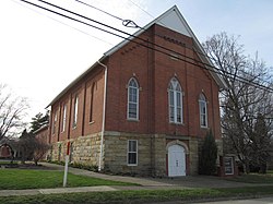
Church in Sheakleyville
Mercer County Pennsylvania Incorporated and Unincorporated areas Sheakleyville Highlighted.svg
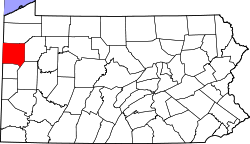
Location of Sheakleyville in Mercer County, Pennsylvania.
USA Pennsylvania location map.svg
Red pog.svg
Sheakleyville, Pennsylvania
Location of Sheakleyville within Pennsylvania
Coordinates: 41°26′36″N80°12′26″W / 41.44333°N 80.20722°W / 41.44333; -80.20722
Country United States
State Pennsylvania
County Mercer
Established1820
Area
[1]
  Total0.20 sq mi (0.51 km2)
  Land0.20 sq mi (0.51 km2)
  Water0.00 sq mi (0.00 km2)
Elevation
[2] (center of borough)
1,282 ft (391 m)
Highest elevation
[2] (southern border of borough)
1,298 ft (396 m)
Lowest elevation
[2] (Mill Run)
1,240 ft (380 m)
Population
 (2020) [3]
  Total151
  Density770.41/sq mi (296.94/km2)
Time zone UTC-4 (EST)
  Summer (DST) UTC-5 (EDT)
Zip code
16151
Area code(s) 724, 878

Sheakleyville is a borough in northern Mercer County, Pennsylvania, United States. The population was 142 at the 2010 census, [4] a figure which increased to 150 tabulated residents in 2020. [5] It is part of the Hermitage micropolitan area.

Contents

Geography

Sheakleyville is located at 41°26′36″N80°12′26″W / 41.44333°N 80.20722°W / 41.44333; -80.20722 (41.443244, -80.207305). [6]

According to the United States Census Bureau, the borough has a total area of 0.2 square miles (0.52 km2), all land.

Demographics

Historical population
CensusPop.Note
1860 218
1870 27325.2%
1880 222−18.7%
1890 191−14.0%
1900 164−14.1%
1910 126−23.2%
1920 108−14.3%
1930 93−13.9%
1940 13848.4%
1950 1412.2%
1960 138−2.1%
1970 1412.2%
1980 1559.9%
1990 145−6.5%
2000 16413.1%
2010 142−13.4%
2020 1505.6%
2021 (est.)149 [5] −0.7%
U.S. Decennial Census [7]

As of the census [8] of 2000, there were 164 people, 65 households, and 49 families residing in the borough. The population density was 1,023.0 inhabitants per square mile (395.0/km2). There were 71 housing units at an average density of 442.9 per square mile (171.0/km2). The racial makeup of the borough was 98.17% White, 0.61% Native American, and 1.22% from two or more races. 29.6% were of German, 22.6% American, 15.7% English and 9.6% Dutch ancestry according to Census 2000.

There were 65 households, out of which 33.8% had children under the age of 18 living with them, 67.7% were married couples living together, 6.2% had a female householder with no husband present, and 23.1% were non-families. 20.0% of all households were made up of individuals, and 12.3% had someone living alone who was 65 years of age or older. The average household size was 2.52 and the average family size was 2.92.

In the borough the population was spread out, with 21.3% under the age of 18, 8.5% from 18 to 24, 28.0% from 25 to 44, 26.8% from 45 to 64, and 15.2% who were 65 years of age or older. The median age was 40 years. For every 100 females there were 105.0 males. For every 100 females age 18 and over, there were 92.5 males.

The median income for a household in the borough was $28,750, and the median income for a family was $38,750. Males had a median income of $32,813 versus $22,083 for females. The per capita income for the borough was $15,479. About 4.1% of families and 9.5% of the population were below the poverty line, including 16.2% of those under the age of eighteen and 18.8% of those sixty five or over.

Related Research Articles

<span class="mw-page-title-main">Blooming Valley, Pennsylvania</span> Borough in Pennsylvania, United States

Blooming Valley is a borough in Crawford County, Pennsylvania, United States. The population was 344 at the 2020 census, up from 337 at the 2010 census.

<span class="mw-page-title-main">Conneaut Lake, Pennsylvania</span> Borough in Pennsylvania, United States

Conneaut Lake is a borough in Crawford County, Pennsylvania, located at the southern end of the lake of the same name. The population was 626 at the 2020 census, down from 653 at the 2010 census.

<span class="mw-page-title-main">Fairfield Township, Crawford County, Pennsylvania</span> Township in Pennsylvania, United States

Fairfield Township is a township in Crawford County, Pennsylvania, United States. The population was 1,015 at the 2020 census, down from the 2010 census.

<span class="mw-page-title-main">South Shenango Township, Crawford County, Pennsylvania</span> Township in Pennsylvania, United States

South Shenango Township is a township in Crawford County, Pennsylvania, United States. The population was 1,836 at the 2020 census, down from 2,037 at the 2010 census.

<span class="mw-page-title-main">Spring Township, Crawford County, Pennsylvania</span> Township in Pennsylvania, United States

Spring Township is a township in Crawford County, Pennsylvania, United States. The population was 1,412 at the 2020 census, down from 1,548 at the 2010 census.

<span class="mw-page-title-main">Springboro, Pennsylvania</span> Borough in Pennsylvania, United States

Springboro is a borough in Crawford County, Pennsylvania, United States, located 35 miles southwest of Erie. The population was 377 at the 2020 census, down from 477 at the 2010 census.

<span class="mw-page-title-main">West Fallowfield Township, Crawford County, Pennsylvania</span> Township in Pennsylvania, United States

West Fallowfield Township is a township in Crawford County, Pennsylvania, United States. The population was 578 at the 2020 census, down from 605 at the 2010 census.

<span class="mw-page-title-main">Woodcock, Pennsylvania</span> Borough in Pennsylvania, United States

Woodcock is a borough in Crawford County, Pennsylvania, United States. The population was 139 at the 2020 census, down from 157 at the 2010 census.

<span class="mw-page-title-main">Platea, Pennsylvania</span> Borough in Pennsylvania, United States

Platea is a borough in Erie County, Pennsylvania, United States. The population was 443 at the 2020 census.

<span class="mw-page-title-main">Plain Grove Township, Lawrence County, Pennsylvania</span> Township in Pennsylvania, United States

Plain Grove Township is a township in Lawrence County, Pennsylvania, United States. The population was 777 at the time of the 2020 census, a decline from the figure of 813 tabulated in 2010.

<span class="mw-page-title-main">South New Castle, Pennsylvania</span> Borough in Pennsylvania, United States

South New Castle is a borough in Lawrence County, Pennsylvania, United States. The population was 649 at the 2020 census. It is primarily a residential community which lies south of the city of New Castle, and is part of the New Castle micropolitan area.

<span class="mw-page-title-main">Wilmington Township, Lawrence County, Pennsylvania</span> Township in Pennsylvania, United States

Wilmington Township is a township in Lawrence County, Pennsylvania, United States. The population was 2,662 at the 2020 census, a decline from the figure of 2,715 tabulated in 2010.

<span class="mw-page-title-main">Clark, Pennsylvania</span> Borough in Pennsylvania, United States

Clark is a borough in western Mercer County, Pennsylvania, United States, along the southern shore of the Shenango River Reservoir. The population was 576 at the 2020 census. It is part of the Hermitage micropolitan area.

<span class="mw-page-title-main">Jackson Center, Pennsylvania</span> Borough in Pennsylvania, United States

Jackson Center is a borough in eastern Mercer County, Pennsylvania, United States. The population was 192 at the 2020 census. It is part of the Hermitage micropolitan area.

<span class="mw-page-title-main">Mercer, Pennsylvania</span> Borough in Pennsylvania, United States

Mercer is a borough in and the county seat of Mercer County, Pennsylvania, United States. The population was 1,982 at the 2020 census. It is part of the Hermitage micropolitan area.

<span class="mw-page-title-main">New Lebanon, Pennsylvania</span> Borough in Pennsylvania, United States

New Lebanon is a borough in northeastern Mercer County, Pennsylvania, United States. The population was 186 at the 2020 census. It is part of the Hermitage micropolitan area.

<span class="mw-page-title-main">Sandy Lake, Pennsylvania</span> Borough in Pennsylvania, United States

Sandy Lake is a borough in eastern Mercer County, Pennsylvania, United States. It was established in 1849. The population was 649 at the 2020 census. It is part of the Hermitage micropolitan area.

<span class="mw-page-title-main">Sharpsville, Pennsylvania</span> Borough in Pennsylvania, United States

Sharpsville is a borough that is located in western Mercer County, Pennsylvania, United States, along the Shenango River. The population was 4,253 as of the 2020 census. It is part of the Hermitage micropolitan area.

<span class="mw-page-title-main">Stoneboro, Pennsylvania</span> Borough in Pennsylvania, United States

Stoneboro is a borough in eastern Mercer County, Pennsylvania, United States. The population was 946 at the 2020 census. It is part of the Hermitage micropolitan area.

<span class="mw-page-title-main">Wheatland, Pennsylvania</span> Borough in Pennsylvania, United States

Wheatland is a borough in Mercer County, Pennsylvania, United States, along the Shenango River. The population was 583 at the 2020 census. It is part of the Hermitage micropolitan area.

References

  1. "ArcGIS REST Services Directory". United States Census Bureau. Retrieved October 16, 2022.
  2. 1 2 3 "Hadley Dam Reservoir Topo Map, Mercer County PA (Greenville East Area)". TopoZone. Locality, LLC. Retrieved 7 September 2019.
  3. "Census Population API". United States Census Bureau. Retrieved Oct 12, 2022.
  4. United States Census Bureau. "2010 Census - Sheakleyville Borough data". 2010.census.gov. Archived from the original on 2012-12-21.
  5. 1 2 Bureau, US Census. "City and Town Population Totals: 2020-2021". Census.gov. US Census Bureau. Retrieved 18 July 2022.
  6. "US Gazetteer files: 2010, 2000, and 1990". United States Census Bureau. 2011-02-12. Retrieved 2011-04-23.
  7. "Census of Population and Housing". Census.gov. Retrieved June 4, 2016.
  8. "U.S. Census website". United States Census Bureau . Retrieved 2008-01-31.