Fredonia, Pennsylvania

Last updated
Fredonia, Pennsylvania
Main above Third, Fredonia.jpg
Main Street
Mercer County Pennsylvania Incorporated and Unincorporated areas Fredonia Highlighted.svg
Location of Fredonia in Mercer County, Pennsylvania.
Coordinates: 41°19′17″N80°15′31″W / 41.32139°N 80.25861°W / 41.32139; -80.25861
Country United States
State Pennsylvania
County Mercer
Established1876
Government
  MayorRichard Nagel
Area
[1]
  Total0.36 sq mi (0.92 km2)
  Land0.36 sq mi (0.92 km2)
  Water0.00 sq mi (0.00 km2)
Elevation
[2] (center of town)
1,175 ft (358 m)
Highest elevation
[2] (southwest end of township)
1,280 ft (390 m)
Lowest elevation
[2] (Mill Run)
1,125 ft (343 m)
Population
 (2020) [3]
  Total436
  Density1,221.29/sq mi (471.54/km2)
Time zone UTC-4 (EST)
  Summer (DST) UTC-5 (EDT)
Zip code
16124
Area code 724

Fredonia is a borough in central Mercer County, Pennsylvania, United States. The population was 435 at the 2020 census. [4] It is part of the Hermitage micropolitan area.

Contents

History

The first resident of the area that became Fredonia was Levi Arnold. Arnold build a grist mill there between 1837 and 1838 and was, over time, joined by several other businesses and residences. [5] [6] [7] William Simmons built the first store in the small village. Based upon the success of his business and the further gains that could be made after the construction of a proposed railroad, Simmons purchased the land that became the borough of Fredonia and had it surveyed and divided into lots. [5] The land came was purchased from two “Donation tracts,” [5] which were tracts of land given to Revolutionary War soldiers in an attempt to encourage them to continue to serve. [8] The name “Fredonia” came from Simmon’s “free” donation of the land for the town square and as a nod to the “Donation” tracts from which the land was purchased. [5] The first post office was established in 1870 and Fredonia was officially incorporated in August 1876. Fredonia was serviced by Bessemer and Lake Erie Railroad passenger trains between 1869 and 1955. The Fredonia Volunteer Fire Department was established in 1934 and has continued to host their “Old Home Week” festival each summer since 1935. [5] [9]

Fredonia was home to the Fredonia Institute, also known as a “normal academy” or “select school.” [7] [5] This higher education institution trained individuals who went on to become physicians, attorneys, teachers, ministers, and enter into other professions. It was incorporated in 1874 and boasted a library established by Andrew Carnegie. [5]

During the Depression, the borough applied for and received Works Progress Administration funds. The funds were used to pave streets and construct a water system to provide water service to the town that had previously relied on streams, individual wells, and cisterns. The WPA also provided workers who helped construct Fredonia-Delaware High School. This stone building was built in 1942 on Delaware Road and served first as a high school until 1960 when it began to be used as an elementary school within Reynolds School District. [5] The elementary school was closed by the district in the mid-1990s, and the building was subsequently purchased and converted into a personal care and independent living facility. [10]

Since the 1940s, Fredonia has also been home to a diner created from a trolley car. The trolley car came from the Harmony Line of the interurban trolley line that ran from New Castle, PA to Pittsburgh, PA. [11] [5] Ownership has changed several times, but the diner is still currently open at its original location. [5]

Fredonia is also home to Pennsylvania’s largest Swiss cheese manufacturer. Fairview Swiss Cheese, which opened in 1955, is operated by John Koller and Son Inc. The company produces over 7 million pounds of Swiss cheese each year. [12]

Geography

Fredonia is located at 41°19′17″N80°15′31″W / 41.32139°N 80.25861°W / 41.32139; -80.25861 (41.321460, -80.258563). [13]

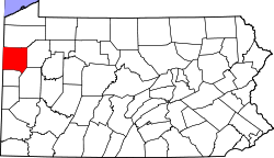
Fredonia is also the proven geographic center of Mercer County, Pennsylvania. A brass placard denoting the spot is located on the premises of "Fredonia Stainless Exhaust", at the southwestern corner of Main and 1st Streets. According to the United States Census Bureau, the borough has a total area of 0.4 square miles (1.0 km2), all land.

Demographics

Historical population
CensusPop.Note
1880 323
1890 42932.8%
1900 4371.9%
1910 4431.4%
1920 422−4.7%
1930 47612.8%
1940 53612.6%
1950 5889.7%
1960 65711.7%
1970 73111.3%
1980 712−2.6%
1990 683−4.1%
2000 652−4.5%
2010 502−23.0%
2020 435−13.3%
2021 (est.)431 [4] −0.9%
Sources: [14] [15] [16] [3]

As of the census [15] of 2000, there were 652 people, 252 households, and 184 families residing in the borough. The population density was 1,641.3 inhabitants per square mile (633.7/km2). There were 272 housing units at an average density of 684.7 per square mile (264.4/km2). The racial makeup of the borough was 99.69% White, 0.15% Asian, and 0.15% from two or more races. Hispanic or Latino of any race were 0.31% of the population.

There were 252 households, out of which 34.5% had children under the age of 18 living with them, 56.0% were married couples living together, 12.3% had a female householder with no husband present, and 26.6% were non-families. 23.0% of all households were made up of individuals, and 9.5% had someone living alone who was 65 years of age or older. The average household size was 2.59 and the average family size was 3.03.

In the borough the population was spread out, with 27.6% under the age of 18, 9.2% from 18 to 24, 26.7% from 25 to 44, 23.6% from 45 to 64, and 12.9% who were 65 years of age or older. The median age was 36 years. For every 100 females there were 96.4 males. For every 100 females age 18 and over, there were 87.3 males.

The median income for a household in the borough was $37,917, and the median income for a family was $39,643. Males had a median income of $32,857 versus $19,500 for females. The per capita income for the borough was $14,233. About 17.6% of families and 19.2% of the population were below the poverty line, including 35.6% of those under age 18 and 13.2% of those age 65 or over.

Related Research Articles

<span class="mw-page-title-main">Akron, Pennsylvania</span> Borough in Pennsylvania, United States

Akron is a borough in Lancaster County, Pennsylvania, United States. As of the 2020 census, it had a population of 4,169,

<span class="mw-page-title-main">Zelienople, Pennsylvania</span> Borough in Pennsylvania, United States

Zelienople is a borough in western Butler County, Pennsylvania, United States, 28 miles (45 km) north of Pittsburgh. The population was 3,812 at the 2010 census. It is part of the Pittsburgh metropolitan area.

<span class="mw-page-title-main">Wormleysburg, Pennsylvania</span> Borough in Pennsylvania, United States

Wormleysburg is a borough in Cumberland County, Pennsylvania, United States. The population was 3,070 at the 2010 census. It is part of the Harrisburg–Carlisle Metropolitan Statistical Area.

<span class="mw-page-title-main">Girard, Pennsylvania</span> Borough in Pennsylvania, United States

Girard is a borough in Erie County, Pennsylvania, United States. The population was 2,994 at the 2020 census. It is part of the Erie Metropolitan Statistical Area.

<span class="mw-page-title-main">Dawson, Pennsylvania</span> Borough in Pennsylvania, United States

Dawson is a borough in Fayette County, Pennsylvania, United States. The population was 352 at the 2020 census, a decline from the figure of 367 tabulated in 2010.

<span class="mw-page-title-main">Rockhill, Pennsylvania</span> Borough in Pennsylvania, United States

Rockhill or Rockhill Furnace is a borough in Huntingdon County, Pennsylvania, United States. The population was 371 at the 2010 census, down from 414 at the 2000 census. It is the site of the East Broad Top Railroad and the Rockhill Trolley Museum.

<span class="mw-page-title-main">Corsica, Pennsylvania</span> Borough in Pennsylvania, United States

Corsica is a borough in Jefferson County, Pennsylvania, United States. The population was 357 at the 2010 census. It was named for the island of Corsica, birthplace of Napoleon Bonaparte. The mayor of the borough is Dave Leadbetter.

<span class="mw-page-title-main">Larksville, Pennsylvania</span> Borough in Pennsylvania, United States

Larksville is a borough in Luzerne County, Pennsylvania, United States. It is 2 miles (3 km) west of Wilkes Barre on the Susquehanna River. The population was 4,216 as of the 2020 census.

<span class="mw-page-title-main">Clark, Pennsylvania</span> Borough in Pennsylvania, United States

Clark is a borough in western Mercer County, Pennsylvania, United States, along the southern shore of the Shenango River Reservoir. The population was 576 at the 2020 census. It is part of the Hermitage micropolitan area.

<span class="mw-page-title-main">Coolspring Township, Mercer County, Pennsylvania</span> Township in Pennsylvania, United States

Coolspring Township is a township in Mercer County, Pennsylvania, United States. The population was 2,112 at the 2020 census, a decline from the figure of 2,278 in 2010.

<span class="mw-page-title-main">Jackson Center, Pennsylvania</span> Borough in Pennsylvania, United States

Jackson Center is a borough in eastern Mercer County, Pennsylvania, United States. The population was 192 at the 2020 census. It is part of the Hermitage micropolitan area.

<span class="mw-page-title-main">Mercer, Pennsylvania</span> Borough in Pennsylvania, United States

Mercer is a borough in and the county seat of Mercer County, Pennsylvania, United States. The population was 1,982 at the 2020 census. It is part of the Hermitage micropolitan area.

<span class="mw-page-title-main">New Lebanon, Pennsylvania</span> Borough in Pennsylvania, United States

New Lebanon is a borough in northeastern Mercer County, Pennsylvania, United States. The population was 186 at the 2020 census. It is part of the Hermitage micropolitan area.

<span class="mw-page-title-main">Sandy Lake, Pennsylvania</span> Borough in Pennsylvania, United States

Sandy Lake is a borough in eastern Mercer County, Pennsylvania, United States. It was established in 1849. The population was 649 at the 2020 census. It is part of the Hermitage micropolitan area.

<span class="mw-page-title-main">Sharpsville, Pennsylvania</span> Borough in Pennsylvania, United States

Sharpsville is a borough that is located in western Mercer County, Pennsylvania, United States, along the Shenango River. The population was 4,253 as of the 2020 census. It is part of the Hermitage micropolitan area.

<span class="mw-page-title-main">Sheakleyville, Pennsylvania</span> Borough in Pennsylvania, United States

Sheakleyville is a borough in northern Mercer County, Pennsylvania, United States. The population was 142 at the 2010 census, a figure which increased to 150 tabulated residents in 2020. It is part of the Hermitage micropolitan area.

<span class="mw-page-title-main">Stoneboro, Pennsylvania</span> Borough in Pennsylvania, United States

Stoneboro is a borough in eastern Mercer County, Pennsylvania, United States. The population was 946 at the 2020 census. It is part of the Hermitage micropolitan area.

<span class="mw-page-title-main">Wheatland, Pennsylvania</span> Borough in Pennsylvania, United States

Wheatland is a borough in Mercer County, Pennsylvania, United States, along the Shenango River. The population was 583 at the 2020 census. It is part of the Hermitage micropolitan area.

<span class="mw-page-title-main">South Greensburg, Pennsylvania</span> Borough in Pennsylvania, United States

South Greensburg is a borough in Westmoreland County, Pennsylvania, United States. The population was 2,117 at the 2010 census.

<span class="mw-page-title-main">Southwest Greensburg, Pennsylvania</span> Borough in Pennsylvania, United States

Southwest Greensburg is a borough in Westmoreland County, Pennsylvania, United States. The population was 2,155 as of the 2010 census.

References

  1. "ArcGIS REST Services Directory". United States Census Bureau. Retrieved October 12, 2022.
  2. 1 2 3 "Fredonia Topo Map, Mercer County PA (Fredonia Area)". TopoZone. Locality, LLC. Retrieved 6 September 2019.
  3. 1 2 "Census Population API". United States Census Bureau. Retrieved Oct 12, 2022.
  4. 1 2 Bureau, US Census. "City and Town Population Totals: 2020-2021". Census.gov. US Census Bureau. Retrieved 18 July 2022.
  5. 1 2 3 4 5 6 7 8 9 10 Appleseed, J. (1976). Fredonia 1837-1976. Program for Fredonia Centennial Celebration.
  6. "Fredonia, Mercer County, PA". www.rootsweb.ancestry.com. Retrieved 2017-07-04.
  7. 1 2 White, John G. (1909). A Twentieth Century History of Mercer County, Pennsylvania: A Narrative Account of Its Historical Progress, Its People, and Its Principal Interests. Lewis Publishing Company.
  8. "PA State Archives - RG-17 - Donation Land Images - Main Interface". www.phmc.state.pa.us. Retrieved 2017-07-04.
  9. Writer, Courtney L. SaylorHerald Staff. "Old Home Week keeps VFD running". The Herald. Retrieved 2017-07-04.
  10. "Greystone Country Estates ~ Personal Care & Independent Living – Personal Care & Independent Living, Experienced, Quality Care". greystonecountryestates.com. Retrieved 2017-07-04.
  11. Butko, Brian; Patrick, Kevin Joseph (1999). Diners of Pennsylvania. Stackpole Books. ISBN   9780811728782.
  12. "Fairview Swiss Cheese History". www.fairviewswisscheese.com. Retrieved 2017-07-04.
  13. "US Gazetteer files: 2010, 2000, and 1990". United States Census Bureau. 2011-02-12. Retrieved 2011-04-23.
  14. "Census of Population and Housing". U.S. Census Bureau. Retrieved 11 December 2013.
  15. 1 2 "U.S. Census website". United States Census Bureau . Retrieved 2008-01-31.
  16. "Incorporated Places and Minor Civil Divisions Datasets: Subcounty Resident Population Estimates: April 1, 2010 to July 1, 2012". Population Estimates. U.S. Census Bureau. Archived from the original on 11 June 2013. Retrieved 11 December 2013.