Saline County is located in the U.S. state of Kansas. Its county seat and largest city is Salina. As of the 2020 census, the county population was 54,303. The county was named after the Saline River.

Osborne County is a county located in the U.S. state of Kansas. It county seat and largest city is Osborne. As of the 2020 census, the county population was 3,500. The county is named for Vincent Osborne, a captain in the American Civil War.

Graham County is a county located in the U.S. state of Kansas. Its county seat and most populous city is Hill City. As of the 2020 census, the county population was 2,415. The county was named for John Graham, a captain in the American Civil War that died during the Battle of Chickamauga. The county is home to Nicodemus, founded 1877, which is the only remaining western town established by African Americans during the Reconstruction Period following the American Civil War.
Bogue is a city in Graham County, Kansas, United States. As of the 2020 census, the population of the city was 155. Bogue is located on K-18, south of U.S. Route 24, on the South Fork Solomon River.

Hill City is a city and county seat of Graham County, Kansas, United States. As of the 2020 census, the population of the city was 1,403.

Morland is a city in Graham County, Kansas, United States. As of the 2020 census, the population of the city was 115.

Beloit is a city in and the county seat of Mitchell County, Kansas, United States. As of the 2020 census, the population of the city was 3,404.

Damar is a city in Rooks County, Kansas, United States. As of the 2020 census, the population of the city was 112.

Nicodemus is an unincorporated community in Graham County, Kansas, United States. As of the 2020 census, the population of the community and nearby areas was 14. The community was founded in 1877 and is named for the Biblical figure Nicodemus.
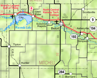
Asherville is an unincorporated community in Mitchell County, Kansas, United States. As of the 2020 census, the population of the community and nearby areas was 19.
Solomon Rapids is an unincorporated community in Mitchell County, Kansas, United States.

Solomon is a census-designated place in Graham County, Arizona, United States. Its population was 399 as of the 2020 census. It is part of the Safford Micropolitan Statistical Area.

The South Fork Solomon River is a 292-mile-long (470 km) river in the central Great Plains of North America. The entire length of the river lies in the U.S. state of Kansas. It is a tributary of the Solomon River.
Penokee is an unincorporated community located in the township of Morse, Ashland County, Wisconsin, United States. Penokee no longer exists but the old town used to be located south of County Highway GG a few yards west of the railway at the Penokee Gap. Canadian National Railway 1.75 miles (2.82 km) west-southwest of Mellen The community takes its name from the Native American work apinikan, which means "wild potato ground". It was marked on local property maps through 1992, and is still marked on Wisconsin Department of Transportation maps.

Bloomington is an unincorporated community in Osborne County, Kansas, United States. It is located about 4 miles west of Osborne.

Studley is an unincorporated community in Sheridan County, Kansas, United States, approximately 16 miles east of Hoxie along U.S. Route 24. It is on the eastern edge of the county in Valley Township, bordering Graham County. It was named after the Studley Royal Park, in England.

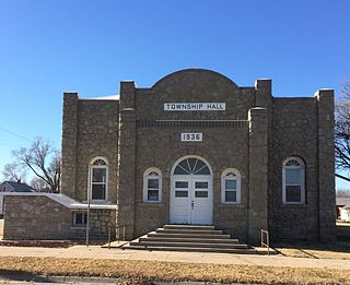
Webster was an unincorporated community in Belmont Township, Rooks County, Kansas, United States.
Tasco is an unincorporated community in Sheridan County, Kansas, United States. It is located about 7 miles east of Hoxie and south of U.S. Route 24 highway, next to an abandoned railroad.
Graham County USD 281 is a public unified school district headquartered in Hill City, Kansas, United States. The district includes the communities of Hill City, Bogue, Morland, Nicodemus, Penokee, St. Peter, and nearby rural areas.
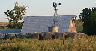
The Harry Keith Barn near Penokee, Kansas was built in 1940. It was listed on the National Register of Historic Places in 2013.


