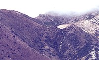
On it are significant sites of the Mount Lyell copper field.
The original Iron Blow was on its mid slopes,[2] discovered on the ridge by Karlson and McDonough.[3]
The North Lyell Mine, scene of the 1912 North Mount Lyell Disaster, was at its northernmost end, on the slopes of Mount Lyell. Very close to the mine was the settlement of the same name; the North Lyell tram traversed the ridge,[4] as did the ill-fated North Lyell aerial tram.[5][6] These features no longer exist due to the mining of the area, but they all had significant parts to play in the history of the Mount Lyell Mining and Railway Company.
The Gap, the point where the Queenstown to Gormanston road (originally known as the Queenstown to Gormanston Dray Road,[7] now known as the Lyell Highway) passed over the ridge, is the southernmost named feature that remains.[8][9] Down the western slope of the ridge, the Mount Lyell Haulage and the Mount Lyell aerial tram took ore from the mines that worked on the ridge to the Queenstown smelters.
The eastern slope of the ridge faced into the Linda Valley and the town of Gormanston.
↑ In the chapter Poverty Gully of The Peaks of Lyell - describes the Iron Blow feature as -the strange formation... jutted twenty or thirty feet above the surface
↑ "GORMANSTON NOTES". The Mercury. Vol.LXXII, no.8844. Tasmania, Australia. 6 July 1898. p.3. Retrieved 9 June 2022– via National Library of Australia.
↑ "COACH UPSET". Zeehan and Dundas Herald. Vol.XVI, no.164. Tasmania, Australia. 26 April 1905. p.4. Retrieved 9 June 2022– via National Library of Australia.
West Coast Council is a local government body in Tasmania, covering much of the western region of the state. West Coast is classified as a rural local government area and has a population of 4,167. The major towns and localities of the region include Strahan, Rosebery, Zeehan and the principal town of Queenstown.
Zeehan is a town on the west coast of Tasmania, Australia 139 kilometres (86 mi) south-west of Burnie. It is part of the West Coast Council, along with the seaport Strahan, and neighbouring mining towns of Dundas, Rosebery and Queenstown.
The West Coast Range is a mountain range located in the West Coast region of Tasmania, Australia.
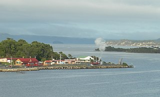
Regatta Point is the location of a port and rail terminus on Macquarie Harbour.
Mount Read is a mountain located in the West Coast region of Tasmania, Australia, and is at the north west edge of the West Coast Range.
Mount Owen is a mountain directly east of the town of Queenstown on the West Coast Range in Western Tasmania, Australia.
The Queen River, part of the King River catchment, is a minor perennial river located in the West Coast region of Tasmania, Australia.
The Mount Jukes mine sites were a series of short-lived, small mine workings high on the upper regions of Mount Jukes in the West Coast Range on the West Coast of Tasmania.
North Mount Lyell was the name of a mine, mining company, locality and former railway north of Gormanston on the southern slopes of Mount Lyell in the West Coast Range on the West Coast of Tasmania, and on to the ridge between Mount Lyell and Mount Owen.
Linda Valley is a valley in the West Coast Range of Tasmania. It was earlier known as the Vale of Chamouni. It is located between Mount Owen and Mount Lyell.
The mines of the West Coast of Tasmania have a rich historical heritage as well as an important mineralogical value in containing or having had found, specimens of rare and unusual minerals. Also, the various mining fields have important roles in the understanding of the mineralization of the Mount Read Volcanics, and the occurrence of economic minerals.
The history of the Railways on the West Coast of Tasmania has fascinated enthusiasts from around the world, because of the combination of the harsh terrain in which the railways were created, and the unique nature of most of the lines.
The Strahan–Zeehan Railway, also known as the "Government Railway", was a railway from Strahan to Zeehan on the west coast of Tasmania.
Linda is the site of an old ghost town in the Linda Valley in the West Coast Range of Tasmania, Australia. It has also been known as Linda Valley.
Dundas was a historical mining locality, mineral field and railway location on the western foothills of the West Coast Range in Western Tasmania. It is now part of the locality of Zeehan.
Zeehan railway station in Tasmania, was a major junction and railway yard for numerous different railway and tramway systems in western Tasmania in the town of Zeehan.
The Western Tasmanian Football Association was an Australian Rules Football competition based on the West Coast of Tasmania, Australia. The competition was made up of mostly miners living and working on the State's West Coast.
The Hercules Haulage, also known as the Mount Read Haulage, the Hercules Tram and the Williamsford Haulage Line, was a self-acting 2 ft narrow gauge tramway on the side of Mount Read in Western Tasmania, that connected the Hercules Mine with Williamsford and then to the North East Dundas Tramway.
Zeehan Highway is a road between Zeehan and Queenstown in Western Tasmania.
The term Mount Lyell Railway was one of the terms used for the railway operated by the Mount Lyell Mining and Railway Company between 1899 and 1963.
This page is based on this Wikipedia article Text is available under the CC BY-SA 4.0 license; additional terms may apply. Images, videos and audio are available under their respective licenses.