
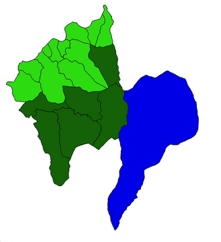
Coimbra is a city and a municipality in Portugal. The population of the municipality at the 2021 census was 140,796, in an area of 319.40 square kilometres (123.3 sq mi). The fourth-largest agglomerated urban area in Portugal after Lisbon, Porto, and Braga, it is the largest city of the district of Coimbra and the Centro Region. About 460,000 people live in the Região de Coimbra, comprising 19 municipalities and extending into an area of 4,336 square kilometres (1,674 sq mi).

Vila do Conde is a municipality in the Norte Region of Portugal. The population in 2011 was 79,533, in an area of 149.03 km2. The urbanized area of Vila do Conde, which includes the parishes of Vila do Conde, Azurara and Árvore, represent 36,137 inhabitants. Vila do Conde is interlinked to the north with Póvoa de Varzim, forming a single urban agglomeration which is a part of the Porto Metropolitan Area. The town is on the Portuguese Way of the Camino de Santiago.

The Peneda-Gerês National Park, also known simply as Gerês, is a national park located in northern Portugal. Created in May 1971, it is the oldest protected area and the only national park in Portugal. It covers an area of 695.9 km2 (268.7 sq mi), occupying the Districts of Viana do Castelo, Braga, and Vila Real and bordering the Spanish Baixa Limia – Serra do Xurés natural park to the north, with which forms the UNESCO biosphere reserve of Gerês-Xurés.

Montalegre is a municipality in northern Portugal, located in the district of Vila Real, along the border with Spain. The population in 2011 was 10,537, in an area of 805.46 km².

Mosteiros is a civil parish in the municipality of Ponta Delgada on the Portuguese island of São Miguel in the Azores. The population in 2011 was 1,123, in an area of 8.95 square kilometres (3.46 sq mi). It contains the localities Chã das Machadas, Lomba dos Homens, Lombinha and Mosteiros.

Belém is a freguesia and district of Lisbon, the capital of Portugal. Belém is located in western Lisbon, to the west of Ajuda and Alcântara and directly east of Lisbon's border with Oeiras. Belém is famous as a museum district, as the home of many of the most notable monuments of Lisbon and Portugal alike, such as the Belém Tower, the Jerónimos Monastery, the Padrão dos Descobrimentos, and Belém Palace. The population in 2011 was 16,528.

The North Region or Northern Portugal is the most populous region in Portugal, ahead of Lisbon, and the third most extensive by area. The region has 3,576,205 inhabitants according to the 2017 census, and its area is 21,278 kilometres (13,222 mi) with a density of 173 inhabitants per square kilometre. It is one of five regions of Mainland Portugal. Its main population center is the urban area of Porto, with about one million inhabitants; it includes a larger political metropolitan region with 1.8 million, and an urban-metropolitan agglomeration with 2.99 million inhabitants, including Porto and neighboring cities, such as Braga, Guimarães and Póvoa de Varzim. The Commission of Regional Coordination of the North (CCDR-N) is the agency that coordinates environmental policies, land-use planning, cities and the overall development of this region, supporting local governments and associations.

Arcos de Valdevez is a municipality along the northern frontier of Portugal and Galicia (Spain). The population in 2011 was 22,847, in an area of 447.60 km2. It is the largest municipality in area of the district of Viana do Castelo.

Terras de Bouro is a municipality in the district of Braga in Portugal. The population in 2011 was 7,253, in an area of 277.46 km². It is bordered to the north by Ponte da Barca and Spain, to the east by Montalegre, to the south by Vieira do Minho, to the southwest by Amares, and to the west by Vila Verde.
Castro Laboreiro is a village and a former civil parish in the municipality of Melgaço in the Viana do Castelo District, Portugal. In 2013, the parish merged into the new parish Castro Laboreiro e Lamas de Mouro. It is in the mountain range of the Laboreiro. As of 2001 the area had 726 inhabitants. The name derives from Castro, a hill fort, and Lepporariu, "of hares", a Latin name from Roman times.
The Protected areas of Portugal are classified under a legal protection statute that allows for the adequate protection and maintenance of biodiversity, while providing services for ecosystem that maintains the natural and geological patrimony.
Vila Real is the capital and largest city of the Vila Real District, in the North region, Portugal. It is also the seat of the Douro intermunicipal community and of the Trás-os-Montes e Alto Douro historical province. The Vila Real municipality covers an area of 378.80 square kilometres (146.26 sq mi) and is home to an estimated population of 49,574 (2021), of which about 30,000 live in the urban area (2021).

Celorico de Basto is a municipality in Braga District in Portugal. The population in 2011 was 20,098, in an area of 181.07 km2. The town of Celorico de Basto has around 2500 inhabitants. The municipality is located bordering the municipality of Cabeceiras de Basto to the north, Mondim de Basto to the east, Amarante to the south, Felgueiras to the southeast and Fafe to the west.

Ponte das Caínheiras is a masonry bridge in the civil parish of Castro Laboreiro e Lamas de Mouro, municipality of Melgaço, in the district of Viana do Castelo, on the narrow traffic area over the Rio das Caínheiras.

The Arado river is a river that originates in the surroundings of Curral do Camalhão, Gerês mountain range, north of the Teixeira valley and flows into the Fafião river after the Cascatas de Fecha be Barjas, parish of Cabril, municipality of Montalegre, district of Vila Real, in the north of Portugal. It lies within the Peneda-Gerês National Park.

George Edward Glass is an American businessman and former diplomat. He served as the Ambassador of the United States to the Portuguese Republic from 2017 to 2021.
Covide is a Portuguese freguesia, located in the municipality of Terras de Bouro in the district of Braga. The population in 2011 was 343, in an area of 19.87 km2. The village is located on the outskirts of the Peneda-Gerês National Park.
Campo do Gerês is a Portuguese freguesia, located in the municipality of Terras de Bouro in the district of Braga. The population in 2011 was 149, in an area of 62.38 km2.


