
The Gotthard Pass or St. Gotthard Pass at 2,106 m (6,909 ft) is a mountain pass in the Alps traversing the Saint-Gotthard Massif and connecting northern and southern Switzerland. The pass lies between Airolo in the Italian-speaking canton of Ticino, and Andermatt in the German-speaking canton of Uri, and connects further Bellinzona to Lucerne, Basel, and Zurich. The Gotthard Pass lies at the hearth of the Gotthard, an important north-south axis in Europe, and it is crossed by three major traffic tunnels, each being the world's longest at the time of their construction: the Gotthard Rail Tunnel (1882), the Gotthard Road Tunnel (1980) and the Gotthard Base Tunnel (2016). With the Lötschberg to the west, the Gotthard is one of the two main north-south routes through the Swiss Alps. Since the Middle Ages, transit across the Gotthard played an important role in Swiss history, the region north of Gotthard becoming the nucleus of the Swiss Confederacy in the early 14th century.

Nufenen Pass is the highest mountain pass with a paved road within Switzerland. It lies between the summits of Pizzo Gallina (north) and the Nufenenstock (south).

Lai da Sontga Maria is a lake, located north of the Lukmanier Pass in Switzerland. It lies almost entirely in the municipality of Medel, a tiny fraction of the south-west part of the lake belonging to the municipalities of Quinto and Blenio. The reservoir has a surface area is 1.77 km2 (0.68 sq mi). The arch dam Santa Maria was completed in 1968. The main road of the Lukmanier Pass runs along the eastern shore of the lake.

Pizzo Rotondo is a mountain in the Lepontine Alps. At 3,190 metres above sea level, it is the highest mountain lying on the border between the cantons of Ticino and Valais, as well as the highest summit of the Lepontine Alps lying between Nufenen Pass and Lukmanier Pass.

Pizzo di Cassimoi is a mountain of the Lepontine Alps, located on the border between the Swiss cantons of Ticino (west) and Graubünden (east). The mountain overlooks two lakes: Lago di Luzzone on its north-eastern side and Zervreilasee on its north-eastern side.

The Cima dell'Uomo is a mountain of the Swiss Lepontine Alps, located north-west of Monte Carasso in the canton of Ticino. It lies east of the slightly higher Pizzo di Vogorno, near the southern end of the range separating the main valley of the Ticino from Valle Verzasca.
Pizzo Barone is a mountain of the Lepontine Alps in Switzerland. It is located south of Pizzo Campo Tencia and is the highest summit of the Valle Verzasca in the canton of Ticino. From Sonogno a trail leads to the summit.

Pizzo Quadro is a mountain of the Lepontine Alps on the Swiss-Italian border. With an elevation of 2,793 metres above sea level, it is the highest summit of the range lying south of the Wandfluhhorn and the Guriner Furggu. Pizzo Quadro is located between the localities of San Rocco di Prèmia (Piedmont) and Campo (Ticino).
Pizzo di Porcaresc is a mountain of the Lepontine Alps, located on the border between Switzerland and Italy. Its summit is the tripoint between the Valle dell'Isorno, the Valle di Campo and the Valle di Vergeletto.
Pizzo Castello is a mountain of the Lepontine Alps, located in the canton of Ticino, Switzerland. It is situated in the upper Valle Maggia, between the Val Bavona (west) and Valle di Peccia (east).
Pizzo d'Orsalia is a mountain of the Swiss Lepontine Alps, overlooking Bosco/Gurin in the canton of Ticino. It lies on the chain that separates the Val Calnègia from the Valle di Bosco/Gurin.
Pizzo Bombögn is a mountain of the Swiss Lepontine Alps, located between Bosco/Gurin and Campo (Vallemaggia) in the canton of Ticino. It lies on the chain east of Pizzo Quadro.
The Rosso di Ribia is a mountain of the Lepontine Alps, located in the canton of Ticino, Switzerland. with a height of 2,547 metres above sea level, it is the culminating point on the range between the Valle di Campo and Valle di Vergeletto. The Rosso di Ribia lies five kilometres east of Pizzo di Porcarese, where the border with Italy runs.
Pizzo Alzasca is a mountain of the Swiss Lepontine Alps, overlooking Cevio in the canton of Ticino.
Pizzo delle Pecore is a mountain of the Swiss Lepontine Alps, located east of Cevio in the canton of Ticino. It lies just south of the slightly higher Cima di Broglio, on the range between the Valle Maggia and the Valle Verzasca.
The Poncione Piancascia is a mountain of the Swiss Lepontine Alps, overlooking Brione in the canton of Ticino. It lies between the Valle Maggia and the Valle Verzasca. The Poncione di Piancascia has an elevation of 2,360 metres and is the highest summit on the range south of Pizzo delle Pecore.

Pizzo di Campedell is a mountain in the Lepontine Alps, located on the border between the Swiss cantons of Ticino and Graubünden. It lies on the range south of Torent Alto between the valley of the Ticino and the Val Calanca.
Pizzo di Cadrèigh is a mountain of the Swiss Lepontine Alps, located west of Olivone in the canton of Ticino. It lies south of the Scopi, between the Val di Campo and the Valle Santa Maria.
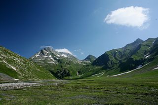
The Greina is a high mountain pass across the western Lepontine Alps, connecting Sumvitg in the canton of Graubünden in Switzerland and Olivone in the canton of Ticino. The pass lies between the Piz Medel on the north and Pizzo Marumo, Piz Terri on the south.
The Gotthard Massif, also Saint-Gotthard Massif is a mountain range in the Alps in Switzerland, located at the border of four cantons: Valais, Ticino, Uri and Graubünden. It is delimited by the Nufenen Pass on the west, by the Furka Pass and the Oberalp Pass on the north and by the Lukmanier Pass on the east. The homonymous Gotthard Pass, lying at the heart of the massif, is the main route from north to south.

