
In Spain, a comarca is either a traditional territorial division without any formal basis, or a group of municipalities, legally defined by an autonomous community for the purpose of providing common local government services. In English, a comarca is equivalent to a district, county, area or zone.

Serranilla Bank is a partially submerged reef, with small uninhabited islets, in the western Caribbean Sea. It is situated about 350 kilometres (220 mi) northeast of Punta Gorda, Nicaragua, and roughly 280 kilometres (170 mi) southwest of Jamaica. The closest neighbouring land feature is Bajo Nuevo Bank, located 110 kilometres (68 mi) to the east.
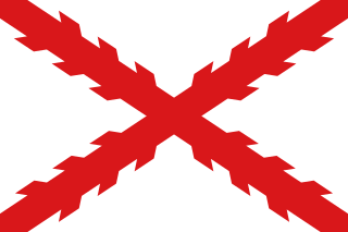
During Spain's New World Empire, its mainland coastal possessions surrounding the Caribbean Sea and the Gulf of Mexico were referred to collectively as the Spanish Main. The southern portion of these coastal possessions were known as the Province of Tierra Firme, or the "Mainland Province". The Province of Tierra Firme, or simply Tierra Firme, was also called Costa Firme.
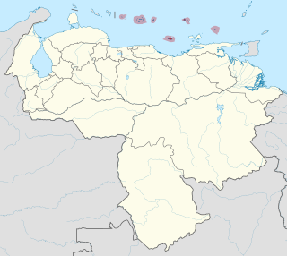
The Federal Dependencies of Venezuela encompass most of Venezuela's offshore islands in the Caribbean Sea and the Gulf of Venezuela, excluding those islands that form the State of Nueva Esparta and some Caribbean coastal islands that are integrated with nearby states. These islands, with a total area of 342 square kilometres, are sparsely populated – according to the preliminary results of the 2011 Census only 2,155 people live there permanently, with another hundred from Margarita Island who live there seasonally to engage in fishing. Local government is officially under the authority of Central government in Caracas, although de facto power is often held by the heads of the sparse and somewhat isolated communities that decorate the territories.
Rosalind Bank, also called Rosalinda or Rosa Linda Bank, is a large, completely submerged bank or atoll in the western Caribbean Sea. It is the culmination of an area of coral reef, some 300 kilometres (190 mi) long, that extends eastward from Cabo Gracias a Dios. The bank area is part of an extensive structure, known as Nicaragua Rise, that continues further east through Pedro Bank towards Jamaica.
Pedro Bank is a large bank of sand and coral, partially covered with seagrass, about 80 km south and south-west of Jamaica, rising steeply from a seabed of 800 m depth.
Domenico Colombo was a weaver, the father of Italian explorer and navigator Christopher Columbus and Bartholomew Columbus.
The Misteriosa Bank is a submerged bank or atoll in the Caribbean Sea, located at 18°48′N83°54′W – approximately equidistant from Mexico, Honduras and Cuba.

Cay Sal Bank is the third largest and the westernmost of the Bahama Banks. It is located between 23º27'N - 24º10'N and 079º25'W – 080º35'W. In a geographical sense, it is separate from the Bahamas proper as it is much closer to Cuba than to the closest Bahamian island. It is separated by Santaren Channel from the Great Bahama Bank, the western rim of which is 50 km (31 mi) to the east. The Straits of Florida separate it from the United States mainland and the Florida Keys.
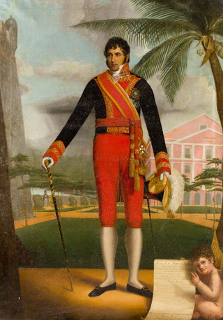
Miguel de la Torre y Pando, conde de Torrepando was a Spanish General, Governor and Captain General, who served in Spain, Venezuela, Colombia and Puerto Rico during the Spanish American wars of independence and afterwards.

Pedro de Candia was a Greek explorer and cartographer at the service of the Kingdom of Spain, an officer of the Royal Spanish Navy that under the Spanish Crown became a Conquistador, Grandee of Spain, Commander of the Royal Spanish Fleet of the Southern Sea, Colonial Ordinance of Cusco, and then Mayor of Lima between 1534 and 1535. Specialized in the use of firearms and artillery, he was one of the earliest explorers of Panama and the Pacific coastline of Colombia, and finally participated in the conquest of Peru. He was killed in the Battle of Chupas, (Peru), on 16 September 1542, by Diego de Almagro II.

Cay Sal is a small island in the Cay Sal Bank between Florida, Cuba, and the Bahamas. It is no longer inhabited.
The southern coast of Chile presents a large number of fjords and fjord-like channels from the latitudes of Cape Horn to Reloncaví Estuary. Some fjords and channels are important navigable channels providing access to ports like Punta Arenas, Puerto Chacabuco and Puerto Natales.

Since the 16th century the island of Cuba had been under the control of the governor-captain general of Santo Domingo. The conquest of Cuba was organized in 1510 by the recently restored Viceroy of the Indies, Diego Colón, under the command of Diego Velázquez de Cuéllar, who became Cuba's first governor until his death in 1524.
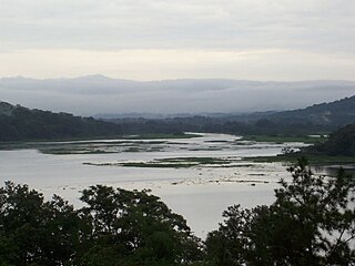
Encarnación, was an armed Spanish merchant ship of the Nao class, which was built in Veracruz, Viceroyalty of New Spain, likely sometime in the mid-1600s. The ship sank in a storm in 1681 at the mouth of the Chagres River and was discovered by archaeologists from the Texas State University in 2011.

The Elbow Cays are uninhabited cays in the Cay Sal Bank, Bahamas. It is the most Western point in the Bahamas. They are part of a reef shelf located at the northwestern end of the bank about 80 km (50 mi) off the Cuban coast and 130 km (80 mi) southeast of Key West, Florida. These cays are an excellent scuba diving spot.
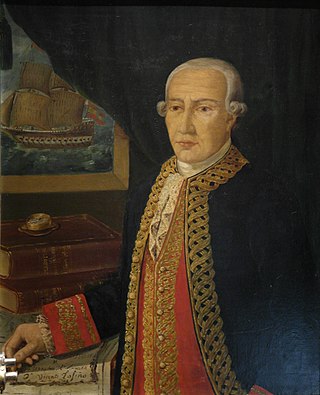
Vicente Tofiño de San Miguel y Vandewalle was a Spanish Navy officer, navigator and cosmographer.
The Sant Jordi Awards are film prizes awarded annually by the Catalan branch of the Spanish public radio network Radio Nacional de España (RNE), Ràdio 4. The awards were established in 1957.
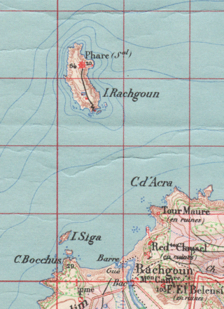
The Island of Limacos or Island of Caracoles, known in Spanish in the 16th century as Risgol and in French as Île de Rachgoun is an Algerian islet located near the North African coast. It has an area of about 66 hectares and it is uninhabited. It is located in front of the mouth of the Tafna River, where the town of Rashgun is located. It is approximately halfway between Oran and the border between Algeria and Morocco. It was literarily described, along with other islets on the Maghreb coast, by the writer Pedro Mata as "one of those sea monsters sentinel that deflower the surface of the sea at various points" in his 1856 work Los moros del Riff o el presidiario de las Alhucemas.


