Geography
The surrounding hydrographic slopes of the Pokotciminikew River are:
- north side: Surprise Lake (Roy River), Caopatina Lake, Lake of the Winds (Opawica River), Opawica River;
- east side: Eau Claire Creek, Eastman Creek, Normandin Lake (Normandin River), Normandin River;
- south side: Kakospictikweak River, Gouin Reservoir, McSweeney Lake, Magnan Lake, Wapous River;
- west side: Kakospictikweak River, Baptiste Lake, Augusta Creek, Encounter Creek, Pascagama River, Aigle River (Doda Lake), Macho River.
The Pokotciminikew River originates at the mouth of an unidentified lake (length: 0.4 kilometres (0.25 mi), altitude: 534 metres (1,752 ft)) located in the township of Pfister, in Eeyou Istchee James Bay (municipality). The mouth of this head lake is located at:
From the mouth of the head lake, the course of the Pokotciminikew River flows entirely into forest area on 10.2 kilometres (6.3 mi) according to the following segments:
- 3.2 kilometres (2.0 mi) northwesterly, then southwesterly, to the eastern border of Balete. Note: this limit also corresponds to the boundary between Eeyou Istchee Baie-James (municipality) and La Tuque;
- 5.4 kilometres (3.4 mi) southwesterly to the northern limit of the township of Mathieu;
- 1.6 kilometres (0.99 mi) southwesterly to the confluence of the Pokotciminikew River with the Kakospictikweak River. [3]
The confluence of the Pokotciminikew River with the Kakospictikweak River is located at:
The Pokotciminikew River flows into a river bend on the north shore of the
Kakospictikweak River. From there, the current flows along the
Kakospictikweak River southward on 19.6 kilometres (12.2
mi) to a bay on the north shore of
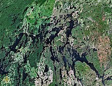
Gouin Reservoir. From the mouth of the
Kakospictikweak River, the current flows south-easterly on 84.1 kilometres (52.3
mi) through the
Gouin reservoir to the southeast bypassing several islands and passing through
Kikendatch Bay to the
Gouin Dam. From there, the current flows along the
Saint-Maurice River to
Trois-Rivières, where it flows into the
St. Lawrence River.

The Muy River is a tributary of the east bank of the Wetetnagami River flowing into the Regional County Municipality (RCM) of Eeyou Istchee James Bay, in the administrative region of Nord-du-Québec, Quebec, Canada.
The Ventadour River is a tributary of the south shore of Robert Lake flowing into Eeyou Istchee Baie-James (municipality), in Jamésie, in the administrative region of Nord-du-Québec, Quebec, Canada.
The Titipiti River is a tributary of Feuquières Lake, in Quebec, in Canada. This watercourse crosses the administrative regions of:
The Queue de Castor River is a tributary of Gabriel Lake, flowing into the Eeyou Istchee James Bay (Municipality), in Jamésie, in the administrative region of Nord-du-Québec, in Quebec, Canada.
The Cawcot River is a tributary of Gabriel Lake, flowing into the municipality of Baie-James, Jamésie, in the administrative region of Nord-du-Québec, Quebec, Canada.
The Ventadour Lake is a freshwater body of the southeastern portion of the Eeyou Istchee James Bay (municipality), in Jamésie, in the administrative region of Nord-du-Québec, in the province of Quebec, in Canada.
The Des Aigle River is a tributary of Doda Lake, flowing in Quebec, Canada, in the administrative regions of:

The Wapous River is a tributary of the Gouin Reservoir, flowing in the territory of the town of La Tuque, in the administrative region of Mauricie, in Quebec, in Canada.

The Atimokateiw River is a tributary of the south shore of the Gouin Reservoir, flowing into the territory of the town of La Tuque, in the area of Mauricie, Quebec, Canada.

The Toussaint River is a tributary of the north shore of the Gouin Reservoir, flowing in Quebec, in Canada in the administrative region of:
The Kakospictikweak River is a tributary of the North Shore of Gouin Reservoir, sinking in Quebec, Canada in the administrative region of Mauricie of:
The Jean-Pierre River is a tributary of the Jean-Pierre Bay, on the south shore of the Gouin Reservoir, flowing into the territory of the town of La Tuque, into the administrative region of Mauricie, in Quebec, in Canada.
The Leblanc River is a tributary of the De La Galette River, flowing on the south shore of the Gouin Reservoir, in the territory of the town of La Tuque, in the Mauricie administrative region, in Quebec, in Canada.
The De La Galette River is a tributary of the southern shore of Gouin Reservoir, flowing into the territory of the town of La Tuque, in the administrative region of the Mauricie, in Quebec, in Canada.

The Nemio River is a tributary of the south shore of the Gouin Reservoir, flowing in the town of La Tuque, in the administrative region of Mauricie, in Quebec, in Canada.
The Mistatikamekw River is a tributary of the Oskélanéo River which flows into the South Bay of Bureau Lake, flowing into the town of La Tuque, in the administrative region of Mauricie, in Quebec, in Canada.
The Faucher River is a tributary of Tessier Lake located on the southwestern side of the Gouin Reservoir. This river runs in the town of La Tuque, in the administrative region of Mauricie, in Quebec, in Canada.
The Plamondon Creek is a tributary of the Plamondon Bay located in the western part of the Gouin Reservoir. This stream runs entirely in forest zone in the town of La Tuque, in the administrative region of Mauricie, in Quebec, in Canada.
The De la Rencontre Creek is a tributary of the Du Mâle Lake located in the western part of the Gouin Reservoir, flowing entirely into forest area in the town of La Tuque, in the administrative region of Mauricie, Quebec, Canada.
The Simard Lake is a freshwater body located in the northwestern part of Gouin Reservoir, in the territory of the town of La Tuque, in the administrative region of Mauricie, in the province of Quebec, in Canada.