Arundel is a township municipality in Quebec, Canada, located 18 kilometres (11 mi) south of Mont Tremblant.
The Town of Île-Perrot is a town and municipality on Île Perrot in southwestern Quebec, Canada. The population as of the Canada 2016 Census was 10,756. The town is at the western end of Lake Saint-Louis, and borders the local island communities of Terrasse-Vaudreuil, Pincourt and Notre-Dame-de-l'Île-Perrot. It also includes Dowker Island and the small Claude and Bellevue Islands.

Piedmont is a small municipality within the Les Pays-d'en-Haut Regional County Municipality, Quebec, Canada, in the Laurentian Mountains of the administrative region of Laurentides. It is located along the North River and Autoroute 15 and Route 117, north of Montreal.

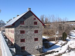
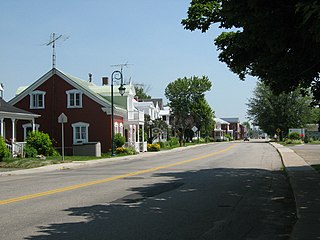
Sainte-Anne-de-la-Pérade is a municipality in the Les Chenaux Regional County Municipality, in the Mauricie region of the province of Quebec in Canada. The town is located near the mouth of the Sainte-Anne River along the Chemin du Roy, a historic segment of Quebec Route 138 that stretches from near Montreal to Quebec City.
Yamachiche is a municipality in the Mauricie region of the province of Quebec in Canada.

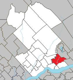
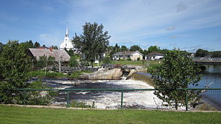
Saint-Prosper-de-Champlain is a municipality of 516 people in the Les Chenaux Regional County Municipality, in Quebec, Canada. It is the smallest municipality in terms of population in the regional county.
Sainte-Jeanne-d'Arc is a village in the Canadian province of Quebec, located within the regional county municipality of Maria-Chapdelaine. The village had a population of 1,089 in the Canada 2011 Census.

Val-David is a village of more than 5,200 inhabitants in the Laurentian Mountains about 80 kilometres (50 mi) north of Montreal, Quebec, Canada. Attracting about 100,000 tourists a year, Val-David is predominantly francophone although it has a small anglophone minority.

Brébeuf is a parish municipality in the Laurentides region of Quebec, Canada, part of Les Laurentides Regional County Municipality. It is located along the Rouge River, near Mont-Tremblant.

Amherst is a township municipality in the Canadian province of Quebec, located within Les Laurentides Regional County Municipality.

Neuville is a village on the north shore of the Saint Lawrence River, just west of Quebec City, part of the Portneuf Regional County Municipality, Quebec, Canada. Founded in 1684, it remains picturesque.

Sainte-Thérèse-de-la-Gatineau is a municipality in the Outaouais region of Quebec, Canada. Located between the Gatineau River and Thirty-One Mile Lake, it is the smallest municipality in terms of population in the La Vallée-de-la-Gatineau Regional County Municipality, Quebec.

Sainte-Marguerite-du-Lac-Masson is a city in Les Pays-d'en-Haut Regional County Municipality in the Laurentides region of Quebec, Canada. It is partially named after and situated on the western shore of Lake Masson.

Ivry-sur-le-Lac is a village and municipality in the Laurentides region of Quebec, Canada, part of the Les Laurentides Regional County Municipality. The municipality completely encompasses Lake Manitou which is a popular cottage vacation location.

Sainte-Anne-du-Lac is a municipality and village in the Laurentides region of Quebec, Canada, part of the Antoine-Labelle Regional County Municipality.

Huberdeau is a village and municipality in the Laurentides region of Quebec, Canada, part of the Les Laurentides Regional County Municipality. It is located along the western banks of the Rouge River.

La Conception is a village and municipality in the Laurentides region of Quebec, Canada, part of the Les Laurentides Regional County Municipality.

Labelle is a village and municipality in the Laurentides region of Quebec, Canada, part of the Les Laurentides Regional County Municipality. Its large "L"-shaped territory surrounds Lake Labelle, and the village is located along the Rouge River and Route 117.
L'Ascension is a municipality in the Laurentides region of Quebec, Canada, part of the Antoine-Labelle Regional County Municipality. The area is known as La Vallée de la Rouge.
Métabetchouan–Lac-à-la-Croix is a city in Quebec, Canada, in the Saguenay–Lac-Saint-Jean region.