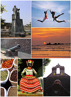
Thalassery, formerly Tellicherry, is a municipality, Commercial City on the Malabar Coast in Kannur district, in the state of Kerala, India, bordered by the districts of Mahé (Pondicherry), Kozhikode, Wayanad, Kasaragod and Kodagu (Karnataka). Thalassery municipality has a population just under 100,000. Thalassery Heritage City has an area of 23.98 square kilometres (9.26 sq mi). Thalassery is situated in an altitude ranging from 2.5m to 30m above mean sea-level.

Iritty is a Municipality and a Taluk of Kannur district in Kerala State, India. The town is the main market place for the farmer communities in the surrounding regions. Iritty is known as The Coorg Valley in God's Own Country. Iritty is one of the fastest upcoming towns in Kerala with the distance of 19.5 km (12.1 mi) from Kannur International Airport and one among five taluks in Kannur district. Iritty is one of the major towns lies between Coorg and Kannur international airport -Mattanur.

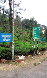
Nedumpoil is a small village in the Kannur district of Kerala, India. It is situated between two major towns, Thalassery and Mananthavady.

Mattanur, also spelled Mattannur, is a town, municipality, and an aerotropolis in Kannur district, Kerala, India. Mattanur is about 27 km east of Kannur and Thalassery, two major towns of the district.
Kuthuparamba is a town and a municipality in the Kannur district, state of Kerala, India. It is about 14 km east of Thalassery and 24 km south east of Kannur.Kuthuparamba is one of the main suburb of the City of Thalassery.The major road passing through the Kuthuparmba town is Thalassery – Coorg Hwy(TC Road) which was made by the British for sending troops to Mysore also plays an important role in the history of Kuthuparamba.

Peravoor is a small town in Kannur district of Kerala state in India. It is east of Kannur (54 km) and Thalassery (44 km). And Iritty, the nearest municipality, is 15 km to the north of Peravoor. Peravoor is situated in the Western Ghats mountain range.
Mavilayi is a census town in Kannur district in the Indian state of Kerala. Situated in Peralasseri Panchayath on Kannur-Kuthuparamba State Highway, 15 km away from Kannur Town.

Anjarakandy is a census town and grama panchayat in Kannur district of Kerala, India. Anjrakandy river is flowing through Anjarakandy town.
Mambaram is a small town situated on the shores of Anjarakkandy river in Thalassery taluk, Kannur district, Kerala state, South India.

Chemperi is a town on the bank of the Chemperi River, in the Western Ghat, in the Kannur district of South India. Chemperi is often referred as the education city of Kannur with the establishment of Vimal Jyothi Engineering College, Chemperi. It is characterized by its production and export of rubber and spices, its beautiful hillocks, and its serene streams. Village and Panchayath of Chemperi is Eruvessi. Both Panchayath and Village offices of Eruvessi are located in Chemperi. Also Lourde Matha Forane Church, Chemperi is another attraction.Paithalmala and Palakkayam thatt is also a few kilometres away from here.

Alakode is an emerging big town in Kannur district in the Indian state of Kerala. It is located 46 km towards north. District headquarters is Kannur. Alakode is located on Taliparamba-Manakadavu-Coorg Road. Alakode was one of the major centers of Malabar Migration.
Cheruvanchery is a village in Kannur district in the Indian state of Kerala. A detailed history of the town for the first time was written in a blog "Cheruvanchery: A Tale of Erased Times".

Kanichar is a village and Grama Panchayat in Kannur district in the Indian state of Kerala.

Kannavam is a small Village in Thalassery Taluk in Kannur District of Kerala State, India. It comes under Chittaripparamba Panchayat. It belongs to North Kerala Division. It is located at 36 km towards East from District headquarters, Kannur; 12 km from Kuthuparamba and 466 km from State capital Thiruvananthapuram
Manantheri is a census town near Kuthuparamba in Kannur district in the Indian state of Kerala.

Manathana is a village in Kannur district of Kerala, India.
Boys Town is a small village near Mananthavady in Wayanad, Kerala, India. The village is 13 km from Mananthavady.
Kannur, India has a number of tourist attractions including beaches, hills, temples and other monuments.

Kannur district is politically organized into a complex web of taluks, blocks, panchayaths and villages. In addition, there are also parliamentary divisions called Assembly constituencies and Lok Sabha constituencies.

The district capital of Wayanad is Kalpetta town. Kalpetta has very good road connectivity with the rest of Kerala and neighboring South Indian cities. National Highway 766 (India) NH766 connects Kalpetta with Kozhikode and Mysore. State Highways connect Kalpetta with Ooty in Tamil Nadu and Madikeri in Karnataka.

