Poplar Plains, Kentucky | |
|---|---|
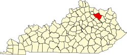
 Poplar Plains Location within the state of Kentucky | |
| Coordinates: 38°21′39″N83°40′28″W / 38.36083°N 83.67444°W | |
| Country | United States |
| State | Kentucky |
| County | Fleming |
| Elevation | 909 ft (277 m) |
| Time zone | UTC-5 (Eastern (EST)) |
| • Summer (DST) | UTC-4 (EDT) |
| ZIP code | 41041 |
| Area code | 606 |
| GNIS feature ID | 501127 [1] |
Poplar Plains is an unincorporated community in Fleming County, Kentucky, in the United States. [1]