Portola Hills, California

Last updated

Portola Hills, California
District of Lake Forest
Orange County California Incorporated and Unincorporated areas Portola Hills Highlighted.svg
Location of Portola Hills within Orange County, California.
Coordinates: 33°41′01″N117°37′58″W / 33.68361°N 117.63278°W / 33.68361; -117.63278
CountryUnited States
State California
County Orange
City Lake Forest
Area
  Total
1.3 sq mi (3 km2)
  Land1.3 sq mi (3 km2)
  Water0.0 sq mi (0 km2)
Population
 (2000)
  Total
6,391
  Density5,063.6/sq mi (1,955.1/km2)
Time zone UTC-8 (PST)
  Summer (DST) UTC-7 (PDT)

Portola Hills is a district in the city of Lake Forest, California in Orange County, United States. It was an unincorporated community and census-designated place before it was fully annexed into Lake Forest. The population was 6,391 at the 2000 census. Portola Hills lies near Whiting Ranch Wilderness Park and Cleveland National Forest. Foothill Ranch is to the west, Rancho Santa Margarita in the southeast, Mission Viejo in the south, and the unincorporated regions of Silverado and Santiago Canyon to the north and northeast.

Contents

History

Portola Hills is named after Gaspar de Portola, first Governor of the Californias. Retrat Gaspar de Portola (Lleida).jpg
Portola Hills is named after Gaspar de Portolá, first Governor of the Californias.

The tracts were developed in the late 1980s through the early 1990s. The development was named after Gaspar de Portolá, California's first terrestrial Spanish explorer, who passed through the vicinity in 1769. (Nearby Trabuco Canyon is named for a blunderbuss which was lost by expedition members.)

Geography

Entrance to Portola Hills Portola Hills.jpg
Entrance to Portola Hills

According to the United States Census Bureau, the CDP has a total area of 1.3 square miles (3.4 km2), all land.

Demographics

Historical population
CensusPop.Note
2000 6,391
U.S. Decennial Census [1]
1850–1870 [2] [3] 1880-1890 [4]
1900 [5] 1910 [6] 1920 [7]
1930 [8] 1940 [9] 1950 [10]
1960 [11] 1970 [12] 1980 [13]
1990 [14] 2000 [15] 2010 [16]

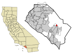
Portola Hills first appeared as a census designated place in the 2000 U.S. Census; [15] and was deleted after being annexed by the city of Lake Forest prior to the 2010 U.S. Census. [15]

Portola Hills CDP, California – Racial and ethnic composition
Note: the US Census treats Hispanic/Latino as an ethnic category. This table excludes Latinos from the racial categories and assigns them to a separate category. Hispanics/Latinos may be of any race.
Race / Ethnicity (NH = Non-Hispanic)Pop 2000 [17] % 2000
White alone (NH)4,99878.20%
Black or African American alone (NH)1011.58%
Native American or Alaska Native alone (NH)140.22%
Asian alone (NH)4256.65%
Native Hawaiian or Pacific Islander alone (NH)80.13%
Other race alone (NH)130.20%
Mixed race or Multiracial (NH)1912.99%
Hispanic or Latino (any race)64110.03%
Total6,391100.00%

As of the census [18] of 2000, there were 6,391 people, 2,164 households, and 1,729 families residing in the CDP. The population density was 5,063.6 inhabitants per square mile (1,955.1/km2). There were 2,181 housing units at an average density of 1,728.0 per square mile (667.2/km2). The racial makeup of the CDP was 84.60% White, 1.63% African American, 0.30% Native American, 6.76% Asian, 0.13% Pacific Islander, 2.64% from other races, and 3.94% from two or more races. Hispanic or Latino of any race were 10.03% of the population.

There were 2,164 households, out of which 52.4% had children under the age of 18 living with them, 69.4% were married couples living together, 8.1% had a female householder with no husband present, and 20.1% were non-families. 14.0% of all households were made up of individuals, and 1.4% had someone living alone who was 65 years of age or older. The average household size was 2.95 and the average family size was 3.30.

In the CDP, the age distribution of the population shows 32.9% under the age of 18, 4.9% from 18 to 24, 41.4% from 25 to 44, 18.0% from 45 to 64, and 2.9% who were 65 years of age or older. The median age was 33 years. For every 100 females, there were 97.4 males. For every 100 females age 18 and over, there were 92.2 males.

Estimated median household income in 2016: $126,434 (it was $90,874 in 2000) Estimated per capita income in 2016: $50,437 (it was $34,057 in 2000)

Politics

In the state legislature Portola Hills is located in the 37th Senate District, represented by Republican John Moorlach, and in the 68th Assembly District, represented by Republican Steven Choi. Federally, Portola Hills is located in California's 45th congressional district, which is represented by Democrat Katie Porter.

Housing

The community of Portola Hills has 2,181 housing units on 348.8 acres (141.2 ha) of land with an average housing density of 6.25 per acre (15.4/ha).

There are 15 tracts of housing built in single and multi-family configurations that can be classified as Condominium, Townhouse, Mix use, Semi-Detached and Detached:

Schools

Children living in the area attend Portola Hills Elementary.

Built in the mid-1990s, Portola Hills Elementary was subject to litigation between the SVUSD school district and the developer concerning land movement at the school site. The litigation was dismissed due to procedural issues regarding the statute of limitations. In 2004, three buildings were vacated for safety reasons due to damage potentially caused by the land movement and the students relocated in portable/temporary classrooms until a permanent solution could be made. As of mid-2008, the developer (USA Portola Center, LLC) entered into a School Facilities Funding and Mitigation Agreement with the school district for development originally known as "Portola Hills South" and now known as "Portola Center." That agreement requires the developer to pay the district $2,900,000 (in addition to any other new development mitigation fees), solely for use in the repair of the school. [19] As of June 2008, the district is moving forward with plans to repair two buildings and potentially demolish/rebuild the third provided approval is obtained from the Department of State Architecture.

Related Research Articles

<span class="mw-page-title-main">Castro Valley, California</span> CDP in California, United States

Castro Valley is a census-designated place (CDP) in Alameda County, California, United States. At the 2010 census, it was the fifth most populous unincorporated area in California. The population was 66,441 at the 2020 census.

<span class="mw-page-title-main">Charter Oak, California</span> Census designated place in California, United States

Charter Oak is a census-designated place (CDP) in Los Angeles County, California, approximately 26 miles (42 km) east of downtown Los Angeles. The population was 9,310 at the 2010 census, up from 9,027 at the 2000 census.

<span class="mw-page-title-main">Aliso Viejo, California</span> City in California, United States

Aliso Viejo is a city in the San Joaquin Hills of southern Orange County, California. It had a population of 52,176 as of the 2020 census, up from 47,823 as of the 2010 census. It became Orange County's 34th city on July 1, 2001, the only city in Orange County to be incorporated since 2000. It is bordered by the cities of Laguna Beach on the west and southwest, Laguna Hills on the east, Laguna Niguel on the southeast, and Laguna Woods on the north. It is similarly named to another nearby city, Mission Viejo.

<span class="mw-page-title-main">Lake Forest, California</span> City in California, United States

Lake Forest is a city in Orange County, California, United States. The population was 85,858 at the 2020 census.

<span class="mw-page-title-main">North Tustin, California</span> Place in California, United States

North Tustin is an unincorporated community and census designated place (CDP) in Orange County, California. The population was 25,718 at the 2020 census, up from 24,917 in 2010. For statistical purposes, the United States Census Bureau has defined North Tustin as a census-designated place (CDP). It is both the largest CDP and largest unincorporated community in Orange County. The CDP's name was changed from Tustin Foothills in 2005. Located outside the city limits of Tustin, North Tustin has 92705 and 92780 ZIP Codes.

<span class="mw-page-title-main">Beckwourth, California</span> Census-designated place in California, United States

Beckwourth is a census-designated place (CDP) in Plumas County, California, United States. Beckwourth is located on the Middle Fork Feather River 5 miles (8.0 km) east of Portola. The population was 432 at the 2010 census, up from 342 at the 2000 census.

<span class="mw-page-title-main">Canyondam, California</span> Census-designated place in California, United States

Canyondam is a census-designated place (CDP) in Plumas County, United States. Canyondam is located near the dam that forms Lake Almanor, 6.25 miles (10.1 km) east-southeast of Almanor. The population was 31 as of the 2010 census, down from 37 as of the 2000 census. On August 6, 2021, the community was destroyed in the Dixie Fire.

<span class="mw-page-title-main">Portola, California</span> City in California, United States

Portola is the only incorporated city in Plumas County, California, United States. The population was 2,104 at the 2010 census, down from 2,227 at the 2000 census. Portola is located on the Middle Fork of the Feather River and was named after Spanish explorer Gaspar de Portolá, although he did not explore this area.

<span class="mw-page-title-main">Woodcrest, California</span> Census-designated place in California, United States

Woodcrest is a census-designated place (CDP) in Riverside County, California, United States. The population was 14,347 at the 2010 census, up from 8,342 at the 2000 United States Census. The adjacent city of Riverside lists Woodcrest as an area for potential annexation.

<span class="mw-page-title-main">Harbison Canyon, California</span> Census-designated place in California, United States

Harbison Canyon is a census-designated place (CDP) in San Diego County, California. It had a population of 4,048 as of the 2020 census, up from 3,841 as of the 2010 census.

<span class="mw-page-title-main">China Lake Acres, California</span> Census-designated place in California, United States

China Lake Acres is a census-designated place (CDP) in Kern County, California, United States. The population was 1,876 at the 2010 census, up from 1,761 at the 2000 census.

<span class="mw-page-title-main">Kendall Park, New Jersey</span> Populated place in Middlesex County, New Jersey, US

Kendall Park is an unincorporated community and census-designated place (CDP) in South Brunswick Township, Middlesex County, New Jersey, United States. As of the 2020 census, the CDP's population was 9,989, up from 9,339 in 2010. Kendall Park has a post office with its own ZIP Code (08824) that encompasses the majority of the CDP, as well as some surrounding areas.

<span class="mw-page-title-main">Canyon Lake, Texas</span> CDP in Texas, United States

Canyon Lake is a census-designated place (CDP) in Comal County, Texas, United States. The population was 31,124 at the 2020 census. It is part of the San Antonio Metropolitan Statistical Area.

<span class="mw-page-title-main">Ladera Ranch, California</span> Place in California, United States

Ladera Ranch is a master-planned community and census-designated place located in south Orange County, California, just outside the city limits of Mission Viejo.

<span class="mw-page-title-main">Bell Canyon, California</span> Place in California, United States

Bell Canyon is an unincorporated community in eastern Ventura County, California, United States. Bell Canyon is a gated community in the Simi Hills with the main access through the Los Angeles community of West Hills and the western San Fernando Valley. Bell Canyon sits at an elevation of 1,368 feet (417 m). The 2020 census reported Bell Canyon's population was 1,946. For statistical purposes, the Census Bureau has defined Bell Canyon as a census-designated place (CDP). According to a 2016 study, Bell Canyon is the seventh wealthiest community in the state of California with an annual median income of $230,000.

<span class="mw-page-title-main">Bear Valley, Mariposa County, California</span> Census-designated place in California, United States

Bear Valley is a census-designated place in Mariposa County, California, United States. It is located 10.5 miles (16.9 km) south-southeast of Coulterville, at an elevation of 2,054 feet (626 m). Bear Valley has been designated California Historical Landmark #331. The population was 156 at the 2020 census.

<span class="mw-page-title-main">Bethel Island</span> Census-designated place in California, United States

Bethel Island is an island in the Sacramento–San Joaquin River Delta of Contra Costa County, California, approximately 10 kilometres (6.2 mi) east of Antioch. The island describes itself as "the heart of the California Delta."

<span class="mw-page-title-main">Cedar Slope, California</span> Census-designated place in California, United States

Cedar Slope is a census-designated place (CDP) in Tulare County, California. Cedar Slope sits at an elevation of 5,584 feet (1,702 m). The 2020 United States census reported that Cedar Slope was 10, this is up from zero in 2010. Cedar Slope can be reached from Porterville by 37 curvy miles on California State Route 190 with an elevation gain of 5,525 feet.

<span class="mw-page-title-main">Box Canyon, Texas</span> CDP in Texas, United States

Box Canyon is a census-designated place (CDP) in Val Verde County, Texas, United States. The population was 34 at the 2010 census. This CDP was formed prior to the 2010 census from parts of the deleted Box Canyon-Amistad CDP.

Harding Gill Tract is an unincorporated community and census-designated place (CDP) in Hidalgo County, Texas, United States. It was first listed as a CDP prior to the 2020 census.

References

  1. "Decennial Census by Decade". United States Census Bureau . Archived from the original on July 6, 2022.
  2. "1870 Census of Population - Population of Civil Divisions less than Counties - California - Almeda County to Sutter County" (PDF). United States Census Bureau . Archived (PDF) from the original on September 7, 2024. Retrieved August 12, 2024.
  3. "1870 Census of Population - Population of Civil Divisions less than Counties - California - Tehama County to Yuba County" (PDF). United States Census Bureau . Archived (PDF) from the original on August 28, 2024. Retrieved August 12, 2024.
  4. "1890 Census of Population - Population of California by Minor Civil Divisions" (PDF). United States Census Bureau .
  5. "1900 Census of Population - Population of California by Counties and Minor Civil Divisions" (PDF). United States Census Bureau . Archived (PDF) from the original on August 12, 2024. Retrieved August 12, 2024.
  6. "1910 Census of Population - Supplement for California" (PDF). United States Census Bureau . Archived (PDF) from the original on August 23, 2024. Retrieved August 12, 2024.
  7. "1920 Census of Population - Number of Inhabitants - California" (PDF). United States Census Bureau .
  8. "1930 Census of Population - Number and Distribution of Inhabitants - California" (PDF). United States Census Bureau . Archived (PDF) from the original on August 28, 2024. Retrieved August 12, 2024.
  9. "1940 Census of Population - Number of Inhabitants - California" (PDF). United States Census Bureau . Archived (PDF) from the original on September 18, 2024. Retrieved August 12, 2024.
  10. "1950 Census of Population - Number of Inhabitants - California" (PDF). United States Census Bureau . Archived (PDF) from the original on September 21, 2024. Retrieved August 12, 2024.
  11. "1960 Census of Population - General population Characteristics - California" (PDF). United States Census Bureau . Archived (PDF) from the original on August 12, 2024. Retrieved August 12, 2024.
  12. "1970 Census of Population - Number of Inhabitants - California" (PDF). United States Census Bureau . Archived (PDF) from the original on August 12, 2024. Retrieved August 12, 2024.
  13. "1980 Census of Population - Number of Inhabitants - California" (PDF). United States Census Bureau . Archived (PDF) from the original on August 23, 2024. Retrieved August 12, 2024.
  14. "1990 Census of Population - Population and Housing Unit Counts - California" (PDF). United States Census Bureau . Archived (PDF) from the original on August 14, 2024. Retrieved August 12, 2024.
  15. 1 2 3 "2000 Census of Population - Population and Housing Unit Counts - California" (PDF). United States Census Bureau .
  16. "2010 Census of Population - Population and Housing Unit Counts - California" (PDF). United States Census Bureau . Archived (PDF) from the original on February 4, 2023. Retrieved August 12, 2024.
  17. "P004: Hispanic or Latino, and Not Hispanic or Latino by Race – 2000: DEC Summary File 1 – Portola Hills CDP, California". United States Census Bureau .
  18. "U.S. Census website". United States Census Bureau . Retrieved January 31, 2008.
  19. http://www.ci.lake-forest.ca.us/pdf/agendas/2008.06.03/17.8.PDF [ bare URL PDF ]