Related Research Articles

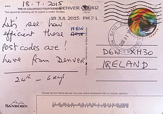
A postal code is a series of letters or digits or both, sometimes including spaces or punctuation, included in a postal address for the purpose of sorting mail.

A ZIP Code is a system of postal codes used by the United States Postal Service (USPS). The term ZIP was chosen to suggest that the mail travels more efficiently and quickly when senders use the code in the postal address. The Philippine Postal Corporation also uses this terminology for the postal code system in the Philippines.

The London postal district is the area in England of 241 square miles (620 km2) to which mail addressed to the London post town is delivered. The General Post Office under the control of the Postmaster General directed Sir Rowland Hill to devise the area in 1856 and throughout its history it has been subject to reorganisation and division into increasingly smaller postal units, with the early loss of two compass points and a minor retraction in 1866. It was integrated by the Post Office into the national postcode system of the United Kingdom during the early 1970s and corresponds to the E, EC, N, NW, SE, SW, W and WC postcode areas. The postal district has also been known as the London postal area. The County of London was much smaller, at 117 square miles (300 km2), but Greater London is much larger at 607 square miles (1,570 km2).

A Canadian postal code is a six-character string that forms part of a postal address in Canada. Like British, Irish, and Dutch postcodes, Canada's postal codes are alphanumeric. They are in the format A1A 1A1, where A is a letter and 1 is a digit, with a space separating the third and fourth characters. As of October 2019, there were 876,445 postal codes, using forward sortation areas (FSAs), from A0A in Newfoundland to Y1A in Yukon.
A Postal Index Number refers to a six-digit code in the Indian postal code system used by India Post. On 15 August 2022, the PIN system celebrated its 50th anniversary.
A geocode is a code that represents a geographic entity. It is a unique identifier of the entity, to distinguish it from others in a finite set of geographic entities. In general the geocode is a human-readable and short identifier.
On 26 June 1964, Swiss Post introduced postal codes as the third country after Germany (1941) and the United States (1963).
Postal codes were introduced in France in 1964, when La Poste introduced automated sorting. They were updated to use the current 5 digit system in 1972.
An address is a collection of information, presented in a mostly fixed format, used to give the location of a building, apartment, or other structure or a plot of land, generally using political boundaries and street names as references, along with other identifiers such as house or apartment numbers and organization name. Some addresses also contain special codes, such as a postal code, to make identification easier and aid in the routing of mail.
A postal address in Ireland is a place of delivery defined by Irish Standard (IS) EN 14142-1:2011 and serviced by the universal service provider, An Post. Its addressing guides comply with the guidelines of the Universal Postal Union (UPU), the United Nations-affiliated body responsible for promoting standards in the postal industry, across the world.

Postcodes in Australia are used to more efficiently sort and route mail within the Australian postal system. Postcodes in Australia have four digits and are placed at the end of the Australian address, before the country. Postcodes were introduced in Australia in 1967 by the Postmaster-General's Department and are now managed by Australia Post, Australia's national postal service. Postcodes are published in booklets available from post offices or online from the Australia Post website.
For the purposes of directing mail, Sweden is divided into a number of postcode areas. The Swedish postcode system is administered by the Swedish Mail Service on behalf of the Swedish Post and Telecom Authority.

Postal codes in Austria were introduced in 1966. known locally as 'Postleitzahlen' are a fundamental aspect of the nation's logistical infrastructure, providing a systematic means of organizing mail delivery and geographical categorization. The term 'Postleitzahlen' translates to 'postal codes' in English.

Postal codes in Brunei Darussalam are known as postcodes, and they are alphanumeric; consisting of two letters followed by four digits. Postcodes in Brunei are issued by the Postal Services Department, a government department under the Ministry of Communications.

Postal codes in Thailand are five digit numbers. The first two digits of the postal code denote the province or special administrative area, while the last 3 digits represent the post office within the province. There are exceptions, for example, Bangkok and Samut Prakan province shared the first two digits 10xxx. It's typical to use postal code ended with zero 0 because they are assigned to post office that are responsible for delivering mail to the district. For example, mails to Dusit district destinations uses postal code 10300 except within Chitralada Palace where postal code 10303 is used. 10300 is postal code of Dusit Post Office which handles the delivery throughout Dusit district while 10303 is postal code of Chitralada Palace Post Office which does not deliver mails outside the palace. Other post offices in Dusit district exist, such as Bang Krabu Post Office with postal code 10301, the code used for mails to be delivered to P.O. Box in the post office.
In 2012, the government of Trinidad and Tobago approved the introduction of postal codes starting later that same year. In addition to the postal code implementation the country has embarked on a nationwide address improvement initiative adopting the Universal Postal Union (UPU) S-42 international standard of addressing. The UPU is an arm of the United Nations and is the coordinating body of postal services worldwide. The intent of this exercise is to correct poor addressing in Trinidad & Tobago and assign to each address a six-digit postal code. This change will result in the following:
Postal codes were adopted in Ghana on 18 October 2017, following the launch of the National Digital Address System. As a joint venture between Ghana Post and Vokacom Ltd as GhanaPost GPS, the Digital Address System assigned postal codes and unique addresses to every square in Ghana.
References
- ↑ "National Address". address.gov.sa. Retrieved 2019-11-11.
- ↑ "National Address". address.gov.sa. Retrieved 2019-11-11.