Powersite, Missouri

Last updated
MOMap-doton-Powersite.png

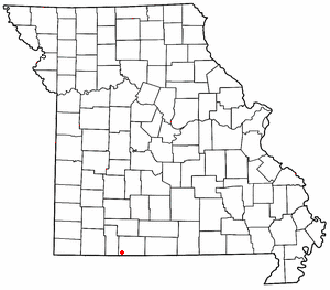
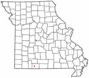
Powersite is an unincorporated community in Taney County, Missouri, United States. [1] It is located across Lake Taneycomo from Forsyth on the southeast end of Powersite Dam. [2] The community is part of the Branson, Missouri Micropolitan Statistical Area.

Unincorporated area Region of land not governed by own local government

In law, an unincorporated area is a region of land that is not governed by a local municipal corporation; similarly an unincorporated community is a settlement that is not governed by its own local municipal corporation, but rather is administered as part of larger administrative divisions, such as a township, parish, borough, county, city, canton, state, province or country. Occasionally, municipalities dissolve or disincorporate, which may happen if they become fiscally insolvent, and services become the responsibility of a higher administration. Widespread unincorporated communities and areas are a distinguishing feature of the United States and Canada. In most other countries of the world, there are either no unincorporated areas at all, or these are very rare; typically remote, outlying, sparsely populated or uninhabited areas.

Taney County, Missouri County in the United States

Taney County is a county located in the southwestern portion of the U.S. state of Missouri. As of the 2010 census, the population was 51,675. Its county seat is Forsyth. It is included in the Branson, Missouri, Micropolitan Statistical Area.

Missouri State of the United States of America

Missouri is a state in the Midwestern United States. With over six million residents, it is the 18th-most populous state of the Union. The largest urban areas are St. Louis, Kansas City, Springfield, and Columbia; the capital is Jefferson City. The state is the 21st-most extensive in area. Missouri is bordered by eight states : Iowa to the north, Illinois, Kentucky, and Tennessee to the east, Arkansas to the south, and Oklahoma, Kansas, and Nebraska to the west. In the South are the Ozarks, a forested highland, providing timber, minerals, and recreation. The Missouri River, after which the state is named, flows through the center of the state into the Mississippi River, which makes up Missouri's eastern border.

Powersite Dam UserKTrimble-Powersite Dam 2008.jpg
Powersite Dam

A post office called Powersite has been in operation since 1913. [3] The community most likely took its name from nearby Powersite Dam. [4]

Related Research Articles

Ridgedale, Missouri unincorporated community in Missouri

Ridgedale is an unincorporated community in southern Taney County, Missouri, United States. It lies approximately ten miles south of Branson on U.S. Route 65, about one-half mile north of the Arkansas state line. The community is part of the Branson, Missouri Micropolitan Statistical Area.

Walnut Shade, Missouri unincorporated community in Missouri

Walnut Shade is an unincorporated community in Taney County, Missouri, United States. It is located approximately six miles northwest of Forsyth on U.S. Route 160. The town sits at the confluence of Bull and Bear Creeks. Walnut Shade is part of the Branson, Missouri Micropolitan Statistical Area.

Beaver Creek (White River tributary) river in Missouri, United States of America

Beaver Creek is a stream in western Douglas and eastern Taney counties of Missouri. It is a tributary to the White River of northern Arkansas. The headwaters of Beaver Creek arise in northern Douglas County and extreme southeast Webster County northwest of Ava and southeast of Seymour. The stream flows south and southwest to join the White River southeast of Forsyth and south of Kissee Mills below the Lake Taneycomo powersite dam. The creek was named due to the presence of beaver dams on the creek.

Baird Mountain is a summit in Taney County in southern Missouri. The peak has an elevation of 1,234 feet (376 m) The peak lies just southeast of the Table Rock Lake dam above Missouri Route 265. Table Rock State Park lies just to the west. Baird Mountain is where the Army Corp of Engineers quarried the rock to make all the concrete for Table Rock Dam. The rock was transported off Baird Mountain with a one-mile long conveyor belt to the site of the dam.

Cedar Valley is an extinct town in Taney County, in the U.S. state of Missouri. The townsite was on Long Creek and Big Cedar Hollow just north of the current Missouri Route 86 bridge. The location is currently submerged under the waters of Table Rock Lake.

Chula Vista is a summit in Taney County in the U.S. state of Missouri. The summit has an elevation of 1,302 feet (397 m).

Day is an unincorporated community in Taney County, in the Ozarks of southern Missouri. Day is located in the northwest part of the county just south of the Taney-Christian county line on Missouri Route 176 and about one mile west of US Route 65.

Dickens is an unincorporated community in north central Taney County, in the U.S. state of Missouri. The community is on Missouri Route 76 about one mile southwest of Taneyville and 4.5 miles northeast of Forsyth.

Flag is an extinct town in Taney County, in the U.S. state of Missouri.

Garber is an unincorporated community in western Taney County in the Ozarks of southern Missouri. Garber is located along the Missouri Pacific Railroad line and Roark Creek about four miles northwest of Branson.

McFarland is an extinct town in Taney County, in the U.S. state of Missouri.

Melva is an extinct town in southern Taney County, in the Ozarks of southwest Missouri. The GNIS classifies it as a populated place. The site was located south of Hollister on the east bank of Turkey Creek along the Missouri Pacific Railroad line.

Mildred is an unincorporated community in Taney County, in the Ozarks of southern Missouri. Mildred is located on Missouri Route 76, south of Forsyth and east of Kirbyville.

Mincy is an unincorporated community in south-central Taney County, in the Ozarks of southern Missouri, United States. Mincy is located approximately four miles north of the Missouri-Arkansas border and near the upper end of Bull Shoals Lake of the White River. Mincy is the namesake for the Drury-Mincy Conservation Area to the south and east.

Ozark Beach is an unincorporated community in Taney County, in the Ozarks of southern Missouri. The site is on the shoreline of Lake Taneycomo, approximately one mile west (upstream) of Powersite Dam.

Swan is an unincorporated community in north central Taney County, in the U.S. state of Missouri. Swan is located on Missouri Route AA, along Blue Creek and approximately 3.5 miles northwest of Taneyville.

Jasper Township is an active township in Taney County, in the U.S. state of Missouri.

Oliver Township is an active township in Taney County, in the U.S. state of Missouri.

Scott Township is an active township in Taney County, in the U.S. state of Missouri.

Swan Township is an active township in Taney County, in the U.S. state of Missouri.

References

  1. U.S. Geological Survey Geographic Names Information System: Powersite, Missouri
  2. Missouri Atlas & Gazetteer, DeLorme, 1998, First edition, p. 62, ISBN   0-89933-224-2
  3. "Post Offices". Jim Forte Postal History. Retrieved 27 December 2016.
  4. "Taney County Place Names, 1928–1945". The State Historical Society of Missouri. Archived from the original on June 24, 2016. Retrieved December 27, 2016.

Coordinates: 36°39′20″N93°07′17″W / 36.65556°N 93.12139°W / 36.65556; -93.12139

Geographic coordinate system Coordinate system

A geographic coordinate system is a coordinate system that enables every location on Earth to be specified by a set of numbers, letters or symbols. The coordinates are often chosen such that one of the numbers represents a vertical position and two or three of the numbers represent a horizontal position; alternatively, a geographic position may be expressed in a combined three-dimensional Cartesian vector. A common choice of coordinates is latitude, longitude and elevation. To specify a location on a plane requires a map projection.