Taney County is a county located in the southwestern portion of the U.S. state of Missouri. As of the 2020 census, the population was 56,066. Its county seat is Forsyth. It is included in the Branson, Missouri, Micropolitan Statistical Area.
Forsyth is a city in Taney County, Missouri, United States. The population was 2,730 at the 2020 census. It is the county seat of Taney County. The town is part of the Branson, Missouri Micropolitan Statistical Area. Forsyth is located on Lake Taneycomo on U.S. Route 160.

Protem is an unincorporated community in southeastern Taney County, Missouri, United States. It is located on Route 125, and is approximately two miles north of the Missouri-Arkansas state line. Protem is part of the Branson, Missouri Micropolitan Statistical Area.

McClurg is an unincorporated community in extreme northeastern Taney County, Missouri, United States. It is located on Missouri Supplemental Route W, approximately three miles east of Brownbranch or twenty miles (32 km) northeast of Forsyth. McClurg is part of the Branson, Missouri Micropolitan Statistical Area.
Point Lookout is an unincorporated community in Oliver Township, Taney County, Missouri, United States, near Branson and Hollister. Point Lookout is in U.S. post office ZIP code 65726. Point Lookout is part of the Branson Micropolitan Statistical Area.
Powersite is an unincorporated community in Taney County, Missouri, United States. It is located across Lake Taneycomo from Forsyth on the southeast end of Powersite Dam. The community is part of the Branson, Missouri Micropolitan Statistical Area.

Walnut Shade is an unincorporated community in Taney County, Missouri, United States. It is located approximately six miles northwest of Forsyth on U.S. Route 160. The town sits at the confluence of Bull and Bear Creeks. Walnut Shade is part of the Branson, Missouri Micropolitan Statistical Area. The ZIP Code for Walnut Shade is 65771.
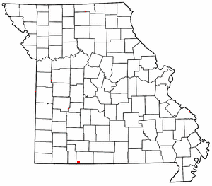
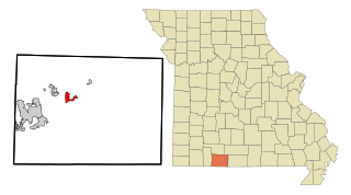
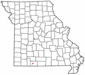
Kirbyville is a village in Taney County, Missouri, United States. The population was 195 at the 2020 census. It is part of the Branson, Missouri Micropolitan Statistical Area.

Kissee Mills is a census-designated place in Taney County, Missouri, United States. It is located on U.S. Route 160, approximately five miles east of Forsyth. Kissee Mills is part of the Branson, Missouri Micropolitan Statistical Area.
Cape Fair is an unincorporated community in Stone County, Missouri, United States. It is located on Route 76 and the southern terminus of Route 173. Cape Fair is on the west side of the James River arm of Table Rock Lake. The community is part of the Branson, Missouri Micropolitan Statistical Area. The ZIP Code for Cape Fair is 65624.

Lampe is an unincorporated community in southern Stone County, Missouri, United States. It is located on Route 13, south of Table Rock Lake.
Cedar Creek or Cedarcreek is an unincorporated community in Taney County, Missouri, United States. It is located approximately fifteen miles southeast of Branson at the intersection of Missouri Supplemental Routes M and KK. The stream Cedar Creek lies about three miles north on route M. The community is part of the Branson, Missouri Micropolitan Statistical Area.

Hilda is an unincorporated community in Taney County, Missouri, United States. It is located on U.S. Route 160 two miles east of the Kissee Mills recreation area on the Beaver Creek arm of Bull Shoals Lake and approximately fifteen miles east of Branson. The Hilda Lookout Tower in approximately one mile south on Lime Kiln Mountain. Hilda is part of the Branson Micropolitan Statistical Area.
Saddlebrooke is a village located in southern Christian County, Missouri, on U.S. Route 65. A small portion of the village extends into Taney County. It is a master-planned community which incorporated in 2003. The population was 309 at the time of the 2020 census.
Chula Vista is a summit in Taney County in the U.S. state of Missouri. The summit has an elevation of 1,302 feet (397 m). The summit lies along Missouri Route 248 at the intersection with Buchannan Road and is approximately four miles north of Branson.
Clevinger Branch is a stream in southwestern Taney County in the U.S. state of Missouri. The stream is a tributary of the Long Creek branch of Table Rock Lake. The Stream headwaters arise just northeast of the route 65/86 junction northwest of Ridgedale at 36°31′57″N93°15′14″W and the former confluence with Long Creek is at 36°33′29″N93°17′35″W. The stream enters Table Rock Lake along a shoreline road in the Long Creek Recreation Area at 36°32′39″N93°15′42″W.
Day is an unincorporated community in Taney County, in the Ozarks of southern Missouri. Day is located in the northwest part of the county, just south of the Taney-Christian county line on Missouri Route 176 and approximately one mile west of U.S. Route 65.
Dickens is an unincorporated community in north central Taney County, in the U.S. state of Missouri. The community is located on Missouri Route 76, approximately one mile southwest of Taneyville and 4.5 miles northeast of Forsyth.
Garber is an unincorporated community in western Taney County in the Ozarks of southern Missouri. Garber is located along the Missouri Pacific Railroad line and Roark Creek, approximately four miles northwest of Branson.

Turkey Creek is a stream in the Ozarks of southern Missouri and northern Arkansas. It is a tributary of Lake Taneycomo. The stream source is two-thirds of a mile south of the Missouri - Arkansas border in Boone County north of the village of Crest. The Missouri Pacific Railroad line follows the stream course after exiting the Crest railroad tunnel under Arkansas State Route 14 at Crest. North of the state line in Taney County the stream flows north through west Hollister to its confluence with Lake Taneycomo south of Branson. The stream covers a linear distance of 86 mi (138 km) between the border and its confluence.