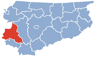
Amarlu District is a district (bakhsh) in Rudbar County, Gilan Province, Iran. At the 2006 census, its population was 7,970, in 2,350 families. The District has one city: Jirandeh. The District has two rural districts (dehestan): Jirandeh Rural District and Kalisham Rural District. Most people of Amarlu District are Tat and they speak Tati.
The King River is a river in the Northern Territory of Australia. It is a tributary of the Daly River which ultimately flows into the Timor Sea.

Avvocata is a quarter of Naples, southern Italy. It is just outside, to the west, of the original historic centre of the Greco-Roman city of Naples. It is the first area beyond the original city developed under the Spanish viceroyship when the Spanish moved into the Kingdom of Naples in the mid-16th century. The most prominent landmark in the area is the large square, Piazza Dante.
Nowra High School is a co-educational public high school, providing education for students in grades 7-12. It has been located on Moss St in Nowra, New South Wales, Australia since 1956. There are around 1,100 students and about 70 staff. The school motto is "Wisdom Through Knowledge".
Santa Rosa District is one of twelve districts of the province Jaén in Peru.

Tokachi River is a river in Hokkaidō, Japan.

Kazusa-Minato Station is a railway station operated by JR East's Uchibō Line located in Futtsu, Chiba Prefecture, Japan. It is 55.1 kilometers from the terminus of the Uchibō Line at Soga Station.

The United States Air Force's 450th Intelligence Squadron is an intelligence unit located at Ramstein Air Base, Germany. The[[squadron (aviation) was first activated in July 1974 as the 6950th Security Squadron and served as an intelligence gathering unit in the United Kingdom until inactivating in 1995. It was reactivated in 2007.

The Lancashire Coastal Way is a long-distance footpath following the coast of the county of Lancashire in the north west of England. Its end points are Silverdale in the north and Freckleton in the south. Its length is variously asserted to be 66 miles (106 km) or 137 miles (220 km).
Pis-Losap is a village and municipality in the state of Chuuk, Federated States of Micronesia.
Pahna is a village in Zayandeh Rud-e Jonubi Rural District, Ben County, Chaharmahal and Bakhtiari Province, Iran. At the 2006 census, its population was 324, in 80 families.

The Winsum train disaster took place on 25 July 1980 near Winsum in the Dutch province of Groningen. 9 people died and 21 were injured.

Bryansk Automobile Plant is a Russian manufacturer of military vehicles based in Bryansk, Russia.
Çavuşlu is a village in the District of Borçka, Artvin Province, Turkey. As of 2010, it had a population of 302 people.
The San Francisco de Miculla petroglyphs, commonly known as the Miculla petroglyphs, are petroglyphs located 22 kilometres (14 mi) from Tacna, Peru. They are carved in low relief in the rocks, and depict people fighting, dancing and hunting animals. They are believed by many to be around 1500 years old, although various people date them from as wide a time period as 500 AD to 1445 AD.
Ayerfjorden is the western branch of Raudfjorden in Albert I Land at Spitsbergen, Svalbard. The glacier Chauveaubreen debouches into the fjord.
Oltinsoy is a raion (district) of Surxondaryo Region in Uzbekistan. The capital lies at Qarluq.
The Sylhet Govt. Pilot High School is one of the oldest schools of Bangladesh as well as the Indian Subcontinent. It is also the first established high school of what is now Bangladesh. Founded in 1836, it is situated in the Kalighat area of Sylhet, on the bank of the Surma River.
Harrison Township is a township in Mercer County, in the U.S. state of Missouri.

Place Ambroise-Courtois is a square in the neighborhood of Monplaisir in the 8th arrondissement of Lyon. It was named after Ambroise Courtois, a city councillor, on 30 October 1944, months after Courtois was assassinated by the Milice française. It had been previously named Place de Monplaisir. The square is bordered by Avenue des Frères-Lumière to the south and Cours Albert-Thomas to the north.


