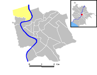
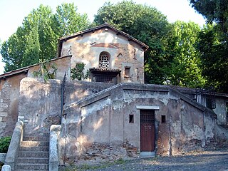
Prati is the 22nd rione of Rome, Italy, identified by the initials R. XXII. It belongs to the Municipio I since 2013, while previously, along with Borgo and quartieriTrionfale and Della Vittoria, it was part of the Municipio XVII.
Its coat of arms depicts the shape of Hadrian's mausoleum, in a blue color on a silver background. Although it technically belongs to the rione Borgo, Hadrian's mausoleum (the modern Castel Sant'Angelo) is one of Prati's landmarks.
History
During the Roman Empire, the area mainly consisted of vineyards and rushes and took the name of Horti Domitii, being owned by Domitia Longina, the wife of Domitian. The area was later called also Prata Neronis and in the Middle Ages it was known as Prata Sancti Petri (St. Peter's Fields), referring to the nearby basilica.
Until 1883 the whole borough was a vast expanse of fields, meadows, pastures and wetlands, with just a few farmhouses, chiefly on the slopes of Monte Mario. All the names by which the area has been called over time denote it as a wild, flat and deserted grassland: Pianella di Prati, Pianella d'Oltretevere and Prati di Castello, the latter referring to Castel Sant'Angelo.
In 1873 cardinal Xavier de Mérode, who owned a great portion of the area, signed an agreement with the municipality, in order to start the construction of the new district, however the first urban interventions began only in 1883, when the area was officially included in the new city plan. The borough, however, remained marginal because of the lack of infrastructures, and de Mérode himself paid for the creation of an iron bridge near the Porto di Ripetta, later dismantled after the inauguration of Ponte Umberto I. MayorErnesto Nathan, between 1907 and 1914, started to deal with the administrative and urban problems of the district, originating from the exceptional development of the city. In 1921 the rione was officially established: it was intended to host administrative offices of the newborn Kingdom of Italy and residences of civil servants coming from all over Italy.
The road scheme was planned in order that from none of the new roads the dome of St. Peter's Basilica could be visible in the background, because of the tense relationship between the new kingdom and the Holy See. Also toponymy is a proof of it, since roads and squares were named after prominent leaders of the Roman Republic and Empire, pagan writers and scholars, heroes of the Risorgimento. In 1911 the main road of the rione was dedicated to Cola di Rienzo, the popular leader who in the 14th century tried to establish a republican government in Rome.
During the construction works, a large amount of ground and fill was carried in the area, in order to create a difference in altitude and to protect the new district from the Tiber floods, that were very common in the past. As the ground employed was mainly clayey, the new buildings often needed stabilization works, and the Palace of Justice had to be reinforced many times to avoid it collapsed because of its size.
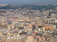
The first buildings arose alongside the Lungotevere dei Mellini and Via Vittoria Colonna. The urbanization of Prati proceeded until the first half of the 20th century, however modern buildings have lately taken the place of the original houses and many buildings have been raised and expanded over time. Wide roads set up in a geometrical scheme, elegant stile Umbertino buildings and Art Nouveau cottages currently distinguishes Prati: born as a public housing district to host civil servants coming from all over Italy, it now claims to be a bourgeois district, and its thoroughfare, Via Cola di Rienzo, one of the most famous streets in Rome, is consistently ranked among the most important shopping streets in the city.
Geography
The main roads of the rione are Via Cola di Rienzo and the rectilinear way formed by Via Cicerone, Via Marcantonio Colonna and Via Lepanto. The said roads are the center of the commercial life of Prati, along with Viale Giulio Cesare, Via Ottaviano and Via Germanico.
Eastward, it borders with quartiereFlaminio (Q. I), whose border is marked by the stretch of the River Tiber between Ponte Matteotti and Via Luisa di Savoia, and with Campo Marzio (R. IV), which is separated from Prati by the Tiber itself, up to Via Ulpiano.
Southward, Prati borders with Ponte (R. V), the boundary being the stretch of the Tiber between Via Ulpiano and Piazza Adriana, with Borgo (R. XIV) (from which is separated by Piazza Adriana itself, Via Alberico II, Via Properzio, Piazza Americo Capponi, Via Stefano Porcari and Piazza del Risorgimento) and the Vatican City, which is separated by the Vatican Walls, from Piazza del Risorgimento to Viale Vaticano.
To the west, the rione borders with quartiereTrionfale (Q. XIV): the boundary is marked by Via Leone IV, up to Viale delle Milizie.
Odonymy
Streets and squares are mostly named after Ancient Rome personalities. Odonyms of the rione can be categorized as follows:
Trastevere is the 13th rione of Rome, Italy. It is identified by the initials R. XIII and it is located within Municipio I. Its name comes from Latin trans Tiberim.
A rione of Rome is a traditional administrative division of the city of Rome. Rione is an Italian term used since the 14th century to name a district of a town. The term was born in Rome, originating from the administrative divisions of the city. The word comes from the Latin word regio, meaning "region"; during the Middle Ages the Latin word became rejones, from which rione comes. Currently, all the rioni are located in Municipio I of Rome.
Ponte is the 5th rione of Rome, Italy, identified by the initials R. V, and is located in Municipio I. Its name comes from Ponte Sant'Angelo, which connects Ponte with the rione of Borgo. This bridge was built by Emperor Hadrian in 134 AD to connect his mausoleum to the rest of the city. Though Pope Sixtus V changed the rione limits, so that the bridge belongs now to Borgo, not to Ponte anymore, the area has kept its name and a bridge as its coat of arms.
Ripa is the 12th rione of Rome, Italy, identified by the initials R. XII, and it is located in the Municipio I.
Borgo is the 14th rione of Rome, Italy. It is identified by the initials R. XIV and is included within Municipio I.
Testaccio is the 20th rione of Rome, Italy, identified by the initials R. XX, deriving its name from Monte Testaccio. It is located within the Municipio I.
Campo Marzio is the 4th rione of Rome, Italy, identified by the initials R. IV. It belongs to the Municipio I and covers a smaller section of the area of the ancient Campus Martius. The logo of this rione is a silver crescent on a blue background.
Parioli is the 2nd quartiere of Rome, identified by the initials Q. II.
Lepanto is an underground station on Line A of the Rome Metro. The station was inaugurated in 1980, and is at the junction of Viale Giulio Cesare with Via Lepanto and Via Marcantonio Colonna, in Prati.
Municipio I is an administrative subdivision of the municipality of Rome, encompassing the centre of the city.
Ostiense is the 10th quartiere of Rome, identified by the initials Q. X.
Val Melaina is the 1st zona of Rome, identified by the initials Z. I, lying north of the city centre and covering an area of 6.2447 km².
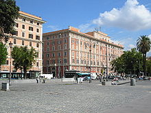
Piazza della Libertà is a square in the rione Prati in Rome (Italy).
Portuense is the 11th quartiere of Rome (Italy), identified by the initials Q.XI.
Flaminio is the 1st quartiere of the Italian capital Rome. Identified by the initials Q. I, it belongs to the Municipio II and has 13,018 inhabitants and an area of 1.1877 km2. The name is derived from the Via Flaminia.
Pinciano is the 3rd quartiere of Rome (Italy), identified by the initials Q. III. The name derives from the Pincian Hill. It belongs to the Municipio II.
Tiburtino is the 6th quartiere of Rome (Italy), identified by the initials Q. VI. The name derives from the ancient road Via Tiburtina. It belongs to the Municipio II, Municipio IV and Municipio V.
Gianicolense is the 12th quartiere of Rome (Italy), identified by the initials Q. XII. It belongs to the Municipio XI and Municipio XII. It takes its name from the Janiculum hill, which lies in the nearby rione Trastevere and whose western extremities correspond to the area of Monteverde.
Aurelio is the 13th quartiere of Rome (Italy), identified by the initials Q. XIII. It belongs to the Municipio XIII and Municipio XIV.
Trionfale is the 14th quartiere of Rome (Italy), identified by the initials Q. XIV. The toponym also indicates the urban zone 19E of Municipio XIV.
This page is based on this Wikipedia article Text is available under the CC BY-SA 4.0 license; additional terms may apply. Images, videos and audio are available under their respective licenses.