
The Pyrenees are a mountain range straddling the border of France and Spain. They extend nearly 500 km (310 mi) from their union with the Cantabrian Mountains to Cap de Creus on the Mediterranean coast, reaching a maximum altitude of 3,404 metres (11,168 ft) at the peak of Aneto.

La Seu d'Urgell is a town located in Alt Urgell county in Alt Pirineu, Catalonia, Spain. The town is also the head of its judicial district and the seat of the Bishop of Urgell, one of the co-princes of Andorra. It is located the most populated town of the region, with 17.4% of its population. La Seu d'Urgell and Puigcerdà together have 30% of the population of the area.

Pallars is a historical and natural region of Catalonia. Located in the Pre-Pyrenees and Pyrenees area, most of its territory is mountainous.

Aneto is the highest mountain in the Pyrenees and in Aragon, and Spain's third-highest mountain, reaching a height of 3,404 metres. It stands in the Spanish province of Huesca, the northernmost of the three Aragonese provinces, 6 kilometres south of the France–Spain border. It forms the southernmost part of the Maladeta massif.
The Cantabrian Mountains or Cantabrian Range are one of the main systems of mountain ranges in Spain. They stretch for over 300 km (180 miles) across northern Spain, from the western limit of the Pyrenees to the Galician Massif in Galicia, along the coast of the Cantabrian Sea. Their easternmost end meets the Sistema Ibérico.
The Montsec Range is a mountain system of the Pre-Pyrenees.

The Corbières Massif is a mountain range in the Pre-Pyrenees. It is the only true foothill of the Pyrenees on their northern side.
The Iberian System is one of the major systems of mountain ranges in Spain. It consists of a vast and complex area of mostly relatively high and rugged mountain chains and massifs located in the central region of the Iberian Peninsula, but reaching almost the Mediterranean coast in the Valencian Community in the east.

Ports de Tortosa-Beseit, also known as Ports de Beseit, or simply as Els Ports or Lo Port by locals, is a limestone mountain massif located at the north-eastern end of the Sistema Ibérico, a complex system of mountain ranges and massifs in the centre of the Iberian Peninsula. Its highest point is Mont Caro, 1,441 m. Rivers such as the Matarranya and the Cenia have their source in these mountains.

The Pyrenees are a 430-kilometre-long, roughly east–west striking, intracontinental mountain chain that divide France, Spain, and Andorra. The belt has an extended, polycyclic geological evolution dating back to the Precambrian. The chain's present configuration is due to the collision between the microcontinent Iberia and the southwestern promontory of the European Plate. The two continents were approaching each other since the onset of the Upper Cretaceous (Albian/Cenomanian) about 100 million years ago and were consequently colliding during the Paleogene (Eocene/Oligocene) 55 to 25 million years ago. After its uplift, the chain experienced intense erosion and isostatic readjustments. A cross-section through the chain shows an asymmetric flower-like structure with steeper dips on the French side. The Pyrenees are not solely the result of compressional forces, but also show an important sinistral shearing.

The Catalan Coastal Range is a system of mountain ranges running parallel to the Mediterranean Sea coast in Catalonia, Spain. It is part of the Catalan Mediterranean System. Its main axis runs between the Foix River and the Roses Gulf and the average altitude is around 500 m. The highest point is 763 m at the Montnegre.
The Catalan Pre-Coastal Range is a system of mountain ranges running parallel to the Mediterranean Sea coast in Catalonia. It is part of the Catalan Mediterranean System. Its main axis runs between the Catalan Transversal Range and the Serra de l'Espina, which connects with the Ports de Tortosa-Beseit, part of the Iberian System. The highest point is 1,706.7 m at the Montseny Massif.
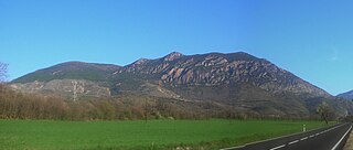
The Serra del Cadí is a mountain range in the north of Catalonia, Spain, part of the Pre-Pyrenees. Its highest peak is the Vulturó, with an altitude of 2,648 metres (8,688 ft).
The Catalan Central Depression is a natural depression between the Pre-Pyrenees and the Catalan Pre-Coastal Range in Spain. It widens towards the west, linking with the Ebro Depression, Catalan: Depressió de l'Ebre, of which it could be considered an eastern extension. The Catalan Central Depression is about 180 km long with an average width of 50 km.

El Turbón is a mountain massif of the Pre-Pyrenees, located in the province of Huesca, the most northerly province in the autonomous community of Aragon, Spain. This 6.3 km (4 mi) long mountain is aligned N - S.
The Mountains of Sis is a 28 km (17 mi) long mountain range of the Pre-Pyrenees. They are located between the valleys of rivers Isábena and the Escales Reservoir, Noguera Ribagorzana, in the Ribagorza comarca, Aragon, Spain. The ridge's highest summits are Pico de l´Amorriador (1791 m) and Puialto (1782 m). Other important summits are 1765 m high La Creu de Bonansa, 1490 m high Altaió d'Aulet and 1066 m high Tossal de Cornudella.

The Cardó Massif, also known as Cardó-Boix Massif, is a mountain massif in the Baix Ebre comarca, in Catalonia, Spain. This massif is composed of a number of mountain ranges located on the left side of the Ebro river near Tortosa. The massive calcareous cliffs of the Serra de Cardó form the eastern side of the spectacular gorges through which the Ebro River winds its way in the final stage of its course, separating the Ebro Valley from the Mediterranean coastal area.

Serra de la Valldàngel or Serra de la Vall d'Àngel,, is a mountain range in the Baix Maestrat comarca, Castellón Province, Valencian Community, Spain.
The Serra de Moixeró is a mountain range running across the north of Catalonia (Spain), part of the Pre-Pyrenees. Along with the adjacent Serra del Cadí, Pedraforca and parts of Tosa d'Alp and Puigllançada, it forms part of the Cadí-Moixeró Natural Park, established in 1983.


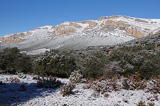
 Summits of the Corbières Massif, the only foothill of the Pyrenees on their northern side
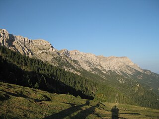
 View of Serra del Cadí
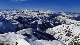
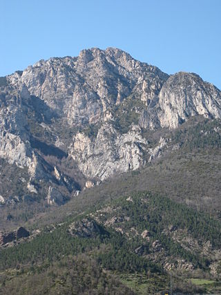
 View of Serra Ferrera
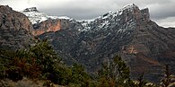 View of the Mountains of Sis
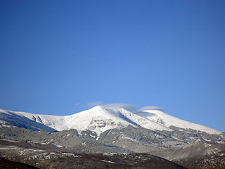
 View of Serra del Jordal


