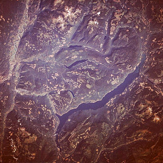
James Todd and George Bohun Martin were employees of the Hudson's Bay Company (HBC). Todd pre-empted about 3 kilometres (2mi) on the south side shore eastward from the present bridge. In 1866, Martin took over Todd's land. Adjacent, Jean Laveau briefly settled to the east,[2] at what became Laveau Creek,[3] and Edward de Champs to the west[4] at what became Neds Creek.[5]
On the north shore, opposite the Martin holding, Arthur Gore Pemberton settled. Preston Bennett and Moses Lumby, who bought south of Martin in 1867, sold this adjoining property to Martin in 1870. To serve paddle steamers, a large wharf was built in the 1860s about 183 metres (600ft) east from the present bridge. The 1885 arrival of the Canadian Pacific Railway (CP) brought a flood of new settlers.[4]
Martin Prairie
In the hills south of his farm, George Martin ranged his cattle. Later, his children Frank, George and Henry established farms in the hills. Initially called Martin's Prairie, the amended spelling emerged in due course. In 1892, Amos and Alfred Herbert established the first homestead. In 1908, the first school for the general area opened.[6][7] In 1911, the Farmers' Institute was formed[6] and fire destroyed the log school. The next year, a larger lumber building opened.[8] Robert Brett operated a sawmill 1914–1922.[9] When the school closed in 1953,[10] students were bussed to Pritchard.[11]
Pritchard name origin
About 4 kilometres (2mi) east was Watmore siding. Watmore came to describe an area along the railway line that encompassed present day Pritchard. Consequently, the school which opened in 1908 immediately east of the wharf was called Watmore.[12][13]
The railway point at Pritchard may have been first called Pemberton Spur (after Arthur G. Pemberton).[14] In September 1907, John G. Fawcett sold Walter P. Pritchard a property on the south shore.[15] Until 1912, Pritchard drove the Vernon–Kamloops stage.[16]
In the 1911 post office application, the Martin Prairie Farmers' Institute unanimously chose the name Pritchard.[12]
Pritchard earlier community
Mrs. A.R. Johnstone was the inaugural postmaster 1911–1911, followed by W.P. Pritchard 1912–1927.[17]
In 1912, John Hutchinson, built a two-storey house[12][18] immediately west of the present bridge. The store on the lower level was taken over by daughter Nellie Boyde,[19] when John, a resident for only a year, died months later.[20]
Pritchard built a three-storey hotel/boarding house[4] in 1912[21] about 152 metres (500ft) east of the present railway crossing,[19] which opened in January 1913.[22] The building comprised 14 bedrooms, a general store,[15] and relocated post office.[23]
The annual fall fairs were held 1913 to the early 1920s. In 1948, Wing Howe bought the hotel, which he immediately closed to the public but became accommodation for Chinese workers.[24]
Being subject to flooding,[12] the Watmore school site was vacated in 1936.[25] Renamed Pritchard, the new school opened that year[26] at 1563 Martin Prairie Rd, about 400 metres (437yd) up from the highway.[27]
In 1950, BC Hydro transmission lines introduced electricity to the area.[28]
In 1965, the establishment of an automatic telephone exchange at Chase introduced dial calling to the Pritchard area.[30]
In 1968, the school closed[31] and the students were bussed to Chase. Formed in 1969, the community association took control of the building as a community hall. In 1972, the abandoned hotel building was demolished and burned.[28]
Pemberton Range
On the benches north of his farm, Arthur Pemberton ranged his cattle. Soon the name changed from Hog Range to Pemberton Range. His 1,200-hectare (3,000-acre) property stretched eastward to Hoffman's Bluff.[32]
In 1909, B.C. Orchards purchased about 810 hectares (2,000 acres) of the holding on the understanding that J.H. Kilmer would in turn acquire the property. When Kilmer was unable to meet the second installment in June 1910, B.C. Orchards sold the property to Messrs. Ross and Shaw after the notice of cancellation expired. The forfeiture was overturned by the lower court, but the British Columbia Court of Appeal reversed that decision. In 1913, the Privy Council upheld the lower court decision.[33] The lack of water rights dashed the plan to subdivide the land into orchards.[32]
A school existed 1913–1965.[34] After burning down in 1929, the school was rebuilt with more windows.[35]
Also acknowledging the name are Pemberton Hill,[36] Pemberton Creek,[37] Pemberton Lake,[38] and Pemberton Gulch. An irrigation ditch from the lake brought water to the Pemberton farm.[39]
In 1966, electricity transmission extended into the area.[40]
Railway
In August 1885, the eastward advance of the CP rail head passed through the locality,[41] regular service having started as far east as Kamloops the previous month.[42]
In 1911, the 13.37 by 4.72 metres (43ft 10in ×15ft 6in) train station building was erected.[43]
In 1912, a derailed car structurally weakened the track through the community, before rerailing at the switch. On being flagged down by a passerby, the following passenger train proceeded slowly over the damaged section.[44]
In 1913, double-tracking was extended eastward to Pritchard,[45] not continuing for a number of years.[46]
In 1921, the station was moved westward closer to the railway crossing.[47]
In 1923, a passenger train fatally struck the section foreman walking the track.[48]
In the 1940s, stockyards were erected at the western end of the siding.[28]
In 1951, 21 horses died while being shipped in a sealed boxcar to Kamloops.[49]
In 1958, one man died and two were seriously injured when a train dragged their vehicle from the railway crossing to the switch.[50]
^a . In 1910, the station possibly existed at Watmore itself, rather than its later location.[65] ^b . In 1914, an unofficial flag stop called Hopgood opened[66] at the Martin Ranch one mile east of Pritchard.[67]
Ferry, bridge, and roads
In the early years, a cross river scow ferry[68] connected to the Pemberton Ranch.[69]
A subsidised ferry was established in 1912.[70][71] To prevent drifting downriver,[24] a guide cable was installed in 1913.[45]
In 1920, a 40-metre (132ft) timber swing span with 300 metres (1,000ft) of trestle approaches replaced the ferry.[72] A fixed span replaced the swing section in 1931,[73] which in turn was replaced in the 1933/34 winter by a lift span to restore navigability to the river. The present one-lane arched trestle bridge, built in 1985, is high enough to allow the passage of a sternwheeler.[68] The Wanda Sue passed by on river tours 1984–2004.[74]
The road which ran to the Martin Ranch on the north side of the train track, past the station, hotel, wharf road, and ferry road, became disused beyond the station after 1950.[75]
In 1874, the Shuswap Wagon Rd was built from Ducks (Monte Creek) to Chase. The right-of-way through the vicinity was present Stoney Flats Rd. In 1925, the route was realigned lower to Stewart Rd. In 1948–49, it was upgraded to highway status.[76] Establishing a bypass around Pritchard, the widening of the highway from two to four lanes was completed for Monte Creek–Pritchard around 2014[77] and Pritchard–Hoffman's Bluff in 2016.[78]
On the north shore west of the bridge, the first phase of the subdivision (comprising 38 lots of 930 square metres (10,000sqft)), was ratified in January 1972. Approval of the second phase (62 lots) was that November and the third phase (70 lots) was September 1976. Multi-use residential zoning allowed single family duplex or single wide mobile homes. By 1976, problems with wastewater drainage were evident.[84] Launched by Pritchard Developments,[85] the properties were later marketed as flat serviced lots, paved roads, and suitable for mobile homes.[86] By 1998, 144 homes stood on these lots.[87]
Installed in 1972, the water supply infrastructure was upgraded in 2010.[88] A further upgrade went out to tender in 2022.[89]
In 1989, the shell of the new 370-square-metre (4,000sqft) community hall was erected at 1714 Duck Range Road.[90][91] Around 1992, the interior was completed.[92] In 1993, the Pritchard voluntary fire department was established.[93]
Although rodeo schools were held for a couple of years in the mid-1970s[94] and a rodeo held in the mid-1980s,[95] the annual Pritchard Rodeo did not commence until 1994.[96] In 2016, a new grandstand replaced the old one at the Pritchard Rodeo Grounds.[97]
The wastewater treatment plant, constructed during 1997–1998 for the Pritchard Developments subdivision,[98] was upgraded in the mid-2010s.[99]
Immediately northwest of the bridge, Riverside Living is a planned 65-unit manufactured home development. During the 2010s, most of the 24 units of the first phase were erected.[100] In 2013, a district waste transfer station opened.[101]
Agriculture and horse stables primarily make up the local economy. A gas station stands adjacent to the general store/post office.[102] The Pritchard Evangelical Free Church holds Sunday services in the community hall.[103]Pritchard Provincial Park is to the east on the north shore.
One estimate puts the 2021 population as 1,500 for the general area.[104] Based on the increase in housing stock since the 1991 census, the 2021 Pritchard population should number about 1,000.
Savona ( is an unincorporated community in the Thompson Country region of south central British Columbia. The place is on the western end and south shore of Kamloops Lake, adjacent to the outlet into the Thompson River. On BC Highway 1, the locality is by road about 38 kilometres east of Cache Creek and 45 kilometres west of Kamloops. The surrounding countryside is semi-arid grasslands and hills, which support cattle ranching.
Spuzzum is an unincorporated community in the lower Fraser Canyon area of southwestern British Columbia, Canada. The place is on the west shore of the Fraser River and north shore of Spuzzum Creek. The locality, on BC Highway 1, is by road about 40 kilometres (25 mi) north of Hope and 69 kilometres (43 mi) south of Lytton.
Pinantan Lake is an unincorporated community, encircling the larger lake of the same name, in the Thompson region of south central British Columbia. The locality is by road about 20 kilometres (12 mi) northwest of Pritchard and 31 kilometres (19 mi) northeast of Kamloops.
Sicamous is a district municipality in the Shuswap Country region of south central British Columbia. The place is adjacent to the narrows, which is the confluence of Mara Lake into Shuswap Lake. At the BC Highway 97A intersection on BC Highway 1, the locality is by road about 73 kilometres (45 mi) west of Revelstoke, 140 kilometres (87 mi) east of Kamloops, and 75 kilometres (47 mi) north of Vernon.
Adams Lake is a deep, cold-water lake in south-central British Columbia, which separates the Thompson and Shuswap regions and the Thompson–Nicola and Columbia–Shuswap regional districts. The upper reaches lie in the northern Monashee Mountains, while the lower end penetrates the Shuswap Highland. The southern end is by road about 79 kilometres (49 mi) northeast of Kamloops.
Walhachin is an unincorporated community in the Thompson Country region of south central British Columbia, Canada. The place is on a south shore bench of the Thompson River between Brassey and Jimmie creeks. The locality, off BC Highway 1, is by road about 77 kilometres (48 mi) northeast of Spences Bridge, 28 kilometres (17 mi) east of Cache Creek, and 66 kilometres (41 mi) west of Kamloops.
Anderson Lake is a deep lake in the Squamish-Lillooet region of southwestern British Columbia. On the northwest side are the Bendor Range and Cadwallader Range. On the southeast is the Cayoosh Range. By road, the southern end is about 47 kilometres (29 mi) northeast of Pemberton.
Little Fort is an unincorporated community in the Thompson region of south central British Columbia. The former ferry site is immediately west of the mouth of Lemieux Creek and on the west shore of the North Thompson River. At the BC Highway 24 intersection on BC Highway 5, the locality is by road about 93 kilometres (58 mi) north of the Kamloops and 30 kilometres (19 mi) southwest of Clearwater.
Donald is an unincorporated community in the East Kootenay region of southeastern British Columbia. This almost ghost town is on the northeast shore of the Columbia River immediately southeast of the mouth of Marl Creek. The locality, on BC Highway 1, is by road about 28 kilometres (17 mi) northwest of Golden and 122 kilometres (76 mi) northeast of Revelstoke.
Alexandria or Fort Alexandria was a general area encompassing a trading post, ferry site, and steamboat landing in the North Cariboo region of central British Columbia. The present unincorporated community is on the eastern side of the Fraser River. On BC Highway 97, the locality is by road about 74 kilometres (46 mi) northwest of Williams Lake and 45 kilometres (28 mi) south of Quesnel.
Monte Creek is an unincorporated community in the Thompson region of south central British Columbia. The former ferry landing is east of the mouth of Monte Creek and on the south shore of the South Thompson River. Immediately west of the BC Highway 97 intersection on BC Highway 1, the locality is by road about 30 kilometres (19 mi) west of Chase and 28 kilometres (17 mi) east of Kamloops.
Albert Canyon is a railway point in the West Kootenay region of southeastern British Columbia. The community was immediately east of the mouth of Albert Creek on the south shore of the Illecillewaet River. That settlement no longer exists, but the Canyon Hot Springs Resort borders to its north. On BC Highway 1, the locality is by road about 33 kilometres (21 mi) northeast of Revelstoke and 30 kilometres (19 mi) southwest of Glacier.
Deroche is an unincorporated community at the foot of Nicomen Mountain in the Fraser Valley region of southwestern British Columbia. Encompassing the northeastern part of Nicomen Island, the infrastructure is centred on the northern shore of Nicomen Slough. The locality, on BC Highway 7, is by road about 29 kilometres (18 mi) west of Agassiz, 89 kilometres (55 mi) east of Vancouver, and 21 kilometres (13 mi) east of Mission.
Mara Lake is a lake in the Shuswap Country region of south central British Columbia, Canada. To the west is Hyde Mountain and east is Morton Peak. The outlet of the Shuswap River forms the upper reaches. The lower end enters the narrows at Sicamous and flows into Shuswap Lake. The northern end of Mara Lake is by road about 73 kilometres (45 mi) west of Revelstoke, 140 kilometres (87 mi) east of Kamloops, and 75 kilometres (47 mi) north of Vernon.
Three Valley Gap is an unincorporated community at the eastern end of Three Valley Lake in the Shuswap Country region of southeastern British Columbia. On BC Highway 1, the locality is by road about 21 kilometres (13 mi) southwest of Revelstoke, and 51 kilometres (32 mi) northeast of Sicamous.
Grindrod is an unincorporated community in south central British Columbia, Canada. Concentrated on the western shore of the Shuswap River, the place borders the Shuswap and Okanagan regions. On BC Highway 97A, the locality is by road about 46 kilometres (29 mi) southwest of Sicamous, 19 kilometres (12 mi) southeast of Salmon Arm, and 51 kilometres (32 mi) north of Vernon.
Keefers is a railway point in the lower Fraser Canyon area of southwestern British Columbia. The ghost town is on the west shore of the Fraser River and north of the mouth of the Nahatlatch River. The locality is by rail about 82 kilometres (50.8 mi) north of Hope and 26 kilometres (15.9 mi) south of Lytton.
Avola is an unincorporated community in the Thompson region of eastern British Columbia. The former ferry site is on the west shore of the North Thompson River immediately north of the mouth of Avola Creek. Off BC Highway 5, the locality is by road about 190 kilometres (118 mi) northeast of the Kamloops and 40 kilometres (25 mi) south of Blue River.
Beavermouth is about 43 kilometres (27 mi) west of Golden, and about 32 kilometres (20 mi) east of the mid-point of the Connaught Tunnel beneath Rogers Pass, in southeastern British Columbia. At the mouth of the Beaver River, the train station was called Beavermouth, but the adjacent community, which no longer exists, was known as Beaver or Beaver Mouth. Nowadays, the closest road access is to the nearby Kinbasket Lake Resort.
Birch Island is an unincorporated community in the Thompson region of south central British Columbia. The former ferry site is by the mouth of Foghorn Creek and straddles the North Thompson River. On BC Highway 5, the locality is by road about 137 kilometres (85 mi) north of the Kamloops and 99 kilometres (62 mi) southwest of Blue River.
References
Stewart, Wendy (1996). Pursuit of Memories. Pritchard Historical Society. ISBN0-9680910-0-8.
This page is based on this Wikipedia article Text is available under the CC BY-SA 4.0 license; additional terms may apply. Images, videos and audio are available under their respective licenses.