Providence often refers to:

Joseph "Quaker Meadows" McDowell Jr. was an American planter, soldier, and statesman from North Carolina. He was known as "Quaker Meadows Joe" to distinguish him from his cousin Joseph "Pleasant Gardens" McDowell, who was also a legislator and American Revolutionary War officer from North Carolina. The two men are not always clearly distinguished in historical records; both were in the 1780 Battle of Kings Mountain, one as a major in the Burke County Regiment of the North Carolina militia, and the other in a subordinate role as a captain.
Joseph "Pleasant Gardens" McDowell was an American lawyer, soldier, and statesman from Morganton, North Carolina.
Robert C. (Bob) Hunter is an American jurist, who served as a Judge of the North Carolina Court of Appeals from 1998 through 2014.

West Virginia Route 16 is a north–south route located in the U.S. State of West Virginia. The southern terminus of the route is at the Virginia state line in Bishop, McDowell County, where the route continues south as Virginia State Route 16. The northern terminus is at West Virginia Route 2 in St. Marys, Pleasants County, on the south bank of the Ohio River. WV 16 continues into Virginia and North Carolina, ultimately ending in Waxhaw, south of Charlotte and just north of the South Carolina border. The total length of highway is just under 475 miles long.

The Overmountain Men were American frontiersmen from west of the Appalachian Mountains who took part in the American Revolutionary War. While they were present at multiple engagements in the war's southern campaign, they are best known for their role in the American victory at the Battle of Kings Mountain in 1780. The term "overmountain" arose because their settlements were west of, or "over", the Appalachians, which was the primary geographical boundary dividing the 13 American colonies from the western frontier. The Overmountain Men hailed from parts of Virginia, North Carolina, and what is now Tennessee and Kentucky.

The Smith-McDowell House is located in Asheville, North Carolina. It is the city's first mansion and oldest surviving house, and the oldest brick structure in Buncombe County.
Joseph Jefferson McDowell was a U.S. Representative from Ohio, son of Joseph McDowell.
The McDowell News is a daily newspaper based in Marion, North Carolina covering McDowell County. The newspaper is owned by Berkshire Hathaway.

The Carson House is a historic house and museum located in Marion, North Carolina that was the home of Col. John Carson, and served as the McDowell County courthouse at the county's inception.
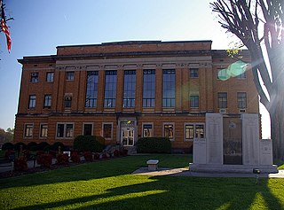
McDowell County Courthouse may refer to:

The 1976 United States presidential election in North Carolina took place on November 2, 1976, and was part of the 1976 United States presidential election. Voters chose 13 representatives, or electors to the Electoral College, who voted for president and vice president.
Providence may refer to the following places in North Carolina:

This list includes properties and districts listed on the National Register of Historic Places in McDowell County, North Carolina. Click the "Map of all coordinates" link to the right to view a Google map of all properties and districts with latitude and longitude coordinates in the table below.

Humpback Mountain is a mountain in the North Carolina High Country and the Pisgah National Forest, located southwest of Linville Falls. The mountain is accessible along the Blue Ridge Parkway, which ride along its eastern slope. The peak reaches an elevation of 4,245 feet (1,294 m), in Avery County; while the overall mountain is also in McDowell County. Two ridges, Mill Ridge and Dividing Ridge, form from the western side of the mountain.
The 2nd Rowan County Regiment was first established in October 22, 1775 as a local militia in Rowan County in the Province of North-Carolina. This regiment was created from the existing Rowan County Regiment of militia. Its original officers were Col Adlai Osborne, Lt Col Christopher Beekman, and Major Charles McDowell. Adlai Osborne was a leader in Rowan County and member of the Rowan County Committee of Safety. On May 9, 1777, the regiment was renamed the Burke County Regiment, which was active until the end of the Revolutionary War in 1783.
Charles McDowell (1743–1815) was a Brigadier General of the Morgan District Brigade of the North Carolina Militia during the American Revolution, state senator, and County Justice of Peace in Burke County, North Carolina.