Providence, Ohio

Last updated
Providence, Ohio
Ghost town

Providence Historical Site PB020155 Maumee & Erie Canal.jpg

OHMap-doton-Providence.png
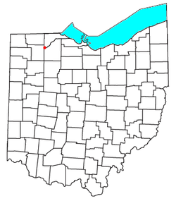
Location of Providence, Ohio
Coordinates: 41°25′05″N83°52′20″W / 41.41806°N 83.87222°W / 41.41806; -83.87222 Coordinates: 41°25′05″N83°52′20″W / 41.41806°N 83.87222°W / 41.41806; -83.87222
Country United States
State Ohio
County Lucas
Township Providence
Time zone Eastern (EST) (UTC-5)
  Summer (DST) EDT (UTC-4)

Providence is a ghost town on the north side of the Maumee River in southern Providence Township, Lucas County, Ohio, United States, about 24 miles (39 km) southwest of Toledo. After suffering a destructive fire and a cholera epidemic in mid-19th century, the village was abandoned. In this period, canal traffic had also fallen off.

Ghost town City depopulated of inhabitants and that stays practically intact

A ghost town is an abandoned village, town, or city, usually one that contains substantial visible remains. A town often becomes a ghost town because the economic activity that supported it has failed, or due to natural or human-caused disasters such as floods, prolonged droughts, government actions, uncontrolled lawlessness, war, pollution, or nuclear disasters. The term can sometimes refer to cities, towns, and neighbourhoods that are still populated, but significantly less so than in past years; for example, those affected by high levels of unemployment and dereliction.

Maumee River river in the United States of America

The Maumee River is a river running from northeastern Indiana into northwestern Ohio and Lake Erie in the United States. It is formed at the confluence of the St. Joseph and St. Marys rivers, where Fort Wayne, Indiana, has developed, and meanders northeastwardly for 137 miles (220 km) through an agricultural region of glacial moraines before flowing into the Maumee Bay of Lake Erie. The city of Toledo is located at the mouth of the Maumee. The Maumee was designated an Ohio State Scenic River on July 18, 1974. The Maumee watershed is Ohio’s breadbasket; it is two-thirds farmland, mostly corn and soybeans. It is the largest watershed of any of the rivers feeding the Great Lakes, and supplies five percent of Lake Erie’s water.

Providence Township, Lucas County, Ohio Township in Ohio, United States

Providence Township is one of the eleven townships of Lucas County, Ohio, United States. The 2010 census found 3,361 people in the township.

Contents

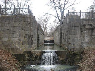
The area is now maintained as Providence Metropark of Toledo, featuring numerous elements of the canal era, including a mule-drawn canal boat on a restored section of the Miami and Erie Canal, and an operating saw and gristmill.
Miami and Erie Canal canal

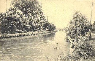
The Miami and Erie Canal was a 274-mile (441 km) canal that ran from Cincinnati to Toledo, Ohio, creating a water route between the Ohio River and Lake Erie. Construction on the canal began in 1825 and was completed in 1845 at a cost to the state government of $8,062,680.07. At its peak, it included 19 aqueducts, three guard locks, 103 canal locks, multiple feeder canals, and a few man-made water reservoirs. The canal climbed 395 feet (120 m) above Lake Erie and 513 feet (156 m) above the Ohio River to reach a topographical peak called the Loramie Summit, which extended 19 miles (31 km) between New Bremen, Ohio to lock 1-S in Lockington, north of Piqua, Ohio. Boats up to 80 feet long were towed along the canal by mules, horses, or oxen walking on a prepared towpath along the bank, at a rate of four to five miles per hour.

History

The village of Providence was founded by a French Canadian, Peter Manor, who was the first white man to settle upriver on the Maumee River away from Lake Erie. [1] He arrived there in 1816 in order to establish a fur trading post for the North West Fur Company, then based in Montreal, Canada. But the United States prohibited Canadian traders from operating below the border and he was closed down.

Peter Manor (1778–1847) was best known as the founder of the town of Providence, Ohio. Of French-Canadian descent, Manor was a fur trader in northwest Ohio starting in the late 18th century. Native Americans in the area, primarily Odawa, considered him a friend, which helped his business. He continued to trade with Native Americans and opened up a trading post that operated until approximately the early 19th century.

In 1822, Manor had a sawmill erected next to the river, and a gristmill was built in 1835. This was about 24 miles from the river's mouth on Maumee Bay, where there was still an Odawa people village, part of a 34-square mile reserve on the south side of the river.

Sawmill facility where logs are cut into timber

A sawmill or lumber mill is a facility where logs are cut into lumber. Modern saw mills use a motorized saw to cut logs lengthwise to make long pieces, and crosswise to length depending on standard or custom sizes. The "portable" saw mill is iconic and of simple operation—the logs lay flat on a steel bed and the motorized saw cuts the log horizontally along the length of the bed, by the operator manually pushing the saw. The most basic kind of saw mill consists of a chainsaw and a customized jig, with similar horizontal operation.

Gristmill mill; grinds grain into flour

A gristmill grinds cereal grain into flour and middlings. The term can refer to both the grinding mechanism and the building that holds it.

As the number of settlers increased in Ohio, promoters of the state discussed a proposal for a Miami and Erie Canal to improve transportation to the southwest parts of the state and connect them to markets on and served by Lake Erie. Manor platted the town to prepare for anticipated development. In 1837, the State of Ohio granted Manor a contract to begin construction, and the town was soon open for business. By 1843, some of the eighty-eight lots laid out were vacated. The village was, in general, considered a favorable place to live by the westward settlers. It was often seen as a haven from the problems of lawlessness, drinking, fighting, and crime that began to plague Ohio canal towns. [2]

Lake Erie one of the Great Lakes in North America

Lake Erie is the fourth-largest lake of the five Great Lakes in North America, and the eleventh-largest globally if measured in terms of surface area. It is the southernmost, shallowest, and smallest by volume of the Great Lakes and therefore also has the shortest average water residence time. At its deepest point Lake Erie is 210 feet deep.

Plat scale map showing the divisions of a piece of land

In the United States, a plat is a map, drawn to scale, showing the divisions of a piece of land. United States General Land Office surveyors drafted township plats of Public Lands Surveys to show the distance and bearing between section corners, sometimes including topographic or vegetation information. City, town or village plats show subdivisions into blocks with streets and alleys. Further refinement often splits blocks into individual lots, usually for the purpose of selling the described lots; this has become known as subdivision.

Ohio State of the United States of America

Ohio is a Midwestern state in the Great Lakes region of the United States. Of the fifty states, it is the 34th largest by area, the seventh most populous, and the tenth most densely populated. The state's capital and largest city is Columbus.

A catastrophic fire swept through the village in 1846, destroying most of the many wooden buildings in the central business district. The destroyed buildings were not rebuilt and the town never recovered. [3] In 1854 river travelers brought a cholera epidemic, also spread by contaminated water. Those who survived rapidly left Providence, so fast that most of their possessions were left behind.

Cholera Bacterial infection of the small intestine

Cholera is an infection of the small intestine by some strains of the bacterium Vibrio cholerae. Symptoms may range from none, to mild, to severe. The classic symptom is large amounts of watery diarrhea that lasts a few days. Vomiting and muscle cramps may also occur. Diarrhea can be so severe that it leads within hours to severe dehydration and electrolyte imbalance. This may result in sunken eyes, cold skin, decreased skin elasticity, and wrinkling of the hands and feet. Dehydration can cause the skin to turn bluish. Symptoms start two hours to five days after exposure.

The remaining structures were eventually destroyed or moved, and the land plats disappeared. On October 28, 1928, Lucas County officially removed Providence from its records. The remaining buildings, the church and the saw and gristmill, have been designated as an historic district by the Department of the Interior.

Miami and Erie Canal

The Miami and Erie Canal was vital to the growth and development of Providence. The canal not only brought goods to the village; it brought passengers, both immigrants and frontiersmen. At a time of few improved roads, water travel had a great advantage over traditional horse and carriage. Because of the large influx of travelers, Providence grew daily.

Once the canal began operating, the local economy boomed. Commodity amounts of produce, pelts, grain, and other goods constantly flowed through the village. When the railroads were completed in the 1870s, canal traffic greatly diminished. The canal was abandoned by the 1900s. The slow pace and low capacity of canal boats was no match for what could be offered by the railroads.

The site of the village is now preserved in part as Providence Metropark, one of the Toledo Metroparks system. It includes the fully operational Isaac Ludwig mill. Near the gristmill is Lock No. 44 of the canal system; it has been restored. In addition, during the temperate season, the park runs a mule-drawn replica canal boat, The Volunteer, which carries visitors along the small section of restored canal and goes through Lock No. 44.

Remaining structures

Many buildings and structures remain standing in the Providence area. Some have been restored. They include the following:

Related Research Articles

Toledo, Ohio City in Ohio, United States

Toledo is a city in and the county seat of Lucas County, Ohio, United States. Toledo is in northwest Ohio, at the western end of Lake Erie bordering the state of Michigan. The city was founded in 1833 on the west bank of the Maumee River, and originally incorporated as part of Monroe County, Michigan Territory. It was re-founded in 1837, after conclusion of the Toledo War, when it was incorporated in Ohio.

The Toledo War (1835–36), also known as the Michigan–Ohio War, was an almost bloodless boundary dispute between the U.S. state of Ohio and the adjoining territory of Michigan.

Maumee, Ohio City in Ohio, United States

Maumee is a city in Lucas County, Ohio, United States. Located along the Maumee River, it is about 10 miles southwest of Toledo. The population was 14,286 at the 2010 census. Maumee was declared an All-America City by the National Civic League in June 2006.

Waterville, Ohio City in Ohio, United States

Waterville is a city in Lucas County, Ohio, United States, along the Maumee River, a suburb of Toledo. The population was 5,523 at the 2010 census.

The Buckeye Trail is a 1,444-mile (2,324 km) hiking trail and long-distance trail that loops around the state of Ohio. Part of it is on roads and part is on wooded trail. Road portions of the trail are gradually being relocated to separate trail.

Battle of Fallen Timbers Battle fought in 1794

The Battle of Fallen Timbers was the final battle of the Northwest Indian War, a struggle between Native American tribes affiliated with the Western Confederacy and a British company, against the United States for control of the Northwest Territory. The battle took place amid trees toppled by a tornado just north of the Maumee River in northwestern Ohio at the site of the present-day city of Maumee. Gen. "Mad" Anthony Wayne's Legion of the United States along with Gen. Charles Scott's Kentucky Militia were victorious against a combined Native American force of Shawnee under Blue Jacket, Miami under Little Turtle, and numerous others. The battle ended major hostilities in the region. This resulted in British and Indian withdrawal from the southern Great Lakes, western Ohio and northeastern Indiana following the Treaty of Greenville and Jay's Treaty.

Wabash and Erie Canal

The Wabash and Erie Canal was a shipping canal that linked the Great Lakes to the Ohio River via an artificial waterway. The canal provided traders with access from the Great Lakes all the way to the Gulf of Mexico. Over 460 miles long, it was the longest canal ever built in North America.

Ohio Lands

The Ohio Lands were the several grants, tracts, districts and cessions which make up what is now the U.S. state of Ohio. The Ohio Country was one of the first settled parts of the Midwest, and indeed one of the first settled parts of the United States beyond the original 13 colonies. The land that became first the anchor of the Northwest Territory and later Ohio was cobbled together from a variety of sources and owners.

Miami is the autonym for the Miami Indians once of Ohio, Indiana, and Michigan.

Ohio and Erie Canal place in Ohio listed on National Register of Historic Places

The Ohio and Erie Canal was a canal constructed during the 1820s and early 1830s in Ohio. It connected Akron with the Cuyahoga River near its outlet on Lake Erie in Cleveland, and a few years later, with the Ohio River near Portsmouth. It also had connections to other canal systems in Pennsylvania.

Warren County Canal

The Warren County Canal was a branch of the Miami and Erie Canal in southwestern Ohio about 20 miles (32 km) in length that connected the Warren County seat of Lebanon to the main canal at Middletown in the mid-19th century. Lebanon was at the crossroads of two major roads, the highway from Cincinnati to Columbus and the road from Chillicothe to the College Township (Oxford), but Lebanon businessmen and civic leaders wanted better transportation facilities and successfully lobbied for their own canal, part of the canal fever of the first third of the 19th century. The Warren County Canal was never successful, operating less than a decade before the state abandoned it.

Fort Miami (Ohio)

Fort Miami (Miamis) was a British fort built in spring 1794 on the Maumee River in what was at the time territory of the United States, and designated by the federal government as the Northwest Territory. The fort was located at the eastern edge of present-day Maumee, Ohio, southwest of Toledo. The British built the fort to forestall a putative assault on Fort Detroit by Gen. "Mad" Anthony Wayne's army, then advancing northward in southwestern Ohio

Providence Metropark is a regional park located near Grand Rapids, Ohio that is part of the Toledo Metroparks. The park contains mule-drawn canal boat rides on the Miami and Erie Canal and features canal lock 44, the only original functioning lock in the state of Ohio.

Side Cut Metropark

Side Cut Metropark is a regional park located in Maumee, Ohio that is part of the Toledo Metroparks. It features Bluegrass Island, a popular fishing destination. Obtained from the state of Ohio in the 1920s, Side Cut was the original metropark. Its name is derived from the site being a sidecut on the Miami and Erie Canal.

Independence Dam State Park

Independence Dam State Park is a 591-acre (239 ha) in Defiance County, Ohio in the United States. This Ohio state park lies on the banks of the Maumee River and features ruins of the Miami and Erie Canal. The park was established in 1949 and is open for year-round recreation including, boating, fishing, hiking and picnicking. It is off U.S. Route 24 just east of Defiance, Ohio.

References

  1. "History of Lucas County", Heritage Pursuit
  2. Rettig, 18
  3. Cottier, Donna (May 16, 1982). "Township past matter of record". Toledo Blade. pp. C5. Retrieved 3 November 2015.
  4. Huffman, June (1982). The Providence Record 1981. Defiance, Ohio: The Hubbard Company. pp. 57, 59.

Further reading