Sylvania Township, Lucas County, Ohio

Last updated
Sylvania Township, Lucas County, Ohio
White Eagle development.jpg
Housing development west of the city of Sylvania
Sylvania Lucas.PNG
Location of Sylvania Township within Lucas County, Ohio.
Coordinates: 41°41′54″N83°41′55″W / 41.69833°N 83.69861°W / 41.69833; -83.69861
Country United States
State Ohio
County Lucas
Area
  Total28.5 sq mi (73.7 km2)
  Land28.4 sq mi (73.5 km2)
  Water0.08 sq mi (0.2 km2)
Elevation
[1]
669 ft (204 m)
Population
 (2020) [2]
  Total50,679
  Density1,786/sq mi (689.5/km2)
Time zone UTC-5 (Eastern (EST))
  Summer (DST) UTC-4 (EDT)
ZIP code
43560, 43617, 43623
Area code(s) 419, 567
FIPS code 39-76025 [3]
GNIS feature ID1086536 [1]
Website www.sylvaniatownship.com

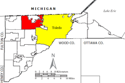
Sylvania Township is one of the eleven townships of Lucas County, Ohio, United States. As of 2020, the total population was 50,679, [4] making it the second most populous municipality of Lucas County, Northwest Ohio, and the 419 / 567 area codes (behind only Toledo).

Contents

The township entirely encompasses the city of Sylvania. Excluding the city of Sylvania, the remainder of the township had a population of 31,668 in 2020. The township government is under direction of a 3-member Board of Trustees (elected to staggered 4-year terms), an elected Clerk and a full-time Administrator.

Geography

Located in the northern part of the county, it borders the following townships and municipalities:

The city of Sylvania lies in northern Sylvania Township.

The Ottawa River and Ten Mile Creek both flow through the township.

Name and history

The township was named for its former woodlands, [5] Sylvania being a name derived from Latin meaning "forest land". It is the only Sylvania Township statewide. [6]

Government

Sylvania township is a limited home rule township governed by a three-member board of trustees, who are elected in November of odd-numbered years to a four-year term beginning on the following January 1. ORC Chapter 504. Two are elected in the year after the presidential election and one is elected in the year before it. There is also an elected township fiscal officer, [7] who serves a four-year term beginning on April 1 of the year after the election, which is held in November of the year before the presidential election. Vacancies in the fiscal officership or on the board of trustees are filled by the remaining trustees.

As of June 2022, the Township Trustees are Neal Mahoney, John Crandall and John Jennewine. Dave Simko is the fiscal officer. [8]

Transportation

The following highways are important transportation arteries in Sylvania Township:

  • (eastbound) - Acres Road (Alexis Road to Monroe Street), ends at Monroe Street
  • (westbound) - Alexis Road (Acres Road to Monroe Street), ends at Monroe Street

Related Research Articles

<span class="mw-page-title-main">Lucas County, Ohio</span> County in Ohio, United States

Lucas County is a county located in the northwestern part of the U.S. state of Ohio. It is bordered to the east by Lake Erie, and to the southeast by the Maumee River, which runs to the lake. As of the 2020 census, the population was 431,279. Its county seat and largest city is Toledo, located at the mouth of the Maumee River on the lake. The county was named for Robert Lucas, 12th governor of Ohio, in 1835 during his second term. Its establishment provoked the Toledo War conflict with the Michigan Territory, which claimed some of its area. Lucas County is the central county of the Toledo Metropolitan Statistical Area.

<span class="mw-page-title-main">Whiteford Township, Michigan</span> Civil township in Michigan, United States

Whiteford Township is a civil township of Monroe County in the U.S. state of Michigan. The population was 4,602 at the 2010 census.

<span class="mw-page-title-main">Sylvania, Ohio</span> City in Ohio, United States

Sylvania is a city in Lucas County, Ohio, United States. The population was 19,011 at the 2020 census. Sylvania is a suburb of Toledo, and encompassed by Sylvania Township. Its northern border is the southern border of the state of Michigan.

<span class="mw-page-title-main">Ohio State Route 120</span> State highway in northwestern Ohio, US

State Route 120 is an east–west state highway in the northwestern portion of the U.S. state of Ohio. Its western terminus is at the Michigan state line, where an unnumbered county highway continues west-northwest. State Route 120’s eastern terminus is in Toledo at State Route 65; the route is, for all practical purposes, a spur of U.S. Route 20, which generally bypasses Toledo to the west and south.

<span class="mw-page-title-main">Interstate 475 (Ohio)</span>

Interstate 475 (I-475) is an auxiliary Interstate Highway in Ohio that is a 20.37-mile (32.78 km) western bypass of Toledo. The southern terminus is I-75 exit 192 near Perrysburg. From the southern terminus to exit 14, I-475 is cosigned with US Route 23 (US 23) and is signed the north–south section of I-475. From exit 14 to the eastern (northernmost) terminus at I-75 exit 204 in central Toledo, it is signed the east–west section of I-475.

<span class="mw-page-title-main">Springfield Township, Lucas County, Ohio</span> Township in Ohio, United States

Springfield Township is one of the eleven townships of Lucas County, Ohio, United States. As of the 2020 census, the total population was 26,957, making it the third most populous part of Lucas County, behind Toledo and Sylvania Township.

<span class="mw-page-title-main">Northwest Ohio</span>

Northwest Ohio, or Northwestern Ohio, consists of multiple counties in the northwestern corner of the US state of Ohio. This area borders Lake Erie, Southeast Michigan, and northeastern Indiana. Some areas are also considered the Black Swamp area. The Toledo metropolitan area is part of the region.

<span class="mw-page-title-main">Amboy Township, Fulton County, Ohio</span> Township in Ohio, United States

Amboy Township is one of the twelve townships of Fulton County, Ohio, United States. As of the 2020 census the population was 1,878, up from 1,846 at the 2010 census. 1,219 of the residents lived in the unincorporated portions of the township in 2010.

<span class="mw-page-title-main">Damascus Township, Henry County, Ohio</span> Township in Ohio, United States

Damascus Township is one of the thirteen townships of Henry County, Ohio, United States. As of the 2020 census the population was 1,783.

<span class="mw-page-title-main">Richfield Township, Henry County, Ohio</span> Township in Ohio, United States

Richfield Township is one of the thirteen townships of Henry County, Ohio, United States. As of the 2020 census the population was 635.

<span class="mw-page-title-main">Monclova Township, Lucas County, Ohio</span> Township in Ohio, United States

Monclova Township is one of the eleven townships of Lucas County, Ohio, United States. The 2020 census found 14,827 people in the township.

<span class="mw-page-title-main">Richfield Township, Lucas County, Ohio</span> Township in Ohio, United States

Richfield Township is one of the eleven townships of Lucas County, Ohio, United States. The 2020 census found 1,575 people in the township.

<span class="mw-page-title-main">Spencer Township, Lucas County, Ohio</span> Township in Ohio, United States

Spencer Township is one of the eleven townships of Lucas County, Ohio, United States. The 2020 census found 1,746 people in the township.

<span class="mw-page-title-main">Washington Township, Lucas County, Ohio</span> Township in Ohio, United States

Washington Township is one of the eleven townships of Lucas County, Ohio, United States. The 2020 census found 3,055 people in the township.

<span class="mw-page-title-main">Toledo metropolitan area</span> Toledo Metropolitan Area in Ohio, United States

The Toledo Metropolitan Area, or Greater Toledo, or Northwest Ohio is a metropolitan area centered on the American city of Toledo, Ohio. As of the 2020 census, the four-county Metropolitan Statistical Area (MSA) had a population of 646,604. It is the sixth-largest metropolitan area in the state of Ohio, behind Cincinnati–Northern Kentucky, Cleveland, Columbus, Dayton, and Akron.

<span class="mw-page-title-main">Ohio State Route 183</span> State highway in eastern Ohio, US

State Route 183 is a north/south state Highway in eastern Ohio. Its southern terminus is SR 800 in Sandy Township, approximately 0.5 miles (0.80 km) east of Sandyville and less than two miles (3.2 km) south of East Sparta. Its northern terminus is SR 14 in Edinburg Township near Interstate 76, about 10 miles (16 km) southeast of Ravenna. The current route was commissioned in 1962.

<span class="mw-page-title-main">Coventry Township, Summit County, Ohio</span> Township in Summit County, Ohio

Coventry Township is one of the nine townships of Summit County, Ohio, United States. The 2000 census found 10,900 people in the township.

<span class="mw-page-title-main">Ottawa Lake, Michigan</span> Unincorporated community in Michigan, United States

Ottawa Lake is an unincorporated community in Monroe County in the U.S. state of Michigan. The community is located within Whiteford Township. As an unincorporated community, Ottawa Lake has no legally defined boundaries or population statistics of its own but does have its own post office with the 49267 ZIP Code.

<span class="mw-page-title-main">U.S. Route 24 in Ohio</span> Section of U.S. Highway in Ohio, United States

U.S. Route 24 (US 24) is a United States Numbered Highway that runs from Minturn, Colorado, to Independence Township, Michigan. In Ohio, it is an expressway and freeway for much of its length, from the Indiana state line to Maumee. From there northeast to the Michigan state line at Toledo, it is a surface highway.

<span class="mw-page-title-main">U.S. Route 23 in Ohio</span> Section of U.S. Highway in Ohio, United States

U.S. Route 23 (US 23) is a United States Numbered Highway that runs from Jacksonville, Florida, to Mackinaw City, Michigan. In the state of Ohio, it is a major north–south state highway that runs from the Kentucky border at Portsmouth to the Michigan border at Sylvania.

References

  1. 1 2 "US Board on Geographic Names". United States Geological Survey. 2007-10-25. Retrieved 2008-01-31.
  2. "Sylvania township, Lucas County, Ohio - Census Bureau Profile". United States Census Bureau. Retrieved 18 July 2023.
  3. "U.S. Census website". United States Census Bureau . Retrieved 2008-01-31.
  4. "Explore Census Data".
  5. Scribner, Harvey (1910). Memoirs of Lucas County and the City of Toledo: From the Earliest Historical Times Down to the Present, Including a Genealogical and Biographical Record of Representative Families. Western Historical Association. p.  181.
  6. "Detailed map of Ohio" (PDF). United States Census Bureau. 2000. Retrieved 2007-02-16.
  7. §503.24, §505.01, and §507.01 of the Ohio Revised Code. Accessed 4/30/2009.
  8. "Elected Officials: Sylvania Township, Sylvania Ohio". Sylvania Township. 23 January 2017. Retrieved 2020-02-11.