Neapolis, Ohio

Last updated
Neapolis, Ohio
Lucas County Ohio incorporated and unincorporated areas Neapolis highlighted.svg
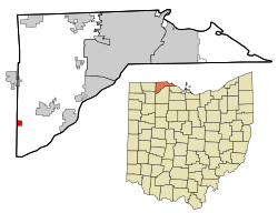
Location in Lucas County and the state of Ohio.
Coordinates: 41°29′26″N83°52′36″W / 41.49056°N 83.87667°W / 41.49056; -83.87667
Country United States
State Ohio
County Lucas
Township Providence
Area
[1]
  Total0.71 sq mi (1.84 km2)
  Land0.71 sq mi (1.84 km2)
  Water0.00 sq mi (0.00 km2)
Elevation
[2]
673 ft (205 m)
Population
 (2020)
  Total497
  Density700.00/sq mi (270.39/km2)
Time zone UTC-5 (Eastern (EST))
  Summer (DST) UTC-4 (EDT)
ZIP codes
43547
FIPS code 39-53718
GNIS feature ID2628936 [2]

Neapolis is a census-designated place (CDP) in northwestern Providence Township, Lucas County, Ohio, United States. [2] As of the 2020 census it had a population of 497. It has a post office, with the ZIP code of 43547. [3]

Contents

History

Neapolis was laid out in 1872. [4] The community was named after Neapolis, in Ancient Greece. [5] A post office called Neapolis has been in operation since 1873. [6]

Demographics

Historical population
CensusPop.Note
2020 497
U.S. Decennial Census [7]

Related Research Articles

<span class="mw-page-title-main">Bascom, Ohio</span> Census-designated place in Ohio, United States

Bascom is a census-designated place in western Hopewell Township, Seneca County, Ohio. It has a post office with the ZIP code 44809 and hosts Hopewell-Loudon High School. The community is located at the intersection of State Routes 18 and 635 east of Fostoria. The population was 397 at the 2020 census.

<span class="mw-page-title-main">Old Fort, Ohio</span> Census-designated place in Ohio, United States

Old Fort is a census-designated place located in northern Pleasant Township, Seneca County, Ohio, United States; located about a mile east of Ohio State Route 53 where N. Township Rd. 73 intersects with E. County Rd. 51. The ZIP code is 44861. The population was 143 at the 2020 census.

Jacksontown is a census-designated place (CDP) in central Licking Township, Licking County, Ohio, United States. It has a post office with the ZIP code 43030. It lies at the intersection of U.S. Route 40 with State Route 13.

<span class="mw-page-title-main">McCutchenville, Ohio</span> Census-designated place in Ohio, United States

McCutchenville is a census-designated place (CDP) in northern Tymochtee Township, Wyandot County, Ohio, United States. It has a post office with the ZIP code 44844. It lies at the intersection of State Routes 53 and 587. The population was 371 at the 2020 census.

<span class="mw-page-title-main">Tippecanoe, Ohio</span> Census-designated place in Ohio, United States

Tippecanoe is an unincorporated community and census-designated place (CDP) in central Washington Township, Harrison County, Ohio, United States. It is located along State Route 800 in the valley of Stillwater Creek, a north-flowing tributary of the Tuscarawas River. It had a post office until 2011 with the ZIP code 44699. The population was 83 at the 2020 census.

<span class="mw-page-title-main">Dola, Ohio</span> Census-designated place in Ohio, United States

Dola is a census-designated place in central Washington Township, Hardin County, Ohio, United States. As of the 2020 United States Census it had a population of 143. It has a post office with the ZIP code 45835.

<span class="mw-page-title-main">Rudolph, Ohio</span> Census-designated place in Ohio, United States

Rudolph is an unincorporated community and census-designated place (CDP) in eastern Liberty Township, Wood County, Ohio, United States. As of the 2020 census, it had a population of 415. It has a post office with the ZIP code 43462.

Buffalo is an unincorporated community and census-designated place in eastern Valley Township, Guernsey County, Ohio, United States. As of the 2020 census it had a population of 373. It has a post office with the ZIP code 43722. It lies along State Route 313.

<span class="mw-page-title-main">Radnor, Ohio</span> Census-designated place in Ohio, United States

Radnor is an unincorporated community and census-designated place (CDP) in central Radnor Township, Delaware County, Ohio, United States. As of the 2020 census it had a population of 180. Radnor has a post office with the ZIP code of 43066. It lies along State Route 203 at its intersection with Radnor Road.

<span class="mw-page-title-main">Lansing, Ohio</span> Unincorporated community and census-designated place in Ohio, United States

Lansing is a census-designated place in northern Pease Township, Belmont County, Ohio, United States, along Wheeling Creek. As of the 2020 census it had a population of 596. It has a post office with the ZIP code 43934.

<span class="mw-page-title-main">Bentonville, Ohio</span> Unincorporated community and Census-designated place in Ohio, United States

Bentonville is a census-designated place in northern Sprigg Township, Adams County, Ohio, United States. The population was 253 at the 2020 census. It has a post office with the ZIP code 45105.

<span class="mw-page-title-main">Monclova, Ohio</span> Unincorporated community in Ohio, United States

Monclova is an unincorporated community in central Monclova Township, Lucas County, Ohio, United States. It has a post office with the ZIP code 43542.

<span class="mw-page-title-main">East Rochester, Ohio</span> Census-designated place in Ohio, United States

East Rochester is an unincorporated community and census-designated place (CDP) in southern West Township, Columbiana County, Ohio, United States. The population was 224 as of the 2020 census. It lies along U.S. Route 30, and has a post office with the ZIP code 44625. It is a part of the Salem micropolitan area, about 20 miles (32 km) east of Canton.

<span class="mw-page-title-main">Sandyville, Ohio</span> CDP in Ohio, United States

Sandyville is an unincorporated community and census-designated place in northern Sandy Township, Tuscarawas County, Ohio, United States. It has a post office with the ZIP code 44671. It lies along State Route 800 between Canton and New Philadelphia. The population was 350 at the 2020 census.

<span class="mw-page-title-main">Reno, Ohio</span> Census-designated place in Ohio, US

Reno is a census-designated place in southern Marietta Township, Washington County, Ohio, United States. It has a post office with the ZIP code 45773. It is located on the Ohio River a short distance south of the county seat of Marietta. State Route 7 forms its main street. The population was 1,129 at the 2020 census.

Flat Rock is a census-designated place in northeastern Thompson Township, Seneca County, Ohio, United States. It has a post office with the ZIP code 44828. The population was 227 at the 2020 census.

<span class="mw-page-title-main">Bourneville, Ohio</span> CDP in Ohio, United States

Bourneville is a census-designated place in central Twin Township, Ross County, Ohio, United States. It has a post office with the ZIP code 45617. It lies along U.S. Route 50. The population of the CPD was 241 at the 2020 census.

<span class="mw-page-title-main">Curtice, Ohio</span> Census-designated place in Ohio, United States

Curtice is a census-designated place in northern Allen Township, Ottawa County, and southwestern Jerusalem Township, Lucas County, Ohio, United States. As of the 2020 census it had a population of 1,552. It has a post office, with the ZIP code of 43412.

<span class="mw-page-title-main">East Fultonham, Ohio</span> CDP in Ohio, United States

East Fultonham is a census-designated place in central Newton Township, Muskingum County, Ohio, United States. It has a post office with the ZIP code 43735. It is located along U.S. Route 22 a short distance east of the village of Fultonham. The population was 290 at the 2020 census.

Euclid is an unincorporated community in Polk County, Minnesota, United States. It is situated on U.S. Route 75, 13.5 miles (21.7 km) north of Crookston. Euclid has a post office with ZIP code 56722.

References

  1. "ArcGIS REST Services Directory". United States Census Bureau. Retrieved September 20, 2022.
  2. 1 2 3 U.S. Geological Survey Geographic Names Information System: Neapolis, Ohio
  3. Zip Code Lookup
  4. Scribner, Harvey (1910). Memoirs of Lucas County and the City of Toledo: From the Earliest Historical Times Down to the Present, Including a Genealogical and Biographical Record of Representative Families. Western Historical Association. p.  172.
  5. "Today's answer to cranium cracker". Times Daily. Mar 11, 1939. p. 5. Retrieved 6 October 2015.
  6. "Lucas County". Jim Forte Postal History. Retrieved 6 October 2015.
  7. "Census of Population and Housing". Census.gov. Retrieved June 4, 2016.