
The Aegean Sea is an elongated embayment of the Mediterranean Sea located between the Greek and Anatolian peninsulas i.e. between the mainlands of Greece and Turkey. In the north, the Aegean is connected to the Marmara Sea and Black Sea by the Dardanelles and Bosphorus. The Aegean Islands are within the sea and some bound it on its southern periphery, including Crete and Rhodes.

An acropolis was in ancient Greece a settlement, especially a citadel, built upon an area of elevated ground—frequently a hill with precipitous sides, chosen for purposes of defense. Acropoleis became the nuclei of large cities of classical antiquity, such as ancient Athens, and for this reason they are sometimes prominent landmarks in modern cities with ancient pasts, such as modern Athens.

Heraklion or Heraclion is the largest city and the administrative capital of the island of Crete and capital of Heraklion regional unit. It is the fourth largest city in Greece. According to the results of the 2011 census, the municipality's population was 173,993 and according to the results of 2011 census, the metropolitan area has a population of 225,574 and it extends over an area of 684.3 km2 (264.2 sq mi).

The Battle of Crete was fought during the Second World War on the Greek island of Crete. It began on the morning of 20 May 1941, when Nazi Germany began an airborne invasion of Crete. Greek and other Allied forces, along with Cretan civilians, defended the island. After one day of fighting, the Germans had suffered heavy casualties and the Allied troops were confident that they would defeat the invasion. The next day, through communication failures, Allied tactical hesitation and German offensive operations, Maleme Airfield in western Crete fell, enabling the Germans to land reinforcements and overwhelm the defensive positions on the north of the island. Allied forces withdrew to the south coast. More than half were evacuated by the British Royal Navy and the remainder surrendered or joined the Cretan resistance. The defence of Crete evolved into a costly naval engagement; by the end of the campaign the Royal Navy's eastern Mediterranean strength had been reduced to only two battleships and three cruisers.

Myrtos is a coastal village in the west of the municipality of Ierapetra, in the Regional Unit of Lasithi on the Greek island of Crete. It is located 50 km (31 mi) from Agios Nikolaos and 15 km (9.3 mi) from Ierapetra, on the road to Viannos. A little to the west of the village is the iconic conical Kolektos mountain. Myrtos is situated on the Libyan Sea. The patron saint of the village is Saint Anthony. The population of the village in 2010 was approximately 600 people.

Eileithyia Cave was a sacred cave dedicated to the goddess of childbirth, Eileithyia, on the island of Crete, that was used from the Neolithic era to the Roman, with worship flourishing in the Late Minoan period. It has been suggested that rock formations within the cave resemble female figures, most prominently a stalagmite in the centre that appears as a standing female.

The Technical University of Crete is a state university under the supervision of the Greek Ministry of Education and was founded in 1977 in Chania, Crete. The first students were admitted in 1984. The purpose of the institution is to conduct research, to provide under-graduate and graduate educational programs in modern engineering fields as well as to develop links with the Greek industry.

Sykologos is a village and a community in the southeastern part of the Heraklion regional unit, in Crete, Greece. Its population in 2011 was 314 for the village, and 396 for the community, which includes the villages Ano Vigla and Tertsa. It is 81.5 km from Heraklion, 16 km from Ano Viannos, 28 km from Ierapetra and 7.5 km from the coastline of the Libyan Sea at Tertsa. Today it is a part of Municipality of Viannos. Olives and bananas are the main crops. The name Sykologos stems from an ancient word for "fig collector".

The Cretan State, was established in 1898, following the intervention by the Great Powers on the island of Crete. In 1897, an insurrection in Crete headed by the Ottoman Empire to declare war on Greece, which led Great Britain, France, Italy and Russia to intervene on the grounds that the Ottoman Empire could no longer maintain control. It was the prelude to the island's final annexation to the Kingdom of Greece, which occurred de facto in 1908 and de jure in 1913.

Greece is a country in Southern Europe, bordered to the north by Albania, North Macedonia and Bulgaria; to the east by Turkey, and is surrounded to the east by the Aegean Sea, to the south by the Cretan and the Libyan Seas, and to the west by the Ionian Sea which separates Greece from Italy.

Gramvousa also Grampousa refers to two small uninhabited islands off the coast of a peninsula also known Gramvousa Peninsula in north-western Crete in the regional unit of Chania. The Gramvousa Peninsula forms the westernmost of the two pairs of peninsulae in north-western Crete and is the western part of Kissamos Bay.
Aspros Volakas is a large white rock, next to Long Beach, on the coast of Crete, near Lambi, in Rethymno regional unit. This rock feature is formally designated as a cape due to the shallow water.
Mavros Volakas is a large rock, next to Long Beach, on the coast of Crete, near Lambi, in Rethymno regional unit.
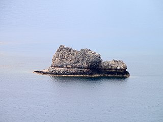
Nisoplaka is a small islet off the coast of the Greek island of Crete in the Libyan Sea. The islet is administered from Asterousia in Heraklion regional unit.

Sideros, also known as Strongylo, is an uninhabited Greek rock, in the Aegean Sea, close to the northeastern coast of eastern Crete. The rock lies just north of the peninsula of Kyriamadi, with which it is connected by a small land bridge. There is also a Cape Sideros on the island of Kyriamadi. Administratively it lies within the Itanos municipality of Lasithi.
Mavros Vrachos, is an uninhabited Greek islet, in the Aegean Sea, close to the eastern coast of Crete. Administratively it lies within the Itanos municipality of Lasithi.

Arnaouti is an islet on the northern coast of Crete in the Aegean Sea. It is just south of the island of Imeri Gramvousa and is located between Imeri Gramvousa and Valenti rock. Administratively, it is located within the municipality of Kissamos, in Chania regional unit.
Valenti is a rock close to the northwestern coast of Crete in the Aegean Sea. It is just south of the island of Imeri Gramvousa and the islet of Arnaouti. Administratively, it is located within the municipality of Kissamos, in Chania regional unit.
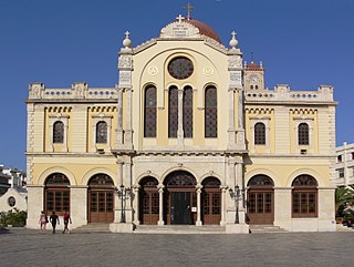
The Church of Crete is an Eastern Orthodox Church, comprising the island of Crete in Greece. The Church of Crete is semi-autonomous (self-governing) under the jurisdiction of the Ecumenical Patriarchate of Constantinople. The current Archbishop of Crete is, since 30 August 2006, Irinaios Athanasiadis.


