
The Gulf of Corinth or the Corinthian Gulf is a deep inlet of the Ionian Sea, separating the Peloponnese from western mainland Greece. It is bounded in the east by the Isthmus of Corinth which includes the shipping-designed Corinth Canal and in the west by the Strait of Rion which widens into the shorter Gulf of Patras and of which the narrowest point is crossed since 2004 by the Rio–Antirrio bridge. The gulf is bordered by the large administrative divisions : Aetolia-Acarnania and Phocis in the north, Boeotia in the northeast, Attica in the east, Corinthia in the southeast and south and Achaea in the southwest. The gulf is in tectonic movement comparable to movement in parts of Iceland and Turkey, growing by 10 mm (0.39 in) per year.

Peristera, also Aspro, locally Xero, anciently Eudemia, is a Greek island in the Sporades. It is administratively part of the municipality of Alonnisos and is also directly east of the namesake island. As of 2011, the resident population of the island was 30. Peristera is in Zone B of the Alonnisos Marine Park.

Samiopoula is a Greek islet located on the south of Samos Island and at a distance of .85 km (0.46 nmi). It is under the authority of the regional unit of Samos and the local jurisdiction of the municipal unit of Pythagoreio. The 2001 census reported a population of five inhabitants. The name Samiopoula is a derivative of Samos and literally means "small Samos".

The Adelfoi Islets are two Greek islands in the Sporades. They are located about 10 kilometres (6.2 mi) east-southeast of the main island of Alonnisos and also administered by a municipality of the same main island name. The 2001 census reported a population of eleven inhabitants.

Imia or Kardak is a pair of small uninhabited islets in the Aegean Sea, situated between the Greek island chain of the Dodecanese and the southwestern mainland coast of Turkey.

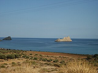
Souda is an islet in Souda Bay on the northwest coast of Crete. In ancient times this islet was one of two islets that were referred to as Leukai. The second islet is known today as Leon.
Mikronisi is an islet off the southern coast of the Greek island of Crete in the Libyan Sea. The islet is in a bay between the capes of Lithino and Kefalas, at Kommos, and close to Gortyn which was the ancient capital of Crete. It is administered within Heraklion regional unit.

Leon, also known colloquially as Nisi and during Venetian rule as Rabbit Island, is an islet in Souda Bay on the northwest coast of Crete.

Afentis Christos is a small islet off the northern coast of the Greek island of Crete named after the small chapel built there. The islet and chapel is only a short distance away from the beach at Malia and a short distance from the islet of Agia Varvara. Afentis Christos is administered from Malia in Heraklion regional unit.
Palaiosouda, also known as Marathi, is an islet located south of the town of Marathi, close to Souda Bay in Crete. The islet is a popular diving location.
Agia Varvara is a small islet off the northern coast of the Greek island of Crete in the Aegean Sea. It is a short distance from the islet of Afentis Christos at Malia. The islet is administered from Malia in Heraklion regional unit.
Kavaloi, is a group of three uninhabited Greek islets, close to the coast of Lasithi, eastern Crete. The close group comprises the islets Anavatis, Kavallos (Καβάλλος), and Kefali. Administratively the islets are part of the municipal unit Lefki.
Ftena Trachylia, also known as Pinnacle Rocks, are a group of uninhabited Greek islets/rocks, in the Aegean Sea, close to the eastern coast of Crete. Administratively they lie within the Itanos municipality of Lasithi.
Daskaleia, is an uninhabited Greek islet, in the Aegean Sea, close to the northeastern coast of Crete. The small islet lies close to the island of Kyriamadi. Administratively it lies within the Itanos municipality of Lasithi.
Karavi, is an uninhabited Greek islet, in the Aegean Sea, close to the northeastern coast of eastern Crete. The small islet lies close to the island of Kyriamadi. Administratively it lies within the Itanos municipality of Lasithi.
Praso, also known as Prasonisi, is an islet close to the eastern coast of Crete, and south-west of the islet of Koursaroi, in the Aegean Sea. Administratively, it is located within the municipality of Kissamos, in Chania regional unit.
Koursaroi, also known as Nisaki, is an islet close to the western coast of Crete, and north-east of the islet of Praso, in the Aegean Sea. Administratively, it is located within the municipality of Kissamos, in Chania regional unit.

Karga, is an uninhabited islet close to the northern coast of Crete in the Aegean Sea. It is located in Souda Bay opposite the islets of Palaiosouda, Souda, and Leon. Administratively, it is within the municipality of Vamos, in Chania regional unit.
Pontikaki is an uninhabited islet off the coast of western Crete that is close to the islet of Pondikonisi. Administratively, it is part of the municipality Kissamos, in Chania regional unit.


