
Argos is a city and former municipality in Argolis, Peloponnese, Greece and is one of the oldest continuously inhabited cities in the world, and the oldest in Europe. It is the largest city in Argolis and a major center in the same prefecture, having nearly twice the population of the prefectural capital, Nafplio.

Hydra, or Ydra or Idra, and in antiquity Hydrea, is one of the Saronic Islands of Greece, located in the Aegean Sea between the Myrtoan Sea and the Argolic Gulf. It is separated from the Peloponnese by a narrow strip of water. In ancient times, the island was known as Hydrea, a reference to the natural springs on the island.

Piraeus is a port city within the Athens urban area, in the Attica region of Greece. It is located eight kilometres (5 mi) southwest of Athens city centre along the east coast of the Saronic Gulf in the Athens Riviera.
Messenia or Messinia is a regional unit in the southwestern part of the Peloponnese region, in Greece. Until the implementation of the Kallikratis plan on 1 January 2011, Messenia was a prefecture (nomos) covering the same territory. The capital and largest city of Messenia is Kalamata.

Poros is a small Greek island-pair in the southern part of the Saronic Gulf, about 58 km south of the port of Piraeus and separated from the Peloponnese by a 200 m (656 ft) wide sea channel, with the town of Galatas on the mainland across the strait. Its surface area is about 31 square kilometres (12 sq mi) and it has 3,261 inhabitants (2021). The ancient name of Poros was Pogon. Like other ports in the Saronic, it is a popular weekend destination for Athenian travellers.

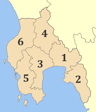
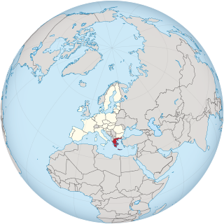
Argolis or Argolida is one of the regional units of Greece. It is part of the region of Peloponnese, situated in the eastern part of the Peloponnese peninsula and part of the tripoint area of Argolis, Arcadia and Corinthia. Much of the territory of this region is situated in the Argolid Peninsula.

The Saronic Islands or Argo-Saronic Islands is an archipelago in Greece, named after the Saronic Gulf in which they are located, just off the Greek mainland. The main inhabited islands of this group are Salamis, Aegina, Agistri, and Poros. The islands of Hydra and Dokos, which lie off the northeast tip of the Peloponnese, are sometimes included as part of the Saronic Islands.

In classical Greece, Lerna was a region of springs and a former lake located in the municipality of the same name, near the east coast of the Peloponnesus, south of Argos. Even though much of the area is marshy, Lerna is located on a geographically narrow point between mountains and the sea, along an ancient route from the Argolid to the southern Peloponnese; this location may have resulted in the importance of the settlement.
Ermioni is a small port town and a former municipality in Argolis, Peloponnese, Greece on the Argolid Peninsula. Since the 2011 local government reform it is part of the municipality Ermionida, of which it is a municipal unit. The municipal unit has an area of 168.180 km2. It is a popular tourist resort.

The British School at Athens is an institute for advanced research, one of the eight British International Research Institutes supported by the British Academy, that promotes the study of Greece in all its aspects. Under UK law it is a registered educational charity, which translates to a non-profit organisation in American and Greek law. It also is one of the 19 Foreign Archaeological Institutes defined by Hellenic Law No. 3028/2002, "On the Protection of Antiquities and Cultural Heritage in General," passed by the Greek Parliament in 2003. Under that law the 19 accredited foreign institutes may perform systematic excavation in Greece with the permission of the government.

Spetses is an island in Attica, Greece. It is counted among the Saronic Islands group. Until 1948, it was part of the old prefecture of Argolis and Corinthia Prefecture, which is now split into Argolis and Corinthia. In ancient times, it was known as Pityussa.
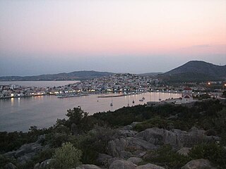
Porto Cheli is a summer resort town in the municipality of Ermionida in the southeastern part of Argolis, Greece. It is situated on a bay of the Argolic Gulf, 7 km south of Kranidi and 40 km southeast of Nafplio. The island of Spetses is located 6 km south of Porto Heli. There are ferry connections from Porto Heli to the islands of Spetses, Hydra and Poros, and to Ermioni and Piraeus. There was a small private airport, Porto Cheli Airport, south of the town, but it's closed since 2004 and now the land was sold.

Franchthi Cave or Frankhthi Cave is an archaeological site overlooking Kiladha Bay, in the Argolic Gulf, opposite the village of Kiladha in southeastern Argolis, Greece.

Oropos is a small town and a municipality in East Attica, Greece.
Troezen is a small town and a former municipality in the northeastern Peloponnese, Greece, on the Argolid Peninsula. Since the 2011 local government reform it is part of the municipality Troizinia-Methana, of which it is a municipal unit. It is part of the Islands regional unit. Population 4,668 (2021).
The Swedish Institute at Athens was founded in 1946 and is one of 19 foreign archaeological institutes operating in Athens, Greece. The Institute is one of three Swedish research institutes in the Mediterranean, along with the Swedish Institute of Classical Studies in Rome and the Swedish Research Institute in Istanbul. Besides the premises in Athens the institute has an office in Stockholm and a guesthouse in Kavala. It also owns the Nordic Library along with the Danish Institute at Athens, the Finnish Institute at Athens and the Norwegian Institute at Athens.
This page list topics related to Greece.
The Dokos shipwreck is the oldest underwater shipwreck discovery known to archeologists. The wreck has been dated to the second Proto-Helladic period, 2700–2200 BC.
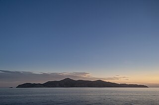
Agios Georgios or San Tzortzis is a Greek uninhabited island in the entry of Saronic Gulf. It is the largest uninhabited island of the Saronic Islands with an area of 4.3 km2. Administratively, it is part of the municipality of Hydra.
Hermione or Hermium or Hermion was a town at the southern extremity of Argolis, in the wider use of this term, but an independent city during the Classical period of Greek history, and possessing a territory named Hermionis (Ἑρμιονίς). The sea between the southern coast of Argolis and the island of Hydra was called after it the Hermionitic Gulf, which was regarded as distinct from the Argolic and Saronic Gulfs. The ruins of the ancient town lie about the modern village of Ermioni.


