Diapori

Last updated
Diapori
Native name: Διαπόρι
Greece location map.svg
Red pog.svg
Diapori
Geography
Coordinates 35°25′18″N24°52′32″E / 35.4217°N 24.8756°E / 35.4217; 24.8756 Coordinates: 35°25′18″N24°52′32″E / 35.4217°N 24.8756°E / 35.4217; 24.8756
ArchipelagoCretan Islands
Administration
Greece
Region Crete
Regional unit Rethymno
Demographics
Population0

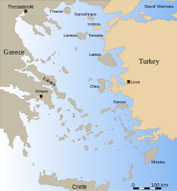
Diapori (Greek : Διαπόρι) is an island that almost touches the coast of Crete, near Geropotamos, in Rethymno regional unit. [1] The islet is not visible on many maps but can be seen on satellite images.

Greek language language spoken in Greece, Cyprus and Southern Albania

Greek is an independent branch of the Indo-European family of languages, native to Greece, Cyprus and other parts of the Eastern Mediterranean and the Black Sea. It has the longest documented history of any living Indo-European language, spanning more than 3000 years of written records. Its writing system has been the Greek alphabet for the major part of its history; other systems, such as Linear B and the Cypriot syllabary, were used previously. The alphabet arose from the Phoenician script and was in turn the basis of the Latin, Cyrillic, Armenian, Coptic, Gothic, and many other writing systems.

Crete The largest and most populous of the Greek islands

Crete is the largest and most populous of the Greek islands, the 88th largest island in the world and the fifth largest island in the Mediterranean Sea, after Sicily, Sardinia, Cyprus, and Corsica. Crete and a number of surrounding islands and islets constitute the region of Crete, one of the 13 top-level administrative units of Greece. The capital and the largest city is Heraklion. As of 2011, the region had a population of 623,065.

Geropotamos Place in Greece

Geropotamos is a former municipality in the Rethymno regional unit, Crete, Greece. Since the 2011 local government reform it is part of the municipality Mylopotamos, of which it is a municipal unit. The municipal unit has an area of 194.590 km2 (75.132 sq mi). Population 7,777 (2011). The seat of the municipality was in Perama.

See also

Related Research Articles

Aegean Sea Part of the Mediterranean Sea between the Greek and Anatolian peninsulas

The Aegean Sea is an elongated embayment of the Mediterranean Sea located between the Greek and Anatolian peninsulas i.e. between the mainlands of Greece and Turkey. In the north, the Aegean is connected to the Marmara Sea and Black Sea by the Dardanelles and Bosphorus. The Aegean Islands are within the sea and some bound it on its southern periphery, including Crete and Rhodes.

Archipelago A group of islands

An archipelago, sometimes called an island group or island chain, is a chain, cluster or collection of islands, or sometimes a sea containing a small number of scattered islands.

Cyprus Island country in Mediterranean

Cyprus, officially the Republic of Cyprus, is an island country in the Eastern Mediterranean and the third largest and third most populous island in the Mediterranean, located south of Turkey, west of Syria and Lebanon, northwest of Israel, north of Egypt, and southeast of Greece.

Greece republic in Southeast Europe

Greece, officially the Hellenic Republic, historically also known as Hellas, is a country located in Southern and Southeast Europe, with a population of approximately 11 million as of 2016. Athens is the nation's capital and largest city, followed by Thessaloniki.

Chios Place in Greece

Chios is the fifth largest of the Greek islands, situated in the Aegean Sea, 7 kilometres (4.3 mi) off the Anatolian coast. The island is separated from Turkey by the Chios Strait. Chios is notable for its exports of mastic gum and its nickname is the Mastic Island. Tourist attractions include its medieval villages and the 11th-century monastery of Nea Moni, a UNESCO World Heritage Site.

Corfu Place in Greece

Corfu or Kerkyra is a Greek island in the Ionian Sea. It is the second largest of the Ionian Islands, and, including its small satellite islands, forms the northwesternmost part of Greece. The island is part of the Corfu regional unit, and is administered as a single municipality, which also includes the smaller islands of Ereikoussa, Mathraki and Othonoi. The municipality has an area of 610,9 km2, the island proper 592,8 km2. The principal city of the island and seat of the municipality is also named Corfu. Corfu is home to the Ionian University.

Ithaca Regional unit in Ionian Islands, Greece

Ithaca, Ithaki or Ithaka is a Greek island located in the Ionian Sea, off the northeast coast of Kefalonia and to the west of continental Greece.

Naxos island in the Aegean Sea

Naxos is a Greek island and the largest of the Cyclades. It was the centre of archaic Cycladic culture. The island is famous as a source of emery, a rock rich in corundum, which until modern time was one of the best abrasives available.

Euboea The second-largest Greek island in area and population, after Crete

Euboea or Evia; Greek: Εύβοια, Evvoia, pronounced [ˈevia]; Ancient Greek: Εὔβοια, Eúboia, [eúboja]) is the second-largest Greek island in area and population, after Crete. The narrow Euripus Strait separates it from Boeotia in mainland Greece. In general outline it is a long and narrow island; it is about 180 kilometres (110 mi) long, and varies in breadth from 50 kilometres (31 mi) to 6 kilometres (3.7 mi). Its geographic orientation is from northwest to southeast, and it is traversed throughout its length by a mountain range, which forms part of the chain that bounds Thessaly on the east, and is continued south of Euboea in the lofty islands of Andros, Tinos and Mykonos.

Cephalonia regional unit in Ionian Islands, Greece

Cephalonia or Kefalonia, formerly also known as Kefallinia or Kephallenia (Κεφαλληνία), is the largest of the Ionian Islands in western Greece and the 6th largest island in Greece after Crete, Evoia, Lesbos, Rhodes, and Chios. It is also a separate regional unit of the Ionian Islands region, and the only municipality of the regional unit. It was also a former Latin Catholic diocese Kefalonia–Zakynthos (Cefalonia–Zante) and short-lived titular see as just Kefalonia.

Ionian Islands Traditional region of Greece

The Ionian Islands are a group of islands in Greece. They are traditionally called the Heptanese, i.e. "the Seven Islands", but the group includes many smaller islands as well as the seven principal ones.

Dodecanese Former prefecture in South Aegean, Greece

The Dodecanese are a group of 15 larger plus 150 smaller Greek islands in the southeastern Aegean Sea, off the coast of Asia Minor (Turkey), of which 26 are inhabited. Τhis island group generally defines the eastern limit of the Sea of Crete. They belong to the wider Southern Sporades island group.

Aegean Islands Region of Greece

The Aegean Islands are the group of islands in the Aegean Sea, with mainland Greece to the west and north and Turkey to the east; the island of Crete delimits the sea to the south, those of Rhodes, Karpathos and Kasos to the southeast. The ancient Greek name of the Aegean Sea, Archipelago was later applied to the islands it contains and is now used more generally, to refer to any island group.

Lesbos Regional unit in North Aegean, Greece

Lesbos is an island located in the northeastern Aegean Sea. It has an area of 1,633 km2 (631 sq mi) with 320 kilometres of coastline, making it the third largest island in Greece. It is separated from Turkey by the narrow Mytilini Strait and in late Palaeolithic/Mesolithic times was joined to the Anatolian mainland before the end of the last glacial period.

Tsimandria Place in Greece

Tsimandria is a village and a community in the southwestern part of Lemnos, a Greek island in the northern part of the Aegean Sea. It is part of the municipal unit of Nea Koutali. It is 1.5 km south of Portianou, 2 km east of Kontias, 4 km southwest of Nea Koutali and 10 km east of Myrina. The eastern half of the Fakos peninsula and the islets Kastria and Kompi are part of the community. In 2011 its population was 259.

Geography of Greece

Greece is a country in Southern Europe, bordered to the north by Albania, North Macedonia and Bulgaria; to the east by Turkey, and is surrounded to the east by the Aegean Sea, to the south by the Cretan and the Libyan Seas, and to the west by the Ionian Sea which separates Greece from Italy.

The Diapori chain is a chain of three uninhabited islands in the Argosaronikos Gulf of Greece. It includes St John’s Island in the north, Diapori Island in the south, and St. Thomas Island in the middle. All are currently being offered for private sale.

Rhodes Island and Municipality in South Aegean, Greece

Rhodes is the largest of the Dodecanese islands of Greece and is also the island group's historical capital. Administratively the island forms a separate municipality within the Rhodes regional unit, which is part of the South Aegean administrative region. The principal town of the island and seat of the municipality is Rhodes. The city of Rhodes had 50,636 inhabitants in 2011. It is located northeast of Crete, southeast of Athens and just off the Anatolian coast of Turkey. Rhodes' nickname is The island of the Knights, named after the Knights of Saint John of Jerusalem, who once conquered the land.

References