Pubarun Khejuria | |
|---|---|
Populated place | |
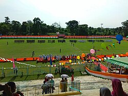 NTPC Stadium | |
 Pubarun Location in West Bengal, India  Pubarun Pubarun (India) | |
| Coordinates: 24°48′54″N87°57′17″E / 24.81507°N 87.95482°E | |
| Country | |
| State | West Bengal |
| District | Malda |
| Languages | |
| • Official | Bengali, English |
| Time zone | UTC+5:30 (IST) |
| PIN | 732315 |
| Telephone/ STD code | 03512 |
| Vehicle registration | WB |
| Lok Sabha constituency | Maldaha Dakshin |
| Vidhan Sabha constituency | Baisnabnagar |
| Website | malda |
Pubarun is a populated place, not identified as a separate place in 2011 census, in the Kaliachak III CD block in the Malda Sadar subdivision of Malda district in the state of West Bengal, India.

