Queensland is the second largest state in Australia. It contains 472 separate protected areas with a total land area of 69,388 km2 (26,791 sq mi). 223 of these are National parks, which is the highest number of any Australian state or territory, totaling 65,871 km2 (25,433 sq mi). Seven others are Scientific National Parks, totaling 522 km2 (202 sq mi).

Southern Moreton Bay Islands is a national park in Queensland, Australia, 44 km southeast of Brisbane. It forms part of the Moreton Bay and Pumicestone Passage Important Bird Area, so identified by BirdLife International because it supports large numbers of migratory waders, or shorebirds.

Moreton Bay is a bay located on the eastern coast of Australia 14 kilometres (8.7 mi) from central Brisbane, Queensland. It is one of Queensland's most important coastal resources. The waters of Moreton Bay are a popular destination for recreational anglers and are used by commercial operators who provide seafood to market.

Moreton Island (Mulgumpin) is an island on the eastern side of Moreton Bay on the coast of South East Queensland, Australia. The Coral Sea lies on the east coast of the island. Moreton Island lies 58 kilometres (36 mi) northeast of the Queensland capital, Brisbane. 95% of the island is contained within a national park and a popular destination for day trippers, four wheel driving, camping, recreational angling and whale watching and a 75-minute ferry ride from Brisbane. It is the third largest sand island in the world. Together with Fraser Island, Moreton Island forms the largest sand structure in the world. It was the traditional country of the Ngugi before the onset of colonization.

Bribie Island is the smallest and most northerly of three major sand islands forming the coastline sheltering the northern part of Moreton Bay, Queensland, Australia. The others are Moreton Island and North Stradbroke Island. Bribie Island is 34 kilometres long, and 8 kilometres at its widest. Archibald Meston believed that the name of the island came from a corruption of a mainland word for it, Boorabee. meaning 'koala'.
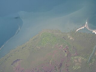
The Great Sandy Strait is a strait in the Australian state of Queensland of 70 kilometres (43 mi) length which separates mainland Queensland from the World Heritage listed Fraser Island. It is also a locality in the Fraser Coast Region local government area. In the 2016 census, Great Sandy Strait had a population of 4 people.

Deception Bay is a coastal suburb in the Moreton Bay Region, Queensland, Australia. It is approximately 32 kilometres (20 mi) north of Brisbane CBD in the south-eastern corner of the bay of the same name which separates the Redcliffe Peninsula and Bribie Island.

Captain Matthew Flinders was an English navigator and cartographer who led the first inshore circumnavigation of the landmass that is now known as Australia. He is also credited as being the first person to utilise the name Australia to describe the entirety of that continent including Van Diemen's Land, a title he regarded as being "more agreeable to the ear" than previous names such as Terra Australis.

Bramble Bay is an embayment of Moreton Bay in South East Queensland, Australia. The Brisway map reference is 12 H5, or see page 91 G19 in Refidex.
The Moreton Bay Marine Park was established in 1992 to protect ecologically significant habitats in Moreton Bay. The marine park extends from Caloundra south to the southern tip of South Stradbroke Island. The marine park's border extends up to the highest tidal mark and covers a total of 3,400 km2.

St Helena Island is a heritage-listed island in Queensland, Australia, 21 kilometres (13 mi) east of Brisbane and 4 kilometres (2.5 mi) east of the mouth of the Brisbane River in Moreton Bay. Originally used as a prison, it is now a national park. Local Australian Aborigines called the island Noogoon but it was renamed St Helena after an aboriginal named Napoleon was exiled there in 1827. The island is visible from the mainland, particularly the suburbs of Wynnum, Manly and Lota. It has its own permanent water supply, a spring in the centre of the island. Many migratory birds use the island as a watering hole; it forms part of the Moreton Bay and Pumicestone Passage Important Bird Area, so identified by BirdLife International because it supports large numbers of migratory waders, or shorebirds.

The Flinders Peak Group is an unnamed range of hills located on the northern edge of the Scenic Rim Region, south west of Logan City and south east of the City of Ipswich in South East Queensland, Australia. The summit in the Range is Flinders Peak reaching 680 metres (2,230 ft) above sea level.

South Passage is channel between the South Pacific Ocean and Moreton Bay. The other entrances to the bay are the North Passage and Jumpinpin Channel in the south.
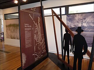
Bribie Island Seaside Museum opened on 14 May 2010 at 1 South Esplanade, Bongaree, on the Pumicestone Passage side of Bribie Island, Moreton Bay Region in Queensland, Australia. It is run by Moreton Bay Regional Council.
Toorbul is a coastal town and a locality in the Moreton Bay Region, Queensland, Australia. In the 2016 census, Toorbul had a population of 930 people.

White Patch is a coastal locality of the Moreton Bay Region in Queensland, Australia.
Bribie Island North is a locality on Bribie Island in the Sunshine Coast Region, Queensland, Australia. In the 2016 census, Bribie Island North had a population of 0 people.

Caloundra Lighthouses are a heritage-listed pair of lighthouses at 3 Canberra Terrace, near Arthur Street, Kings Beach, Caloundra, Sunshine Coast Region, Queensland, Australia. The first, known as the Old Caloundra Light, was designed by Francis Drummond Greville Stanley and built in 1896; the second, New Caloundra Light, was built in 1968. They were added to the Queensland Heritage Register on 5 February 2010.
The following is a timeline of the history of the city of Brisbane, Queensland, Australia.

The Geography of Brisbane is characterised by its coastal location in the south eastern corner of the Queensland state of Australia. It is located precisely halfway up the Australian east coast with longitudinal and latitudinal coordinates of 27.5° south and 153° east. The city resides within the Moreton Bay Floodplain, stretching from Caboolture to the north, Beenleigh to the south and as far as Ipswich to the west whilst being bordered by the Pacific Ocean to the east.


