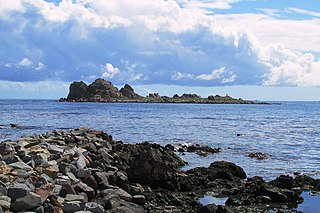
Los Vilos? is both a Chilean coastal commune and a coastal city with over 9,000 inhabitants, located in the Province of Choapa, part of the IV Region of Coquimbo. The city has a harbour called Puerto Punta Chungo, that ships the material of Los Pelambres mine. Fishing is one of its main activities. The city also has a significant amount of tourism, mainly due to its two beaches: La Principal and Las Conchas. It is located at 246 kilometres (153 mi) from La Serena and 246 kilometres (153 mi) from Santiago.
Alto Palena Airport is an airport serving Palena, a small town in the mountains of the Los Lagos Region of Chile. Palena is 5 kilometres (3.1 mi) from the Argentina border. The airport is just north of the town, and south of a bend in the Palena River.
Los Confines Airport is an airport serving Angol, a city in the Araucanía Region of Chile. The airport is just northeast of the city.
Pupelde Airport is an airport serving Ancud, a Pacific port city in the Los Lagos Region of Chile. Ancud is on the northern shore of Chiloé Island.
Chaitén Airfield was an airport serving Chaitén, a town in the Los Lagos Region of Chile. The airport was damaged and closed after the 2008 eruption of Chaitén Volcano.
Vodudahue Airport Spanish: Aeropuerto Vodudahue, is an airstrip 56 kilometres (35 mi) northeast of Chaitén, a town in the Los Lagos Region of Chile. The airstrip is in the valley of the Vodudahue River, 5 kilometres (3.1 mi) east of where the river empties into the Comau Fjord. The valley extends eastward into Pumalín Park.
Caleta Gonzalo Airport is an airstrip by a cove off the Reñihué Fjord in the Los Lagos Region of Chile. The airstrip is 42 kilometres (26 mi) north of Chaitén, the largest town in the area.
Reñihúe Airport is an airport serving the hamlet of Reñihúe, 41 kilometres (25 mi) north-northeast of Chaitén, a city in the Los Lagos Region of Chile. Reñihué is at the eastern end of Reñihué Fjord, which opens into the Gulf of Ancud.
Pumalín Airport is an airport on Isla Llahuen, the easternmost of the islands separating the Gulf of Ancud from the Gulf of Corcovado. The runway is on a spit at the entrance of the small Pumalín Bay, 26 kilometres (16 mi) north-northwest of Chaitén, a city in the Los Lagos Region of Chile.
Tic Toc Airport is an isolated airstrip on an inlet off the Gulf of Corcovado in the Los Lagos Region of Chile. The nearest community is Puerto Raúl Marín Balmaceda (es) 18 kilometres (11 mi) to the south. Chaitén is 78 kilometres (48 mi) north of the airstrip.
Chañaral Airport Spanish: Aeropuerto de Chañaral, is an airport serving Chañaral, a Pacific coastal city in the Atacama Region of Chile.
Chile Chico Airport Spanish: Aeródromo Chile Chico, is an airport serving Chile Chico, a lakeside town in the Aysén Region of Chile. Chile Chico is on the south shore of General Carrera Lake, 3 kilometres (1.9 mi) west of the Argentina border. The airport is 5 kilometres (3.1 mi) southeast of the town.
Siberia Airport Spanish: Aeropuerto Siberia, is an airport serving the Arauco forest products plant at Cholguán (es), a town in the Bío Bío Region of Chile.
Punta el Saco Airport Spanish: Aeropuerto Punta el Saco, is an airport on the south shore of Isla Mocha, a small Pacific island 32 kilometres (20 mi) off the coast of Chile. Isla Mocha is part of Chile's Bío Bío Region.
Punta Galera Airport Spanish: Aeropuerto Punta Galera, is an airstrip located 62 kilometres (39 mi) west-northwest of La Unión, a city in the Los Ríos Region of Chile.
San Rafael Airport Spanish: Aeródromo de San Rafael de Los Andes, is an airport serving Los Andes, a city in the Valparaíso Region of Chile. The airport is 5 kilometres (3.1 mi) west-northwest of the city.

María Dolores Airport is an airport serving Los Ángeles, capital of Bío Bío Province in the Bío Bío Region of Chile.
El Mirador Airport, is an airport just southeast of Puerto Varas, a city in the Los Lagos Region of Chile. Puerto Varas is on the southwest shore of Llanquihue Lake.
Marco Davison Bascur Airport, is an airport on Isabel Island, an island in the Strait of Magellan, 29 kilometres (18 mi) north-northeast of Punta Arenas, the capital of the Magallanes Region of Chile.
Punta Baja Airport is an airstrip on the shore of General Carrera Lake in the Aysén Region of Chile. The nearest village is Puerto Guadal (es) 8 kilometres (5.0 mi) away on the other side of the lake.


