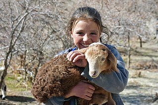
The Wakhi people, also locally referred to as the Wokhik, are an Iranian ethnic group native to Central and South Asia. They are found in Afghanistan, Tajikistan, Pakistan and China—primarily situated in and around Afghanistan's Wakhan Corridor, the northernmost part of Pakistan's Gilgit−Baltistan and Chitral, Tajikistan's Gorno−Badakhshan Autonomous Region and the southwestern areas of China's Xinjiang Uyghur Autonomous Region. The Wakhi people are native speakers of the Wakhi language, an Eastern Iranian language.

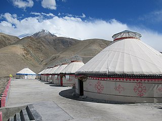
Taxkorgan Tajik Autonomous County is an autonomous county of Kashgar Prefecture, in western Xinjiang, China. The county seat is Tashkurgan. The county is the only Tajik autonomous county in China.

Kizilsu Kyrgyz Autonomous Prefecture is an autonomous prefecture in western Xinjiang, China, bordering Kyrgyzstan and Tajikistan. Its capital is Artux. The prefecture is home to 622,222 people and covers an area of 70,916 km2 (27,381 sq mi). Most Kyrgyz in China reside in Kizilsu; they make up a little over a quarter of the prefecture's population. The Uyghurs are the largest ethnic group in Kizilsu, consisting of nearly two-thirds of the population.

Bayingolin Mongol Autonomous Prefecture is an autonomous prefecture in the southeastern Xinjiang, China. It borders Gansu to the east, Qinghai to the southeast and the Tibet Autonomous Region to the south. It is the largest prefecture-level division nationally, with an area of 471,480 km2 (182,040 sq mi), which is even larger than its neighboring province of Gansu. The prefectural capital is Korla. Despite being designated an autonomous area for Mongols in China, only about four percent of Bayingolin's population is Mongol.

Artux or Artush or Atush is a county-level city and the capital of Kizilsu Kyrgyz Autonomous Prefecture in Xinjiang, China. The government seat is in Guangming Road Subdistrict. As of 2018, it has a population of 285,507 people, 81.4 per cent of whom are Uyghurs.

Qapqal Xibe Autonomous County in Ili Kazakh Autonomous Prefecture in Northern Xinjiang, is the only Xibe autonomous county of China, bordering Kazakhstan's Almaty Region to the west. It has an area of 4,430 square kilometers and a population 160,000 (2000). Qapqal means "the granary" in the Xibe language.

Uqturpan County or Uchturpan County, also Wushi County, is a county in the Xinjiang Uyghur Autonomous Region under the administration of Aksu Prefecture and shares an approximately 150 km (93 mi) long border with Kyrgyzstan's Issyk-Kul Region. The county is bordered to the northeast by Onsu County (Wensu), to the southeast by Aksu city, to the west by Akqi County in Kizilsu Kyrgyz Autonomous Prefecture and to the south by Kalpin County (Keping). It has an area of 9,012 square kilometres (3,480 sq mi) and as of the 2002 census a population of 180,000.

Makit County is a county in Kashgar Prefecture, Xinjiang Uyghur Autonomous Region, China. It contains an area of 10,927 km2 (4,219 sq mi). The Yarkand River passes through the county. The county is bordered to the north by Maralbexi County, to the east by Guma County (Pishan) in Hotan Prefecture, to the west by Yarkant County, and to the south by Kargilik County.

Shufu County, also transliterated from Uyghur as Konaxahar County or Konasheher County/Kona Sheher County, is a county in Kashgar Prefecture, Xinjiang Uyghur Autonomous Region, China. It contains an area of 3,513 km2 (1,356 sq mi). According to the 2002 census, it has a population of 360,000.

Akto County is a county in Kizilsu Kyrgyz Autonomous Prefecture, Xinjiang Uygur Autonomous Region, China. The county borders Tajikistan and Kyrgyzstan and has two towns, 11 townships, four state-owned farms and a plant nursery under its jurisdiction with the county seat being Akto Town. The county contains an area of 24,555 km2 (9,481 sq mi) and has a population of 221,526 as of 2015, of 231,756 as of 2017.

Karakax County, alternatively Moyu County, also transliterated from Uyghur as Qaraqash County, alternately Qaraqash, is a county in the Xinjiang Uyghur Autonomous Region and is located in the southern edge of the Tarim Basin, it is under the administration of the Hotan Prefecture. It contains an area of 25,667 km2 (9,910 sq mi). According to the 2011 census it has a population of 577,000 and 98,1% are Uyghurs. The county is bordered to the north by Awat County in Aksu Prefecture, to the northeast by Lop County, to the southeast by Hotan County, to the northwest by Maralbexi County in Kashgar Prefecture, and to the southwest by Pishan County and Kunyu. Exclaves of Kunyu are located within the county.

Xinyuan County as the official romanized name, also transliterated from Uyghur as Künas County, is a county in the Xinjiang Uyghur Autonomous Region and is under the administration of the Ili Kazakh Autonomous Prefecture. It contains an area of 7,581 km2. According to the 2002 census, it has a population of 290,000. The county is served by Xinyuan Nalati Airport.

Gongliu County as the official romanized name, also transliterated from Uyghur as Tokkuztara County, is a county situated within the Xinjiang Uyghur Autonomous Region and is under the administration of the Ili Kazakh Autonomous Prefecture. It contains an area of 4,119 km2 (1,590 sq mi). According to the 2002 census, it has a population of 160,000.

Hotan Prefecture is located in the Tarim Basin region of southwestern Xinjiang, China, bordering the Tibet Autonomous Region to the south and Union Territory of Ladakh and Gilgit-Baltistan to the west. The vast majority of the Aksai Chin region which is disputed between China and India is administered as part of Hotan Prefecture. The seat of Hotan Prefecture is Hotan and its largest county by population is Karakax County. The vast majority of the residents of the prefecture are Muslim Uyghurs and live around oases situated between the desolate Taklamakan Desert and Kunlun Mountains.
Qigxin is an oasis town in central Xinjiang Uyghur Autonomous Region of Northwest China. It is under the administration of Yanqi Hui Autonomous County in Bayin'gholin Mongol Autonomous Prefecture. According to the 2000 census, the town has a population of 12,629 people and covers an area of 755 square kilometres (292 sq mi). The town is 36 kilometres (22 mi) west of Bosten Lake and is largely agricultural, producing grains, oil, sugar beet, fennel, pepper, cotton, tomato and livestock, but just on its outskirts lie the Tarim Basin, a desert.
Beidaqu is a township in Yanqi Hui Autonomous County in the Bayin'gholin Mongol Autonomous Prefecture of Xinjiang, in Northwestern China. According to the 2000 Chinese census, the township has a population of 9,026 people.
Wuhaoqu is a township in Yanqi Hui Autonomous County in the Bayin'gholin Mongol Autonomous Prefecture of Xinjiang, in Northwestern China. According to the 2000 Chinese census, the township has a population of 14,791 people and covers 96 square kilometres.
Borhoi is a township in Central Xinjiang Uyghur Autonomous Region of Northwest China, 26 kilometres (16 mi) west of Bosten Lake, the largest lake in Xinjiang. It is under the administration of Yanqi Hui Autonomous County in Bayin'gholin Mongol Autonomous Prefecture. According to the 2006 Chinese census, the township has a population of 5964 people, the majority being involved in agriculture.
Jigin Township is considered to be the westernmost township of China located in Ulugqat County (Wuqia), Kizilsu Kyrgyz Autonomous Prefecture, Xinjiang Uygur Autonomous Region. The township covers an area of 1,452 square kilometers. It has four villages under its jurisdiction and its seat is at Saz Village (萨孜村).
Barin Township, also spelled Baren Township, is a township of Akto County (Aketao), Kizilsu Kyrgyz Autonomous Prefecture (Kezilesu), Xinjiang Uygur Autonomous Region, China. The township is located on the western edge of the Taklamakan Desert, at the foot of the Pamir Mountains. Located in the middle west of the northeastern part of the county, the township covers an area of 1,087 square kilometers with a population of 38,706. It has 19 administrative villages under its jurisdiction. Its seat is at Barin Village (巴仁村).


