
Royal Air Force Syerston, commonly known simply as RAF Syerston, is a Royal Air Force station in the parish of Flintham, near Newark, Nottinghamshire, England. Opened in 1940, it was used by the Royal Air Force (RAF) as a bomber base during the Second World War, operating Vickers Wellingtons, Avro Manchesters, and the Avro Lancaster heavy bombers. Post-war, it became home to Jet Provosts of the 2 Flying Training School. It is now home to the Royal Air Force Central Gliding School.
Royal Air Force Snailwell or more simply RAF Snailwell is a former Royal Air Force station located near to the village of Snailwell, Cambridgeshire, located 3 miles (4.8 km) north of Newmarket, Suffolk, England.

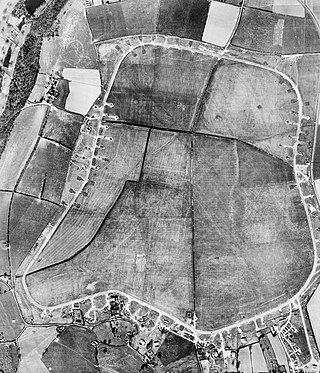
Royal Air Force Barford St John or more simply RAF Barford St John is a Royal Air Force station just north of the village of Barford St. John, Oxfordshire, England. It is now a non-flying facility, operated by the United States Air Force as a communications centre with many large communications aerials, and is a satellite of RAF Croughton.
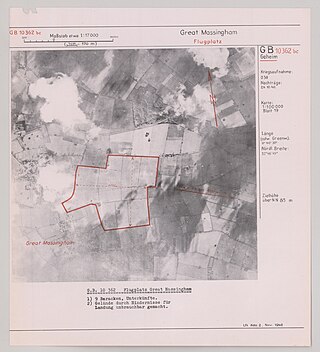
Royal Air Force Great Massingham or more simply RAF Great Massingham is a former Royal Air Force station located 8.1 miles (13 km) southwest of Fakenham, Norfolk and 11.7 miles (18.8 km) east of King's Lynn, Norfolk, England.

Royal Air Force Kings Cliffe or more simply RAF Kings Cliffe is a former Royal Air Force station located near Kings Cliffe, Northamptonshire, 12 miles (19 km) west of Peterborough in Cambridgeshire. The airfield was built with hard-surfaced runways and a perimeter track, these were extended early in 1943.

Royal Air Force Atcham, or more simply RAF Atcham, is a former Royal Air Force station located 5 miles (8 km) east of Shrewsbury, Shropshire, England, on the north eastern boundary of Attingham Park.

Royal Air Force Keevil or more simply RAF Keevil is a former Royal Air Force station, now controlled by the Army Air Corps. It lies between the villages of Keevil and Steeple Ashton, about 4 miles (6.4 km) east of the town of Trowbridge, in Wiltshire, England.

Royal Air Force Colerne or more simply RAF Colerne is a former Royal Air Force station which was on the outskirts of the village of Colerne in Wiltshire, England, and was in use from 1939 to 1976.
Royal Air Force Beaulieu or more simply RAF Beaulieu is a former Royal Air Force station in the New Forest, Hampshire, England. It was also known as Beaulieu airfield, Beaulieu aerodrome and USAAF Station AAF 408. It is located on Hatchet Moor 1 mile (2 km) west of the village of East Boldre, about 2 miles (3 km) west-southwest of the village of Beaulieu and 4 miles (6 km) north-east of Lymington.
Royal Air Force Hurn or more simply RAF Hurn is a former Royal Air Force station located approximately 4 miles (6.4 km) north west of Christchurch, Dorset, England

Royal Air Force Chilbolton or RAF Chilbolton is a former Royal Air Force station in Hampshire, England. The airfield was located in Chilbolton approximately 4 miles (6.4 km) south-southeast of Andover.

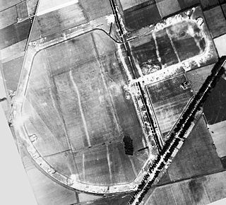
Royal Air Force Balderton or more simply RAF Balderton was a former Royal Air Force satellite station located 2.0 miles (3.2 km) south of Newark-on-Trent, sandwiched between the now extinct Great Northern Railway (GNR) Bottesford-Newark line and the A1 road in Nottinghamshire, England.
Royal Air Force Kirton in Lindsey or more simply RAF Kirton in Lindsey is a former Royal Air Force station located 15 miles (24 km) north of Lincoln, Lincolnshire, England.
Royal Air Force Zeals, or more simply RAF Zeals, is a former Royal Air Force station in Wiltshire, sited to the north of the village of Zeals, next to the village of Stourton and the Stourhead estate.
Royal Air Force Wymeswold, or more simply RAF Wymeswold, is a former Royal Air Force satellite station located 3.5 miles (5.6 km) north-east of Loughborough, Leicestershire, England. The airfield is situated between Hoton, Wymeswold and Burton on the Wolds, lying in the current district of Charnwood.

Royal Air Force Tarrant Rushton or more simply RAF Tarrant Rushton is a former Royal Air Force station near the village of Tarrant Rushton east of Blandford Forum in Dorset, England from 1943 to 1947. It was used for glider operations during World War II and later revived for civilian operations. It is currently disused, though some buildings survive. Today it serves as a visual reference point (VRP) for VFR flights, in particular NW departures from Bournemouth Airport.

Royal Air Force Culmhead or more simply RAF Culmhead is a former Royal Air Force station, situated at Churchstanton on the Blackdown Hills in Somerset, England. It was originally named RAF Church Stanton.

Royal Air Force Charterhall or more simply RAF Charterhall is a former Royal Air Force satellite station located in the Scottish Borders and the historic county of Berwickshire between the village of Greenlaw and Duns. It was originally a First World War landing ground named Eccles Toft. The airfield was reconstructed in 1942 and was used mainly by No. 54 Operational Training Unit during Second World War. The RAF left in 1947 and the airfield was officially closed.
Royal Air Force Macmerry or more simply RAF Macmerry is a former Royal Air Force satellite station located 4.5 miles (7.2 km) west of Haddington, East Lothian, Scotland and 11.4 miles (18.3 km) east of Edinburgh. It was situated immediately to the north east of Macmerry on the north side of the A1 road. It has also been called RNAS Macmerry and unofficially RAF Tranent and RAF Penston during its life.

Royal Air Force Charmy Down or more simply RAF Charmy Down is a former Royal Air Force station in Somerset, England, approximately 3 miles (4.8 km) north-northeast of Bath.


