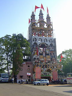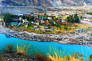
Raipur is the capital city of the Indian state of Chhattisgarh. Raipur is also the administrative headquarters of Raipur district and Raipur division, and the largest city of the state. It was a part of Madhya Pradesh before the state of Chhattisgarh was formed on 1 November 2000. It has exponential industrial growth, and has become a major business hub in central India. It is ranked 7th in Ease of Living Index 2019 by Union Ministry of Housing and Urban Affairs (MoHUA).

Raipur district is a district in the Chhattisgarh state of India. Its administrative headquarters is the city of Raipur. The district is rich in mineral resources and there are many wildlife sanctuaries. With a population of 4 million, it is the most populous district of Chhattisgarh.

Amethi (अमेठी) is a town in the Indian state of Uttar Pradesh. It is a major town of the Amethi district, in the Faizabad division. The Hanumangarhi temple is located near the town.

Kathua (kəˈθʊə) is a town located in the Indian union territory of Jammu and Kashmir, near its border with Punjab and Himachal Pradesh. The town serves as the District Headquarter of its namesake district and is divided into 27 wards which constitute the Kathua Municipal Council and its adjoining Outgrowths (M.Cl.+OGs). It is situated along NH-44. The town has a bustling industrial area and an Army Cantonment adjoining it.Jodh Singh a famous Rajput of Andotra clan migrated from HASTINAPUR to KATHUA nearly 2000 years ago and settled here. The three Hamlets of Taraf Tajwal, Taraf Manjali and Taraf Bhajwal were established by his three sons Viz. Teju, Kindal and Bhaju. Their descendent are now called as Tajwalia, Bhajwalia and Khanwalia Rajputs of Andotra sub-caste. The conglomeration of these three hamlets was loosely called “KATHAI” in earlier times which with the passage of time came to be called as KATHUA.

Raipur Rani is a census town in Panchkula district in the Indian state of Haryana. It is Located on the Chandigarh- Nahan-Paonta Sahib-Dehradun highway 30 kilometres east from the Chandigarh-Mohali-Panchkula urban cities combine. It is about 20 kilometres from the Dera Bassi Industrial belt and 10 kilometres from the Barwala industrial estate. Narayangarh in the Ambala District is the next large town in its proximity.

Raipur is a census town in Dehradun district in the Indian state of Uttarakhand.

Ramban is a town in Ramban district of Jammu and Kashmir, India, which is the district headquarters of Ramban district. It lies on the banks of the Chenab river in Chenab Valley on the National Highway-1A at about 150 km from Jammu and about 150 km from Srinagar, making it almost the central point on the Jammu-Srinagar National Highway.
Jammu Lok Sabha constituency is one of the five Lok Sabha (parliamentary) constituencies in Jammu and Kashmir union territory of in northern India. This constituency was created in 1967.
Raipur may refer to the following places:

Raipur is a community development block that forms an administrative division in the Khatra subdivision of the Bankura district in the Indian state of West Bengal.

Raipur is a village under Raipur–Supur gram panchayat of Bolpur Sriniketan block in Bolpur subdivision of Birbhum district in the Indian state of West Bengal.

Anuppur Junction railway station is a railway station in Anuppur town of Anuppur district in Madhya Pradesh. The station code of Anuppur Junction is 'APR'. It has four platforms. It comes under Bilaspur railway division of South East Central Railway Zone. It is on the Allahabad-Jabalpur section and connects to Katni-Bilaspur line and Katni-Ambikapur line.

Raipur, referred to in census reports as Raipur Bazar, is a census town in the Raipur CD block in the Khatra subdivision of the Bankura district in the state of West Bengal, India.

National Smart Cities Mission is an urban renewal and retrofitting program by the Government of India with the mission to develop smart cities across the country, making them citizen friendly and sustainable. The Union Ministry of Urban Development is responsible for implementing the mission in collaboration with the state governments of the respective cities. The mission initially included 100 cities, with the deadline for completion of the projects set between 2019 and 2023.

Uslapur Railway Station is a railway station of Bilaspur, Chhattisgarh, India. It is one of important railway station of Bilaspur city. Uslapur is the fourth biggest railway station of Bilaspur District. Uslapur is situated at West of Bilaspur city. There are three well furnished railway platforms.
Mula Ram is a former minister of social justice in Jammu and Kashmir, India. He is a leader of Indian National Congress. He elected was Raipur-Domana and Marh constituency in Jammu and Kashmir Legislative Assembly.

Raipur is a census town in Galsi I CD Block in Bardhaman Sadar North subdivision of Purba Bardhaman district in the Indian state of West Bengal.

Shahdol railway station is a railway station in Shahdol town of Shahdol district in Madhya Pradesh. Station Code of Shahdol is 'SDL'. It has three platforms. It comes under Bilaspur railway division of South East Central Railway Zone. It is on the Allahabad-Jabalpur section.


