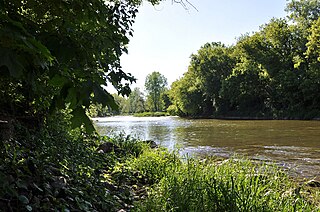
Indian River may refer to:

North Glengarry is a township in eastern Ontario, Canada, in the United Counties of Stormont, Dundas and Glengarry. It is a predominantly rural area located between Ottawa-Gatineau, Montreal and Cornwall.

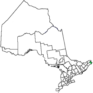
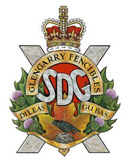
The United Counties of Stormont, Dundas and Glengarry, shortened to SDG, is an upper-tier municipality in the Canadian province of Ontario that comprises three historical counties and excludes the City of Cornwall and the Mohawk Nation of Akwesasne. However, both Cornwall and Akwesasne form part of a larger census division named for the United Counties of Stormont, Dundas and Glengarry. The municipality's administrative office is located within Cornwall.
The Nith River is a river in Brant, Oxford and Perth Counties and the Regional Municipality of Waterloo in Southwestern Ontario, Canada. The Nith River is approximately 125km in length and empties into the Grand River at the town of Paris. It is named after the River Nith in Scotland.

South Glengarry is a township in eastern Ontario, Canada on the Saint Lawrence River in the United Counties of Stormont, Dundas and Glengarry.

The Necanicum River is a river on the Pacific coast of northwest Oregon in the United States, approximately 21 miles (34 km) long. It drains a timber-producing area of the Northern Oregon Coast Range northwest of Portland. It forms the first estuary south of the mouth of the Columbia River along the Oregon Coast, reaching the Pacific Ocean at Seaside in Clatsop County.

The Petawawa River is a river in the Saint Lawrence River drainage basin in Nipissing District and Renfrew County in eastern and northeastern Ontario, Canada. The river flows from Algonquin Provincial Park to the Ottawa River at the town of Petawawa, and is only one of two major tributaries of the Ottawa River to flow completely free. The river's name comes from the Algonquian for "where one hears a noise like this", which refers to its many rapids.
Stormont County area 248,608 acres (1,006 km2) is a county in the Canadian province of Ontario.
Glengarry County, an area covering 288,688 acres (1,168 km2), is a county in the Canadian province of Ontario. It is historically known for its settlement of Scottish Highlanders. Glengarry County now consists of the modern-day townships of North Glengarry and South Glengarry and it borders the Saint Lawrence River.

The Bayfield River is a river in Huron and Perth Counties in southwestern Ontario, Canada, that empties into Lake Huron at the community of Bayfield in the municipality of Bluewater.

The Crowe River is a river in the counties of Haliburton, Hastings, Northumberland and Peterborough in southern Ontario, Canada. It is in the Lake Ontario drainage basin and is a tributary of the Trent River.
South Dundas is a municipality in eastern Ontario, Canada, in the United Counties of Stormont, Dundas and Glengarry along the north shore of the St. Lawrence River. It is located approximately 100 kilometres south of Ottawa and is midway between Kingston and Montreal, Quebec.
South Stormont is a township in eastern Ontario, Canada, in the United Counties of Stormont, Dundas and Glengarry. It is located 53 kilometres (33 mi) southeast of Ottawa. South Stormont borders on, but does not include, the city of Cornwall.
Stormont, Dundas and Glengarry Highlanders is a Primary Reserve infantry regiment of the Canadian Army. It is part of 33 Canadian Brigade Group, 4th Canadian Division and is headquartered in Cornwall, Ontario.
The Stormont, Dundas and Glengarry County Library, Ontario, Canada, was established in 1971, the SD&G County Library grew from the merger of seven existing libraries located in a number of small rural communities of Eastern Ontario, Canada: Lancaster, Ingleside, Newington, Morrisburg, Chesterville, Winchester and South Mountain. Added in the same year were branches in Maxville and Alexandria, followed by Long Sault (1972); Crysler (1973); Moose Creek, Avonmore, St. Andrews, Williamstown (1975); Brinston (1976–1998); Finch (1978) and Dalkeith (1978-2016); Williamsburg (1979); Morewood (1986-2016); Glen Robertson (1988–1998); Lancaster Township (1992–2001); and Iroquois (1998).

The Vermilion River is a river in the Lake Huron drainage basin in Sudbury District and Greater Sudbury in Northeastern Ontario, Canada.

The Kapuskasing River is a river in the James Bay drainage basin in Cochrane District and Algoma District in northeastern Ontario, Canada. The river is a left tributary of the Mattagami River.

The Beaver River is a river in Grey County and Simcoe County in Southern Ontario, Canada. It is part of the Great Lakes Basin, and is a tributary of Lake Huron. The river's drainage basin is under the auspices of Grey Sauble Conservation.
The Glengarry and Stormont Railway (G&SR) was a short line railway running from the town of Cornwall in eastern Ontario to connect to the Canadian Pacific Railway's (CP) Ontario and Quebec Railway (O&Q) mainline just inside the Quebec border, a total distance of about 45 kilometres (28 mi). The name refers to the counties it passed through, today amalgamated as Stormont, Dundas and Glengarry.

