
Mount Auburn is a village in Christian County, Illinois, United States. The population was 452 at the 2020 census.

Emerald Park is an unincorporated community in Saskatchewan, Canada within the Rural Municipality (RM) of Edenwold No. 158. It is 9 km (5.6 mi) east of Regina and is adjacent to the Town of White City.
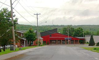
Centreville is a former village in Carleton County, New Brunswick, Canada. It held village status prior to 2023 and is now part of the town of Carleton North.
The city of Gusau, located in northwestern Nigeria, is the capital of Zamfara State. It is also the name of the state's Local Government Area (LGA), which has an area of 3,364 km (2,090 mi)² and a population of 383,162 as of the 2006 census.
Benton is a census-designated place and unincorporated community in Yazoo County, Mississippi. It was first named as a CDP in the 2020 Census which listed a population of 415.
Crabwood Creek is a small community on the Corentyne River in the East Berbice–Corentyne region of Guyana. The population of 4,459 people as of 2012 and primarily Indo-Guyanese.
Cholapuram is a panchayat town in the Thanjavur district of the state of Tamil Nadu, India.In ancient time, it's called as Bhairavapuram.

Sainthia is a city and a municipality in Suri Sadar subdivision of Birbhum district in the Indian state of West Bengal. The city is known as business city of Birbhum district. The city is under the jurisdiction of Sainthia police station. Sainthia is the fourth most populous city in Birbhum district and 95th most populous city in West Bengal. The city covers an area of 10 km2 and had a population of 44,601 in 2011. Located on the banks of Mayurakshi River, Sainthia has been a major human settlement. The city is famous for Nandikeshwari Temple, one of the Shakti Peethas in Indian subcontinent.
Talod is a town and a municipality in Sabarkantha district in the Indian state of Gujarat.

Cummings is an unincorporated community in Traill County, North Dakota, United States.
Piduguralla is a town in Palnadu district of the Indian state of Andhra Pradesh.The town is the headquarters of Piduguralla mandal and administered under Gurazala revenue division. The town is also known as Lime City of India as there are abundant reserves of limestone.
Govindaraopet is a village and a mandal in Mulugu District in the state of Telangana in India. It is located approximately 70 km (43 mi) distance from Hanamkonda along National Highway-163 which connects Hyderabad in Telangana and Bhopalapatnam in Chhattisgarh. And it is 200 km (120 mi) distance from its state capital Hyderabad.
Harugeri (ಹಾರುಗೇರಿ) is a town in Raybag tehsilin Belguam District of the Indian state of Karnataka.
Chapa de Mota is one of 125 municipalities located in the northwest of Mexico State. The municipal seat is the village of Chapa de Mota and largest town is San Felipe Coamango. It is located in the north part of the State of Mexico. By car, it is two hours from Mexico City.
Shapur is a village in Vanthali taluk in Junagadh district in the Indian state of Gujarat. This region is known as "Sorath", after the former Princely State of Junagadh.
Udayanatham (East) is a village in the Udayarpalayam taluk of Ariyalur district in the Indian state of Tamil Nadu.

Cedar Hill is a city in Dallas and Ellis counties in the U.S. state of Texas. It is located approximately 16 miles (26 km) southwest of downtown Dallas and is situated along the eastern shore of Joe Pool Lake and Cedar Hill State Park. Per the 2020 United States census, the population was 49,148. Cedar Hill is a suburb of the city of Dallas and is part of the Best Southwest area, which includes the nearby cities of DeSoto, Duncanville, and Lancaster.

The Ranasan State was a small princely state belonging to the Mahi Kantha Agency of the Bombay Presidency during the era of the British Raj. It had its capital in Ranasan village, Talod municipality, Sabarkantha district of present-day Gujarat State.
Raghunathapuram is a village located in Nalgonda district, Telangana, India. This village is 12 km from the famous hill temple Yadagirigutta. This village has population of ~6,000.
Fort Wellington is a village located in the Mahaica-Berbice region of Guyana, serving as its regional capital.

